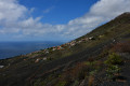
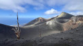
Martin’s Volcano from Los Canarios

Most of the walk is easy, following a path through the forest and then along several craters without any difficulty or vertigo, before reaching Martin’s Crater

Only the final ascent gets steeper and steeper – very, very steep towards the end – on volcanic gravel, but you can avoid it by taking the path on the left both on the way there and back.

Details

96652391
Creation:
Last update:
Last review:
  • Walking
    Activity: Walking
  • ↔
    Distance: 8.44 mi
  • ◔
    Average duration: 6h 30 
  • ▲
    Difficulty: Moderate

  • ⚐
    Back to start: Yes
  • ↗
    Ascent: + 2,976 ft
  • ↘
    Descent: - 2,989 ft

  • ▲
    Highest point: 5,210 ft
  • ▼
    Lowest point: 2,349 ft

Description of the walk

Car park behind the church and on the road leading up to it (free)

Most of the walk is easy and well signposted (it follows the GR®131), taking a path through the forest and then along several craters before the junction at point 1, which leads directly up to Martin’s Volcano

Only the final ascent gets steeper and steeper, becoming very, very steep towards the end on volcanic gravel, but you can avoid it by taking the path on the left both on the way up and on the way back. The sign for the volcano isn’t on the GR®

Waypoints

  1. S/E : mi 0 - alt. 2,382 ft - Car park behind the church in Los Canarios
  2. 1 : mi 3.52 - alt. 4,760 ft - Junction with a choice of routes
  3. 2 : mi 3.54 - alt. 4,787 ft - Start of the steep section
  4. 3 : mi 4.01 - alt. 5,121 ft - Martin’s Volcano sign
  5. 4 : mi 8.32 - alt. 2,352 ft - The Room Bakery, Chez Zulay
  6. S/E : mi 8.44 - alt. 2,382 ft - Car park behind the church in Los Canarios

Notes

No water along the route

The duration of the walk includes plenty of photo stops and a snack at the summit

At the end of the walk, you can pop into Zulay Bakery ‘The Room’: a lovely place with excellent food

Always be cautious and plan ahead when you're outdoors. Visorando and the author of this route cannot be held responsible for any accidents occurring on this route.

The GR® and PR® markings are the intellectual property of the Fédération Française de Randonnée Pédestre.

Other walks in the area

For more walks, use our search engine .

The GPS track and description are the property of this route's author. Please do not copy them without permission.