


Ch74

 Visorando Member
Sign up:
Published route(s)
 Martin’s Volcano from Los Canarios
 8.44 mi
 +2,976 ft
 -2,989 ft
 6h 30
6h 30
 Moderate
 Departure from Fuencaliente de la Palma (Province de Las Palmas)
Most of the walk is easy, following a path through the forest and then along several craters without any difficulty or vertigo, before reaching Martin’s Crater
Only the final ascent gets steeper and steeper – very, very steep towards the end – on volcanic gravel, but you can avoid it by taking the path on the left both on the way there and back.
Tour of Blue Lagoon
 7.32 mi
+26 ft
-26 ft
3h 25
Moderate
Departure from Tunisia
7.32 mi
+26 ft
-26 ft
3h 25
Moderate
Departure from Tunisia
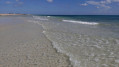
This tour of the lagoon (Blue Lagoon) involves walking in the water for 500 metres (ankles or knees deep, depending on the tide). There’s also a 15-metre stretch to swim. The depth is 7 metres at the marked point, but there’s no current. The route starts from Club Med Djerba or the El Mouradi Hotel. On the left-hand side of the lagoon, there’s a dirt track lined with stalls selling local specialities: trainers are recommended.