Tour of Saint-Nectaire

This short walk is a great way to get to know St-Nectaire and its history. It will take you through the streets to discover the Basilica of Notre-Dame-du-Mont-Formadore, the Cheese House, the Dolmen Park and the petrifying fountain.

Details

n°108911969
Creation:
Last update:
Last review:
–
  • Walking
    Activity: Walking
  • ↔
    Distance: 3.30 mi
  • ◔
    Average duration: 2h 00 
  • ▲
    Difficulty: Easy

  • ⚐
    Back to start: Yes
  • ↗
    Ascent: + 594 ft
  • ↘
    Descent: - 623 ft

  • ▲
    Highest point: 2,736 ft
  • ▼
    Lowest point: 2,228 ft

Description of the walk

Start from the car park next to the emergency services centre.

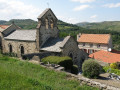
(S/E) Leave the car park, then take Rue Barberoux. Take the first street on the left and then immediately the one on the right to go round the back of the town hall, then take the street on the left to reach the basilica.

(1) Turn round, go straight on to the right, then turn left onto Rue de l’École. Keep to the right and carry on straight ahead.

(2) At the T-junction, keep right and cross the park. At the exit, take the D996 to the right onto Avenue du Docteur Roux.

(3) Turn left, then drive back and forth as far as the Maison du Fromage.

(4) Head back the way you came.

(3) Cross the road and continue straight ahead.

(5) First turn right then left, then carry on straight ahead and take the first left. Take the path opposite at the bend.

(6) At the junction, carry on straight ahead; at the Y-junction, carry on straight ahead, then take the first right and carry on straight ahead again.

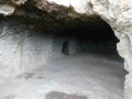
(7) Turn left at the junction and head towards the caves.

(8) Turn round.

(7) Then turn left twice and head back to the junction.

(6) Keep to the left. At the end, continue to the left and return to the starting point (S/E).

Waypoints

  1. S/E : mi 0 - alt. 2,516 ft - Car park, Rue Barberoux
  2. 1 : mi 0.22 - alt. 2,451 ft - Basilica of Notre Dame du Mont Cornadore
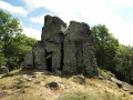
  3. 2 : mi 0.83 - alt. 2,359 ft - Dolmen Park - Fontaines pétrifiantes
  4. 3 : mi 1.54 - alt. 2,326 ft - T-junction. Return to the Cheese House
  5. 4 : mi 1.62 - alt. 2,343 ft - Cheese Centre - Fredet (cours d'eau) - Affluent de la Couze Chambon
  6. 5 : mi 1.76 - alt. 2,336 ft - Bend
  7. 6 : mi 1.91 - alt. 2,398 ft - Junction of the two circular loops
  8. 7 : mi 2.41 - alt. 2,703 ft - Junction. Return trip to the cave
  9. 8 : mi 2.54 - alt. 2,736 ft - Grotte de Chateauneuf
  10. S/E : mi 3.3 - alt. 2,510 ft - Back to car park

Notes

No water source

Worth a visit

Basilica

Dolmen Park

Petrifying Fountains

Ecomuseum and cheese house

Châteauneuf Caves

Other walks in the area

For more walks, use our search engine .

The GPS track and description are the property of this route's author. Please do not copy them without permission.