Country:

 City:
City:


In Treizanches, park on the outskirts of the village alongside the D640: space for only two or three vehicles.
(S/E) Turn right onto the Chemin des Roudadoux and walk past the crêperie. Follow the path as it bends to the right and joins a junction.
(1) Turn right, then immediately keep left towards the village of Farges
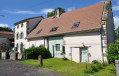
(2) Turn left at the green farm gate (which may be open or closed depending on the day). Carry on straight ahead at the junction, go round the Puy des Parots and then the Puy Tomba, and, once you can see Thones le Jeune, turn right to reach the hamlet.
(3) Turn right, cross the hamlet and carry on straight on to Grandeyrolles.
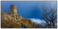
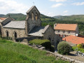
(4) Walk through the hamlet (Romanesque church). Continue straight on, leaving the Puy de Grandeyrolles on your left (view of the Livradois-Forez), then take the winding descent which passes beneath the Tour de Rognon and veers left as it reaches the road (D996); follow this road to join the D640.
(5) Cross the D996 and follow the path down towards the Ruisseau de Quinsat. At the small stone bridge, keep to the right bank and continue upstream, crossing four footbridges. After the fourth footbridge, turn right, cross the Ruisseau de Combres and follow the path as it winds its way up to the plateau.
(6) At the junction, take the path furthest to the left, which descends slightly at first before climbing back up to a main track; turn left here: views of the Monts du Forez, the Couzes region and the Sancy massif. Continue past the riding centre to the road junction at Thones le Vieux.
(7) Cross the bridge on the left, then turn immediately right towards Thones-le-Jeune. At the Fork in the road, keep right without entering the village.
(3) Follow the path to the right, ignoring the one on the left that you took on the way there, and carry on straight ahead. Ignore two paths branching off to the left and you’ll reach a three-way junction.
(8) Follow the path to the left until you reach the original junction at Treizanches.
(1) Carry on straight ahead, keep to the right at the three-way junction just after this, and reach the junction with the Chemin du Peroux.
(9) Turn right, then right again onto the D640 to reach the car park (S/E).

 Association / Club / Walk leader
 Easy
Easy 
 Visorando Member