Refine your search for walks in Mont Major (542 m)
Mont Major (542 m) walks


 Mont Major
 Visorando Member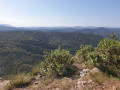
 8.68 mi
 +1,398 ft
 -1,394 ft
 5h 10
5h 10
 Moderate
 Departure from Saint-Pierre-des-Champs (Aude)
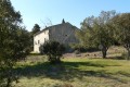
Despite its modest altitude, Mont Major (542 m), the highest point of the Serre de Blanes, offers a magnificent, almost 360° panorama encompassing the Montagne d’Alaric, the Carcassonne plain and, on a clear day, the peaks of the Ariège Pyrenees and the Canigou. The ascent, starting from the village of Saint-Pierre-des-Champs, takes place amidst a landscape typical of the Corbières, with small, isolated vineyards, pine trees and heath where holm oaks reign supreme. A breath of fresh air in a setting where peace and quiet are guaranteed.
Villerouge-Termenès – Lagrasse
 11.57 mi
+1,496 ft
-2,146 ft
6h 35
Moderate
Departure from Villerouge-Termenès (Aude)
11.57 mi
+1,496 ft
-2,146 ft
6h 35
Moderate
Departure from Villerouge-Termenès (Aude)
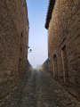
The second stage between Villerouge-Termenès and Lagrasse begins on the heights of the Corbières and then descends gradually towards the superb medieval village of Lagrasse and its abbey.
Walks near Mont Major (542 m)
Lagrasse – Mayronnes
 10.62 mi
+1,880 ft
-1,430 ft
6h 30
10.62 mi
+1,880 ft
-1,430 ft
6h 30
 Difficult
Departure from Lagrasse (Aude)
Difficult
Departure from Lagrasse (Aude)
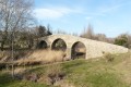
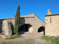
The third and final stage runs between the medieval village of Lagrasse and the village of Mayronnes, passing by the Notre-Dame du Carla Chapel and the Roman bridge at Rieux-en-Val.