The two valleys starting from Val-de-Reuil

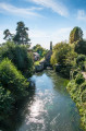
Set off to explore ‘the two valleys’, with their chalky slopes, lakes and bird sanctuary. Here, everything evokes the world of river transport and the paintings of the Impressionists. Along this walk, you’ll be impressed by the dam as it spews out cubic metres of water with incredible force, before you settle into the gentle pace of life along the towpath, where every little cottage has its own small terrace overlooking the Seine. It was here, in fact, that Michèle Ratel, a post-Impressionist painter, chose to set up her saltires and her art gallery.

Details

n°52024654
Creation:
Last update:
Last review:
  • Walking
    Activity: Walking
  • ↔
    Distance: 11.04 mi
  • ◔
    Average duration: 5h 05 
  • ▲
    Difficulty: Moderate

  • ⚐
    Back to start: Yes
  • ↗
    Ascent: + 20 ft
  • ↘
    Descent: - 20 ft

  • ▲
    Highest point: 52 ft
  • ▼
    Lowest point: 20 ft
  • ⚐ Country: France
  • ⚐ City: Val-de-Reuil (27100)
  • ⚑
    Start/End: N 49.273631° / E 1.223759°
  • ❏
    IGN map(s): Ref. 1911ET, 2011SB, 2012OT
  • Hour-by-hour weather

Photos

Description of the walk

Starting point: 3 Avenue des Falaises, 27100 Val-de-Reuil.
Parking: Val-de-Reuil SNCF railway station.

Signposting: Yellow

(S/E) From the station car park exit, head towards the bridge, cross the River Eure, then turn right immediately. Continue to the church.

(1) Walk past the church and, at the bridge, turn right towards the River Eure. Cross the river.

(2) Take the road on the left until you reach the railway line.

(3) Turn right into the tunnel and continue to the D110. Cross the road and enter the Léry Poses leisure park in Normandy.

(4) Turn left onto a small path running alongside the Lac des Deux Amants. The path joins and then runs alongside the D110 until you reach the exit of the campsite on Île Adeline.

(5) Cross the road using the pedestrian crossing. Walk past the Île Adeline campsite and continue left along a path, then left again to reach the banks of the Seine.

(6) Turn right towards the Poses dam.

(7) Continue along the road running alongside the Seine. Stay along the river until you have passed the Île Adeline campsite.

(8) Take the path opposite that runs alongside the Seine until it leaves the riverbank.

(9) Turn right onto a small road, then turn left. Cross the channel and continue along the road until you reach the ‘Stop’ sign at Tournedos-sur-Seine.

(10) Turn right and take the D147 towards the bird sanctuary. Follow the road, past the cemetery and then the track, until you reach the access path to the bird sanctuary.

(11) Turn left onto a footpath. Walk alongside the pond until you reach the D110. Walk along the grassy verge until you reach the road.

(12) Turn right, cross the D110 and follow the small road opposite which runs behind the Vaudreuil golf course. At the end of the road, turn left and cross the River Eure

(13) Turn right and walk alongside the river to reach Val-de-Reuil station (S/E), keeping to the right at the bridge.

Waypoints

  1. S/E : mi 0 - alt. 33 ft - Gare de Val-de-Reuil
  2. 1 : mi 1.14 - alt. 30 ft - Église Saint-Ouen (Léry)
  3. 2 : mi 1.36 - alt. 33 ft - Eure (rivière)
  4. 3 : mi 1.81 - alt. 23 ft - Railway line
  5. 4 : mi 1.91 - alt. 26 ft - Leisure park - Lac des Deux Amants
  6. 5 : mi 3.86 - alt. 30 ft - Île Adeline Campsite
  7. 6 : mi 4.16 - alt. 26 ft - Seine [la]
  8. 7 : mi 4.5 - alt. 33 ft - Barrage de Poses
  9. 8 : mi 6.25 - alt. 33 ft - Léry-Poses Campsite
  10. 9 : mi 6.69 - alt. 30 ft - Seine [la]
  11. 10 : mi 7.64 - alt. 36 ft - Tournedos-sur-Seine
  12. 11 : mi 8.53 - alt. 33 ft - Réserve ornithologique de la Grande Noë
  13. 12 : mi 9.5 - alt. 39 ft - Route
  14. 13 : mi 10.35 - alt. 36 ft - Eure (rivière)
  15. S/E : mi 11.04 - alt. 33 ft - Gare de Val-de-Reuil

Notes

Check with the local council or on theONF website for hunting seasons from September to the end of February

Worth a visit

The Seine, a river in the Paris Basin, has a total length of 776 km. It rises at an altitude of 471 metres on the Langres Plateau, near Dijon in the Côte-d’Or. The river features numerous dams, including the Poses Dam, which is the last dam before the sea, situated 163 km away.

The dam: the last dam on the Seine, situated 163 km from the sea and 202 km from Paris. Commissioned in 1885, this 235-metre-long structure regulates the water level for navigation.

The Seinoscope: built in 1992 at the same time as the hydroelectric power station, it enables fish to swim upstream along the Seine and overcome the difference in water level via 22 successive passages forming steps of approximately 30 cm.

The Atelier Galerie du Bord de Seine: Michèle Ratel, a Post-Impressionist painter, will introduce you to the charm of this place and share her love for the river through her paintings.

The River Transport Museum, comprising the barge ‘Midway’ and the 1920 tugboat ‘Le Fauvette’, which is listed as a Historic Monument.

The Grande Noé Bird Reserve, managed by the Normandy Ornithological Group (GONm). You can observe numerous birds from various observation points, but please respect the wildlife by staying on the path.

La Ferme de la Motte, built in themid-18th century

Saint-Ouen Church in Léry: a mid-12th-century Romanesque church built of white stone, restored towards the end of the 19th century and partially listed as a Historic Monument in 1911.

Reviews and comments

4.7 / 5
Based on 1 review

Reliability of the description
5 / 5
Ease of following the route
4 / 5
Route interest
5 / 5
Office de Tourisme Seine-Eure

Hello,

Thank you for your feedback on this walk; we have taken note of your comments.

Kind regards,

The Tourist Office team

Machine-translated

dmoutier
dmoutier

Overall rating : 4.7 / 5

Date of your route : Jun 29, 2024
Reliability of the description : ★★★★★ Very good
Ease of following the route : ★★★★☆ Good
Route interest : ★★★★★ Very good
Very busy route : No

A very pleasant walk.
The walk round the lake is excellent, with varied scenery, and also takes you past the water sports centre.
Just before the finish, there’s a lovely surprise in the form of an open-air farm with lots of animals.
Please note that it is no longer possible to pass before point 12; you must follow the road.

Machine-translated

Other walks in the area

For more walks, use our search engine .

The GPS track and description are the property of this route's author. Please do not copy them without permission.