Short circular loop around Muids

Amidst the fields and the Seine, take a short tour of Muids and explore the town.

Details

n°8296754
Creation:
Last update:
Last review:
  • Walking
    Activity: Walking
  • ↔
    Distance: 4.11 mi
  • ◔
    Average duration: 2h 00 
  • ▲
    Difficulty: Easy

  • ⚐
    Back to start: Yes
  • ↗
    Ascent: + 135 ft
  • ↘
    Descent: - 138 ft

  • ▲
    Highest point: 194 ft
  • ▼
    Lowest point: 26 ft
  • ⚐ Country: France
  • ⚐ City: Muids (27430)
  • ⚑
    Start/End: N 49.22383° / E 1.290563°
  • ❏
    IGN map(s): Ref. 2012OT
  • Hour-by-hour weather

Photos

Description of the walk

Starting point: Cité de la Troplaie.

(S/E) With your back to the Cité, follow Rue de la Troplaie to the right and, at the fork, head up to the right then continue across the fields.

(1) At the edge of the woods, take the path on the right and follow the fields until you reach the tarmac road.

(2) Head downhill to the right towards the town. At the water tower, carry on straight ahead and follow this road (Rue de l’Abreuvoir) to the end (Stop sign). Continue straight ahead onto a path and head for the Île du Moulin bridge (caution: hunting reserve).

(3) Cross the bridge and immediately take the path on the right. Walk along the riverbank to the next bridge. Cross it.

(4) Just past the houses in the hamlet of Le Moulin, take the grassy path on the left and continue along the Seine.

(5) Pass the fishing spots and then turn right straight away onto Voie de la Libération.

(6) Turn right, walk past the town hall, then turn left onto Avenue Pierre Dupont just after the Charles Aznavour Hall.

(7) At the end of the street, turn right, then turn right again onto Rue de la Troplaie and head towards the housing estate (S/E).

Waypoints

  1. S/E : mi 0 - alt. 59 ft - La Troplaie Estate
  2. 1 : mi 0.79 - alt. 177 ft - Edge of the woods
  3. 2 : mi 1.76 - alt. 190 ft - Walk down towards the town
  4. 3 : mi 2.44 - alt. 30 ft - Île du Moulin Bridge
  5. 4 : mi 2.96 - alt. 39 ft - Grassy path on the left
  6. 5 : mi 3.71 - alt. 33 ft - Fishing spot - Seine [la]
  7. 6 : mi 3.83 - alt. 56 ft - Junction, turn right
  8. 7 : mi 3.99 - alt. 59 ft - Junction: turn right
  9. S/E : mi 4.11 - alt. 59 ft - La Troplaie Estate

Notes

Fishing spot, dog-friendly.

(6) You can also turn left and then turn right at the roundabout towards the large manor house.

Worth a visit

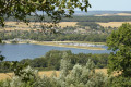
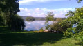
Do feel free to stop at the jetties to dip your toes in the water or even have a go at fishing.
Pop into the Café de la Poste for a refreshing drink to round off your walk!

Reviews and comments

4 / 5
Based on 2 reviews

Reliability of the description
4 / 5
Ease of following the route
4.5 / 5
Route interest
3.5 / 5
adex
adex

Overall rating : 3.3 / 5

Date of your route : Jan 25, 2022
Reliability of the description : ★★★☆☆ Average
Ease of following the route : ★★★★☆ Good
Route interest : ★★★☆☆ Average
Very busy route : No

Hunters everywhere. Best to get out of here......

Machine-translated

noellechahi
noellechahi

Overall rating : 4.7 / 5

Date of your route : May 17, 2021
Reliability of the description : ★★★★★ Very good
Ease of following the route : ★★★★★ Very good
Route interest : ★★★★☆ Good
Very busy route : No

A pleasant, easy walk.
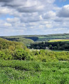
There’s a lovely view on the way back down towards the town.

Machine-translated

Other walks in the area

For more walks, use our search engine .

The GPS track and description are the property of this route's author. Please do not copy them without permission.