Country:
 City:


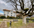
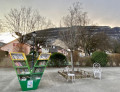
The walk starts at the Veyrier-Village bus stop on line 8, on Route du Pas-de-l’Échelle.
(S) Walk a few dozen metres (to No. 106) and turn right onto Rue des Boulangers. Continue straight on through the village along Chemin-sous-Balme and then Chemin des Marais until you reach the village boundary at the junction after a right-hand bend.
(1) Take the Chemin des Tournettes, which veers to the left, then, after about 150 m, turn right onto the Chemin des Diocès. After a long straight stretch, it curves to the right, running alongside private property, and reaches a fork in the road.
(2) Turn left at a right angle onto the Chemin des Serraillones towards Troinex. After a straight stretch running alongside some greenhouses, turn right onto the Route de Bossey. Follow this road until you reach the Route de Pierre-Grand, just after the Maison forte de Troinex. Turn left and follow the road for about 150 m before turning right onto the Chemin Jacques Ormond, crossing the small bridge over the Drize.
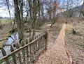
(3) Just after the bridge, turn left onto the Grande Cour, cross the village and follow the street until it meets the Route de Moillebin; follow this to the left for about a hundred metres. After passing a sculptor’s studio (with a garden full of bronze sculptures), turn left onto the Chemin des Bis-de-Troinex. Follow it until it turns into a footpath. Continue along this path which runs alongside the Drize. If the path is too muddy, feel free to head into the small wood alongside the river, where there are numerous paths that are usually dry. You’ll reach the junction with the Chemin d’Evordes.
(4) Take this road on the right. At the crossroads – reached after a bend to the left, then to the right, then left again – turn left towards Croix de Rozon, pass the Evordes riding school and continue straight on along the Chemin des Forches to the centre of the village of Croix de Rozon at the junction with the Route d’Annecy. Turn left until you reach the roundabout.
(5) Cross the road (take care) and continue straight on along the Route d’Annecy before turning right onto the Route du Prieur towards Landecy. Then take thefirst left onto the Chemin des Côtes de Landecy. This leads through the vineyards to a water tower. A beautiful view of the Jura ridges to the west, the Salève behind you to the west and the city of Geneva (with the Jet d’Eau!) on your right.
(6) Continue along the same path until you reach the junction with the Chemin de la Chocande. Cross over and carry on straight ahead along the Chemin des Epetex. At the next T-junction, turn left, then immediately right onto the Chemin des Vignes Blanches for about a hundred metres before turning left onto the Chemin du Garde Vigne and following it to the end, where it meets the Route de Foliaz. Turn left onto this road and follow it to the centre of the village of Bardonnex. After passing thefirst café on your right, continue past the bend to the Place des Brunes, where you’ll find asecond café on your right.
(7) Turn right towards Perly-Arare. Follow the main road, which curves to the left and descends to a Y-junction with the Chemin du Rouet, which branches off to the left and leads to a large crossroads after about 400 metres.
(8) At the junction, cross carefully and keep to the right onto the Route de Bardonnex. Follow it for about a hundred metres before turning left down Chemin du Pré Berghem. At the end, turn right onto Chemin Marc Charrot, then immediately left and cross the footbridge over the motorway. The signposting then directs you to turn left onto Chemin Crépois, which skirts a wood and leads to Route de la Ravière.
(9) At the junction, head up the left-hand path for a good hundred metres before turning right onto Chemin des Jules, which descends to the right for about a hundred metres and reaches the bank of a stream. Follow the stream until a sign directs you to turn right between two blocks of flats. This leads onto the Route de Saint-Julien and, on the left, to the Perly-Douane bus stop (line D), the end point of this route (E).

 Visorando Member
 Difficult
 Very difficult
 Easy