Country:
 City:
City:


The walk starts at the roundabout in front of the Drize Secondary School. Access:
- By bike, park at the cycle park at the Site de Batelle (University) opposite the starting point.
- By bus, get off at the Grange-Collomb stop in Carouge, which is very close to the starting point.
- By car, you can park at the Rondeau de Carouge car park, a 10-minute walk from the starting point, by walking up the Route de Drize.
(S/E) From the roundabout, head west and follow the Chemin de Grange Collomb alongside the secondary school. Pass the Bruckner Foundation’s ceramics centre (red buildings).
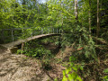
(1) Just before the bridge over the Drize, take the path on the left which runs alongside the river. Cross the first footbridge to reach the opposite bank, then cross a second footbridge.
(2) Then cross the river again. On the other side, turn right and walk along the river on your right-hand side for about 500 m. When you reach the foot of a road bridge, head up to the left onto the road and then turn right to cross the bridge.
(3) Take the first street on the left (be careful when crossing the road; if there is too much traffic, walk a little further to use a pedestrian crossing). Follow the Chemin des Moulins de Drize eastwards, then turn left onto this path. You’ll come out onto the Route de Troinex; follow it to the left. Cross a stream.
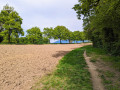
(4) Take the second street on the right, the Chemin Aloys Pictet (ignore the Chemin de la Combette just before it). A little further on, go round a field on the right. Then turn left and follow a path lined with trees that hide the Ruisseau des Marais.
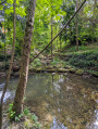
(5) Shortly before reaching a tree-lined avenue on your left, cross the river via a discreet footbridge well hidden amongst the trees. Head straight on towards the south-west to the end of Chemin de Sous-le-Crêt. At the end, turn right onto Route de Troinex and follow it for about thirty metres.
(6) Go down a well-hidden flight of steps on the left and cross the Drize again. Continue straight on along the Vidollet de la Forge. At the end, turn left onto the Chemin de Saussac. At the crossroads, opposite the village inn, turn right onto the Chemin de la Fondelle. After about twenty metres, take the footpath on the left and follow it until you come out onto the Vidollet-l’École on your right.
(7) Cross the Chemin de Lullin and then the Chemin Dottrens. At the end of the footpath, turn left onto the Chemin de Roday. Follow it to the right until you reach the Route d’Annecy. Cross the Route d’Annecy at the traffic lights and follow it to the left, heading south.
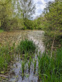
(8) Shortly after the white housing estate, turn right into the Bois de Milly Nature Reserve. At the fork in the road, follow the path on the right which crosses the woodland behind the white housing estate, heading north-west. Then walk along the edge of the reserve’s meadows until you reach the Étangs de la Bistoquette on your right.
(9) Follow the ‘Sentier des Étangs de la Bistoquette’, which turns right, then left. Continue along it until you reach the Route de Saconnex-d’Arve, then turn right there.
(10) At No. 24, turn left onto the path that runs east of the Compostelle development area. When you reach the Route de la Chapelle, cross it, then head right to the Ferme de la Chapelle, the City of Lancy’s art centre.
(11) Just past the Ferme de la Chapelle, head down the Chemin du Bief-à-Dance on the left to reach the Drize and the footbridge you crossed at the start of the route.
(2) Cross this footbridge again and, once you’ve crossed it, turn left (north). Follow the Chemin du Bief-à-Dance. When you reach the Route de Drize, turn left and you’ll soon reach the starting point (S/E).


 Visorando Member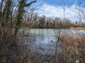

 Difficult
 Very difficult
 Moderate