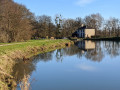
The eleven locks of Hédé-Bazouges

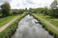
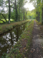
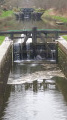
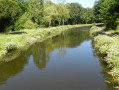
Discovering the site of the eleven locks on the Ille-et-Rance Canal. Over a distance of 2 km, the eleven locks enable boats to negotiate a 27-metre difference in height via an astonishing ‘water staircase’ along the towpath.
Information boards are dotted along the route, providing details on biodiversity, the bocage landscape, agriculture, the canal, the architecture and community initiatives, as well as introductory guides to drawing and painting.

Details

29999936
Creation:
Last update:
Last review:
  • Walking
    Activity: Walking
  • ↔
    Distance: 6.07 mi
  • ◔
    Average duration: 2h 55 
  • ▲
    Difficulty: Easy

  • ⚐
    Back to start: Yes
  • ↗
    Ascent: + 102 ft
  • ↘
    Descent: - 108 ft

  • ▲
    Highest point: 220 ft
  • ▼
    Lowest point: 125 ft
  • ⚐ Country: France
  • ⚐ City: Hédé (35630)
  • ⚑
    Start/End: N 48.305776° / W 1.79178°
  • ❏
    IGN map(s): Ref. 1117SB, 1217SB
  • Hour-by-hour weather

Photos

Description of the walk

Park in the museum car park.

(S/E) From the car park, head south-west towards the Écluse de la Magdeleine. Turn right to walk alongside the canal on your left until you reach the D3795 road, just round the corner from the Maison du Canal d’Ille-et-Rance.
Turn left and carefully cross the canal via the bridge on the D3795 road. Immediately afterwards, turn left onto the path running alongside the canal, a few metres to your left, heading south-east. At the start, the path crosses a grassy area in the middle. Shortly afterwards, the path enters a wooded area. Follow it until you reach the D87 road, near the hamlet of La Parfraire on the right. As you pass, look out for the Écluse de la Jaunaie on the left, followed by lock number 26. Turn left onto the D87 road

(1). Carefully cross the canal via the Pont de la Parfraire bridge over the lock of the same name. Continue for about a hundred metres before turning right onto a farm track known as Rue des Douves.
Follow the track, which curves to the left in an S-shape past a house, before heading straight on towards the east and reaching the D287. When you reach it, turn left and follow the road carefully for about one hundred and fifty metres.

(2) Turn left onto the road leading to La Fosse Marie, next to a green electricity substation. Continue carefully along the small road, pass through the hamlet of La Fosse Marie and join the D87.

(3) When you reach it, turn left and follow this road carefully until you come to a small pond on the left-hand side, about three hundred metres further on. Turn right onto the path opposite the pond, which runs alongside a stream towards the Étang de la Bézardière.
After a hundred metres, the path turns left and crosses a woodland, then further on joins the Étang de la Bézardière, which you follow to your right.

(4) At the corner of the pond, turn right onto the path that runs alongside the pond heading north-east towards the hamlet of La Bézardière. After this hamlet, the path veers away from the pond, heading left until it reaches the road near the hamlet of Montdidier. Turn right and follow the small road carefully. Pass Montdidier, keeping slightly to the left.

(5) Turn left onto a path about one hundred and fifty metres after the hamlet, on the edge of a small wood just past a fenced-off patch of grass. Continue along this shaded path, which heads west and eventually curves to the right in an S-shape to reach the hamlet of Rouyon. On reaching it, turn right onto the Route de Rouyon, which heads north and runs parallel to the D3795 road further to the west. You’ll arrive at the junction with the Place du Château on your right.

(6) Carry on straight ahead. The route now follows a signpostedPR® trail. Pass the Gué de Guisel, then walk alongside two adjoining ponds on the right to reach the Croix Saint-Joseph.
At the junction, turn left to join the D795 road. Cross it with great care and continue straight ahead along the path. Follow it to Saint-Méloir des Bois. Here you will see the crosses (see the ‘During the walk’ section).

(7) At the crossroads in Saint-Méloir des Bois, where there is a beautiful wayside cross, take the road on the right and follow it, turning left twice to reach the hamlet of La Touche aux Aubry.
At the entrance to the hamlet, turn right onto a farm track heading west to reach the Ille-et-Rance Canal, descending from the plateau and passing through a short wooded area before the canal, where the River Donac flows.

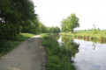
(8) At the canal bank, turn left onto the Voie Verte heading south. Follow the canal on your right until you reach the D795 road.

(9) Pass under the D795 road, then, about ten metres further on, take the path on the left leading up to the footbridge running parallel to the road. From the top of the footbridge, there is a fine view of the succession of eleven locks stretching for 2 km to the south-east.
Come back down from the footbridge to rejoin the Greenway. Follow it south-eastwards, keeping the canal on your right. Pass through La Dialais, where the Guéhardière Lock is located, then further on, La Petite Magdeleine and its lock, before finally returning to the D3795 road at La Magdeleine.
Cross the D3795 road with care, walk past the Maison du Canal d’Ille-et-Rance and turn left to return to the car park (S/E).


Waypoints

  1. S/E : mi 0 - alt. 171 ft - Car park at La Magdeleine
  2. 1 : mi 0.51 - alt. 190 ft - Parfaire Lock - Canal d'Ille-et-Rance
  3. 2 : mi 1.36 - alt. 220 ft - D287
  4. 3 : mi 1.82 - alt. 190 ft - D87
  5. 4 : mi 2.42 - alt. 180 ft - Fork in the path
  6. 5 : mi 2.84 - alt. 203 ft - Route de Montdidier x path on the left
  7. 6 : mi 3.28 - alt. 167 ft - Junction with Place du Château
  8. 7 : mi 4.05 - alt. 164 ft - Crossroads at La Croix in Saint-Méloir des Bois
  9. 8 : mi 4.74 - alt. 128 ft - Junction with the canal towpath
  10. 9 : mi 5.39 - alt. 154 ft - Junction of the canal with the D795 road
  11. S/E : mi 6.07 - alt. 171 ft - Car park at La Magdeleine

Notes

The car park is located at the Canal Museum (access via the small road on the right, approximately two hundred and fifty metres north of the Magdeleine Bridge over the canal).

This walk across varied terrain requires suitable footwear.

This walk does not present any real navigation difficulties as it is signposted in yellow. In addition, it is advisable to follow the directions in the description and on the map, whilst also paying close attention to the landscape. The waypoints (with their GPS coordinates and the distance from the starting point) provide helpful guidance for walkers exploring the route for the first time.

Hike completed by the author of this guide on 11 May 2023 and 27 August 2023.

Worth a visit

The Onze Écluses site and the Maison du Canal
A canal and its locks are like a huge staircase of water for boats. The terrain is levelled to form perfectly horizontal leats (or reaches) several kilometres long. The locks act as lifts for barges. The barge passes through a first gate to enter the lock chamber. By filling or draining the chamber of water, the lock keeper raises or lowers the barge. Once the level of the next step has been reached, it passes through the second gate and continues its journey to the next lock. At Hédé-Bazouges, the series of locks is steep and the locks are close together: eleven locks must be passed through to ascend or descend a 27-metre difference in level over just 2 km!
Places to visit: Maison du canal d’Ille-et-Rance, 12, La Madeleine, 35630 Hédé-Bazouges. Tel. 02 99 45 48 90. contact@maisonducanal.bzh. www.maisonducanal.bzh.
Open all summer from 10 am to 1 pm and from 2 pm to 6 pm (5 pm on Tuesdays and Saturdays). Admission to the museum is free.

The chalets at Étang de Bazouges
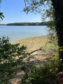
In the interwar period, many city-dwellers from Rennes took the ‘petit tacot’ (the tram line linking Rennes to Miniac-Morvan between 1901 and 1950) to Hédé to fish in the Bazouges, La Bézardière or Hédé ponds. Land was leased by the State to private individuals who built chalets on the banks of the Bazouges pond in the 1920s and 1930s, some of which still stand today. Single-storey, wooden, small in size and usually surrounded by a small garden, they are lined up in a tight row facing the pond.

The Parfraire Lock Keeper’s House
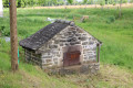
The lock-keepers’ houses were built in the early 19th century as part of the construction of the Ille-et-Rance Canal. There are 48 such houses along this canal. Around thirty lock-keepers’ houses are still in use on the Ille-et-Rance Canal.

The Bézardière Pond
The route runs alongside the Bézardière Pond, owned by the regional authority, which is a very popular fishing spot. The route passes close to the old Bézardière watermill, which ceased operation in 1978.

The Bézardière Tumulus.

The Crosses at Saint-Méloir-des-Bois
Saint-Méloir-des-Bois was a former parish which had a church, a cemetery and a vicarage. One of the two crosses visible on site probably comes from the old cemetery. The one bearing a relief of Christ is thought to date from the 16th century, whilst the other is thought to date from the 17th century.

The eleven locks as seen from La Dialais
The lock-keeper’s house at La Dialais is still in use. The lock-keeper’s role is to ensure that boats pass through under the safest possible conditions, whilst keeping river traffic flowing smoothly. He lives in the house near the lock: this is his official accommodation.
A lovely view from the footbridge running parallel to the D795 road.
Source: leaflet published by the Tourist Office

A bit of history
Ah, those English! Had it not been for their desire to impose a naval blockade, cutting off boat traffic along the Breton coast, Napoleon would doubtless never have had the idea of digging a canal linking the English Channel to the Atlantic, which passes through Hédé-Bazouges.

A site steeped in history
It took 30 years, 48 locks and nearly 2,000 prisoners of war to complete this colossal project. From Hédé-Bazouges, the view is breathtaking.
It is not hard to imagine that this astonishing succession of river engineering structures is a technical feat. Spaced 200 to 300 metres apart over a total length of 2 km, the locks are like the rungs of a water ladder, enabling vessels to negotiate a 27-metre drop in water level. It takes around three hours to pass through them all by boat.
Press article (excerpts)

Always be cautious and plan ahead when you're outdoors. Visorando and the author of this route cannot be held responsible for any accidents occurring on this route.

The GR® and PR® markings are the intellectual property of the Fédération Française de Randonnée Pédestre.

Reviews and comments

4.7 / 5
Based on 4 reviews

Reliability of the description
4.7 / 5
Ease of following the route
4.8 / 5
Route interest
4.8 / 5
User 26336084

Overall rating : 5 / 5

Date of your route : May 10, 2025
Reliability of the description : ★★★★★ Very good
Ease of following the route : ★★★★★ Very good
Route interest : ★★★★★ Very good
Very busy route : Yes

Easy, step-by-step guide with explanations

Machine-translated

Maqroll
Maqroll

Overall rating : 5 / 5

Date of your route : Sep 13, 2024
Reliability of the description : Not used / Not applicable
Ease of following the route : ★★★★★ Very good
Route interest : ★★★★★ Very good
Very busy route : No

We followed this route on a weekday in September, in fine weather; it was very quiet apart from along the canal bank (which is very popular with dog walkers). It’s a very pleasant walk; the most interesting part is, of course, the section where you can see the locks, between S/E and 1 and between 9 and S/E. We actually strayed slightly from the route, choosing to walk along the canal between 1 and 2 rather than following the suggested route, so that we could enjoy the views of the waterway for longer. The rest of the route is also pleasant and relatively varied; we enjoyed walking alongside the Bézardière pond (around 4) and the sunken path between 6 and 7, after crossing the road. A couple of minor drawbacks: a bit too much tarmac (even though there’s virtually no traffic) and a bit too much noise between 6 and 7 (coming from the D3795).
Thanks to the route’s creator, who enabled us to discover a lovely spot.

Machine-translated

bucolique
bucolique

Overall rating : 4.7 / 5

Date of your route : May 18, 2024
Reliability of the description : ★★★★★ Very good
Ease of following the route : ★★★★★ Very good
Route interest : ★★★★☆ Good
Very busy route : No

Without making it much longer, this walk could have included a short stretch along the Bazouges reservoir. This walk forms a lovely circular route that takes in part of the Hédé locks (which are often very busy), but the majority of the route is quiet and offers beautiful views of the ponds and the surrounding countryside.

Machine-translated

DOMYRANDO
DOMYRANDO
• Edited:

Overall rating : 4.3 / 5

Date of your route : Sep 25, 2023
Reliability of the description : ★★★★☆ Good
Ease of following the route : ★★★★☆ Good
Route interest : ★★★★★ Very good
Very busy route : Yes

Hello,
After we popped into the tourist office on the site before setting off, the lady there recommended another route (11 km) featuring the 11 locks (which follows part of your walk); in fact, your suggestion, despite the title, doesn’t include the 11 locks but only 6. However, as the area is very pleasant and the route takes you past a pond, this slightly shorter walk is certainly very good and has been confirmed by the receptionist. Beautiful views, lovely stretches through the countryside, pleasant and well-maintained. I would definitely recommend it.

Machine-translated

Other walks in the area

For more walks, use our search engine .

The GPS track and description are the property of this route's author. Please do not copy them without permission.