The Abbesse Bridge in Tinténiac

A walk offering a varied route between the Ille-et-Rance Canal and the countryside around Québriac and Tinténiac. A stop in the historic centre of Tinténiac is a must to appreciate its rich architectural heritage.

Details

3390262
Creation:
Last update:
Last review:
  • Walking
    Activity: Walking
  • ↔
    Distance: 8.23 mi
  • ◔
    Average duration: 4h 00 
  • ▲
    Difficulty: Moderate

  • ⚐
    Back to start: Yes
  • ↗
    Ascent: + 230 ft
  • ↘
    Descent: - 233 ft

  • ▲
    Highest point: 262 ft
  • ▼
    Lowest point: 102 ft
  • ⚐ Country: France
  • ⚐ City: Tinténiac (35190)
  • ⚑
    Start/End: N 48.329312° / W 1.835226°
  • ❏
    IGN map(s): Ref. 1117SB, 1217SB
  • Hour-by-hour weather

Description of the walk

Start at Place André Ferré in Tinténiac.

(S/E) Leave the car park via the north exit and cross Rue de la Libération with care. Continue straight ahead, veering slightly to the right, into Rue de la Corderie. After 50 metres, go straight on into Rue de Saint-Mirel. Continue to the end of the street, alongside the canal.

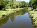
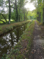
(1) Turn right along the canal and, turning left, cross the Pont de la Libération. After the bridge, turn immediately left onto Quai de la Donac. Pass the Musée de l’Outil et des Métiers. Continue along the canal to lock no. 34 at La Gromillais.

(2) Leave the canal by turning right onto the road to follow the shared footpath and cycle path. At the roundabout, carry on straight ahead along Rue de la Gromillais and take thefirst street on the right, Rue des Dames.

(3) Cross Rue de la Liberté and continue straight on along Rue du Courtil Jamet. Turn right as you leave the town. Head south towards La Saude Cochère.

(4) Before reaching the departmental road, turn left to follow it alongside, heading towards the radio mast, then continue along the track. Join the departmental road at the Pondichéry farm.

(5) Cross the D20 and follow the road leading to Longrais for 50 metres. Turn left after the farm (this track does not appear on IGN maps) and carry on until you reach a road.

(6) Turn right and walk alongside the Étang de Rolin (private). Ignore the path on the left and carry on straight ahead. Cross a road and continue straight on. You’ll reach a junction with the D795.

(7) Turn right and follow the right-hand verge of the D795 for 200 m. Take thefirst road on the right. Continue to the right towards Trignoux. Pass through the entire hamlet staying on the same road and, on leaving it, turn left and continue westwards.

(8) At the bend, carry on straight ahead along the path. At the crossroads, carry on straight ahead (this path does not appear on IGN maps) until you reach the road leading to Cohier. Turn right.

(9) Cut across the clump of trees, turning left to join the Route du Mesnil. Follow it to the left. Pass under the high-voltage power line and walk past the houses of Glehec on your right.

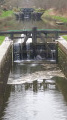
(10) After the right-hand bend, take the path on the left which leads into Tinténiac onto Rue du Clos de Justice. Turn left onto the protected pavement. Continue left along Rue du Pont à l’Abbesse and cross the bridge again. Below on the left is lock no. 33 at Pont à l’Abbesse.

(11) Turn left just after the bridge and stay on Rue de l’Écotay as it moves away from the canal. At the end of the street, turn right onto Rue du Four à Ban, then left onto Rue du Prieuré, which runs alongside the church. Keep left at the roundabout, then turn right onto Rue du Bas Champ.

(12) At the roundabout by the cemetery, turn right onto Rue Rafred, then right again onto Rue du Puits Frin. Continue left onto Rue Nationale, then finally turn right to reach the car park (S/E).

Waypoints

  1. S/E : mi 0 - alt. 157 ft - Place André Ferré
  2. 1 : mi 0.21 - alt. 118 ft - Canal d'Ille-et-Rance
  3. 2 : mi 1.45 - alt. 115 ft - Gromillais Lock
  4. 3 : mi 1.92 - alt. 154 ft - Junction with Rue de la Liberté
  5. 4 : mi 2.63 - alt. 177 ft - La Saude Cochère
  6. 5 : mi 3.21 - alt. 220 ft - Pondicherry
  7. 6 : mi 3.55 - alt. 207 ft - Rolin Pond
  8. 7 : mi 4.79 - alt. 253 ft - Junction with the D795
  9. 8 : mi 6.15 - alt. 213 ft - Path continuing along this route
  10. 9 : mi 6.63 - alt. 148 ft - Path to the left
  11. 10 : mi 7.08 - alt. 171 ft - Path to the left
  12. 11 : mi 7.65 - alt. 128 ft - The Pont à l’Abbese lock
  13. 12 : mi 8.06 - alt. 167 ft - Cemetery crossroads
  14. S/E : mi 8.22 - alt. 157 ft - Place André Ferré

Worth a visit

The Pont à l’Abbesse lock (lock no. 33)

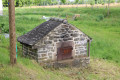
The construction of the Ille-et-Rance Canal between 1804 and 1832 boosted the town’s economic development by serving the tannery and the flour mill situated alongside the canal at Pont à l’Abbesse. The Pont à l’Abbesse lock site was a hub for significant goods traffic: grain, timber, coal and firewood destined for bakers in the towns of Rennes, Dinan and Saint-Malo.

The Museum of Tools and Trades

On the banks of the canal, former grain stores have been converted into the Museum of Tools and Crafts, housing extensive collections of tools and equipment displayed in context to recreate the workshops of rural craftsmen.

The church of Quériac and its twisted bell tower (12th century)

Take a look at the top of the bell tower. It appears to be slightly twisted to the right. But no, it is actually twisted by one-eighth of a turn and is one of around fifty twisted bell towers recorded to date in Europe – and the only one in Brittany.

The historic centre of Tinténiac

Tinténiac was renowned throughout France and Europe for its trade and industry in linen and hemp cloth, which brought it prosperity from the 14th century until the end of the 17th century.
Places to see: the 16th-century carved ‘gerbières’ on Rue Nationale (roof windows opening onto the loft through which bundles of firewood were passed); the houses with porches, the Grand Cour manor house (15th century, Rue des Dames), the ‘logis-porche’ (15th century, Place de l’Auditoire), and the former salt storehouse (16th century; 11, Rue de l’Écotay).

Reviews and comments

4.6 / 5
Based on 3 reviews

Reliability of the description
4.3 / 5
Ease of following the route
4.7 / 5
Route interest
4.7 / 5
randobre
randobre

Overall rating : 4.3 / 5

Date of your route : Mar 26, 2024
Reliability of the description : ★★★★☆ Good
Ease of following the route : ★★★★★ Very good
Route interest : ★★★★☆ Good
Very busy route : No

We went on a group walk today; the starting point was signposted at the Quai du Canal de l’Île-et-Rance, where it was very easy to park. There was a slightly damp section along a sunken path, but it was a very pleasant and varied walk. The total distance was 12 km. It was the perfect spot for a picnic at lunchtime, with plenty of tables available.

Machine-translated

Mordelles Rando
Mordelles Rando
• Edited:

Overall rating : 4.3 / 5

Date of your route : Mar 06, 2024
Reliability of the description : ★★★★☆ Good
Ease of following the route : ★★★★☆ Good
Route interest : ★★★★★ Very good
Very busy route : Yes

A lovely 12-kilometre walk, with the option of taking shortcuts to bring the distance down to 10 km. No particular difficulties – follow this up with a visit to the town of Tinténiac and its magnificent church

Machine-translated

Laurence44810
Laurence44810

Overall rating : 5 / 5

Date of your route : Oct 10, 2020
Reliability of the description : ★★★★★ Very good
Ease of following the route : ★★★★★ Very good
Route interest : ★★★★★ Very good
Very busy route : Yes

A lovely walk. Beautiful countryside. The signposting is spot on, as most of the route follows Vitré Communauté’s Route No. 61. I’d highly recommend it!

Machine-translated

Other walks in the area

For more walks, use our search engine .

The GPS track and description are the property of this route's author. Please do not copy them without permission.