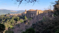
Pérache Valley from Collobrières

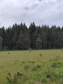
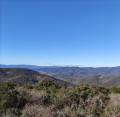
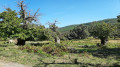
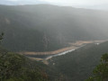
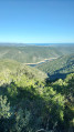
Enjoy a stroll in the shade in the Maures mountains. The climb up the hill will allow you to take in the magnificent views of Collobrières and the various valleys.

Details

63223257
Creation:
Last update:
Last review:
  • Walking
    Activity: Walking
  • ↔
    Distance: 2.39 mi
  • ◔
    Average duration: 1h 45 
  • ▲
    Difficulty: Easy

  • ⚐
    Back to start: Yes
  • ↗
    Ascent: + 715 ft
  • ↘
    Descent: - 715 ft

  • ▲
    Highest point: 1,227 ft
  • ▼
    Lowest point: 495 ft

Description of the walk

Walk through the village of Collobrières with its narrow streets to reach the car park next to the Confiserie Azuréenne.

(S/E) Leave the car park by turning right, then left, heading towards the town centre. Cross the old bridge and continue straight ahead along Rue Camille Desmoulins: follow the red and white markings forthe GR®90.

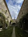
(1) Take the alley opposite (Rue Blanqui) to come out onto Rue Montesquieu. First turn right then left to reach Rue Copernic, turn left and head towards the ruins of Saint-Pons Church.

(2) Turn right, then left a few metres further on. Keep to the right at the first junction, following theGR® markings. Head into the woodland; further on, veer slightly to the left whilst continuing to climb. Join the nature trail.

(3) Follow it, turning right. Pass the viewpoint and carry on straight ahead downhill.

(4) Head right towards the village. Pass the cemetery on your left, go past a small car park and head diagonally left to follow Rue Jean-Jacques Rousseau. At the end, turn left and cross the bridge.

(5) Turn right onto Avenue du Général Koenig and carry on straight ahead to reach the car park by the sweet shop (S/E).

Waypoints

  1. S/E : mi 0 - alt. 512 ft - Car park near the - Réal Collobrier (rivière)
  2. 1 : mi 0.15 - alt. 512 ft - Rue Blanqui
  3. 2 : mi 0.25 - alt. 587 ft - Saint-Pons Church
  4. 3 : mi 0.99 - alt. 1,181 ft - Discovery trail
  5. 4 : mi 1.53 - alt. 886 ft - Junction
  6. 5 : mi 2.21 - alt. 495 ft - Avenue du Général Koenig
  7. S/E : mi 2.39 - alt. 512 ft - Car park

Always be cautious and plan ahead when you're outdoors. Visorando and the author of this route cannot be held responsible for any accidents occurring on this route.

The GR® and PR® markings are the intellectual property of the Fédération Française de Randonnée Pédestre.

Reviews and comments

4.7 / 5
Based on 2 reviews

Reliability of the description
5 / 5
Ease of following the route
5 / 5
Route interest
4 / 5
Arnauld13
Arnauld13

Overall rating : 4.7 / 5

Date of your route : Apr 24, 2025
Reliability of the description : ★★★★★ Very good
Ease of following the route : ★★★★★ Very good
Route interest : ★★★★☆ Good
Very busy route : No

A lovely walk

Machine-translated

RONALD CONEJERO
RONALD CONEJERO

Overall rating : 4.7 / 5

Date of your route : Apr 14, 2025
Reliability of the description : ★★★★★ Very good
Ease of following the route : ★★★★★ Very good
Route interest : ★★★★☆ Good
Very busy route : No

A lovely, shaded and fairly easy walk; the car park at the start is big enough to park in without any problems.

Machine-translated

Other walks in the area

For more walks, use our search engine .

The GPS track and description are the property of this route's author. Please do not copy them without permission.