The Coudre Valley, starting from Saint-Germain-de-la-Coudre

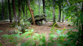
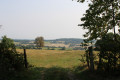
A lovely walk through the Percheron countryside and the Perche Regional Park. Numerous watercourses flow through this area: the Coudre, the Même, the Coutillonnière and the Jaunet, all of which flow into the Huisnes. The undulating route follows beautiful sunken lanes lined with pollarded trees.

Details

n°4532813
Creation:
Last update:
Last review:
  • Walking
    Activity: Walking
  • ↔
    Distance: 10.24 mi
  • ◔
    Average duration: 5h 20 
  • ▲
    Difficulty: Average

  • ⚐
    Back to start: Yes
  • ↗
    Ascent: + 673 ft
  • ↘
    Descent: - 650 ft

  • ▲
    Highest point: 607 ft
  • ▼
    Lowest point: 318 ft

Photos

Description of the walk

Start from the car park at the edge of the village on the Bellême side.

(S/E) Cross the footbridge over the River Coudre, keep to the right and follow Rue de l’Arche, which leads onto the D107.

(1) Turn left onto the D107 and, after about 450 m, turn right onto the stony path of Clos Fontaine, which climbs steeply up to a wide stony track.

(2) Follow this lane to the right as it enters the woods and heads due south for 2 km.

(3) Before reaching La Verrerie, leave the track to the right and follow a small dirt track which descends, passes Les Marquetières and joins a small tarmac road at a place called Pont Andreux.

(4) Turn left onto this road, cross the bridge over the Même and join the D7, which you follow to the left for 20 m. Opposite, take the grassy track that passes through La Roncinière and leads to a tarmac road.

(5) Turn left and, after about 100 metres, turn right onto the Chemin de la Perruche. Continue straight ahead. Pass a fence post, cross the pasture and rejoin the path leading to the hamlet known as Le Carrefour.

(6) Before reaching the houses, turn right onto a path through the woods and, before heading down towards Les Bouillons, turn left onto a tarmac road, which you follow to the left until you reach a Fork in the road.

(7) Turn right, pass Les Arpents and, before the water tower, turn right onto a stony track leading to La Renardière.

(8) Turn left onto a dirt track which leads to Gagnier and follow the tarmac road. Pass La Miterie, continue to a road which you follow to the right, and go past La Buchère.

(9) At a bend, take a track on the right which descends towards l’Oseraie; pass this and turn left towards Champ Sauvage and Courmartin.

(10) Cross the D638, head towards Le Bignon and join the D211.

(11) Turn right towards Moulin de Buat, which you pass. Continue along this road as it climbs.

(12) Take the Chemin du Mothuet on the right, which leads to La Grange Rouge.

(13) Before you reach the buildings, turn left and follow the road past the mine and then a factory.

(14) When you reach the D211, turn right and enter Saint-Germain-de-la-Coudre. Walk past the church and return to the starting car park (S/E).


Waypoints

  1. S/E : mi 0 - alt. 341 ft - Car park at the town’s exit towards Bellême, on the banks of the - Coudre (cours d'eau) - Affluent de la Même
  2. 1 : mi 0.27 - alt. 354 ft - Exit via the D107
  3. 2 : mi 0.87 - alt. 604 ft - Junction with the forest track
  4. 3 : mi 2.18 - alt. 548 ft - Junction before La Verrerie
  5. 4 : mi 2.65 - alt. 322 ft - The Pont Andreux - Même (rivière)
  6. 5 : mi 3.55 - alt. 423 ft - Route de la Roncinière
  7. 6 : mi 4.89 - alt. 574 ft - Locality: Le Carrefour
  8. 7 : mi 5.82 - alt. 574 ft - Route des Arpens
  9. 8 : mi 6.35 - alt. 574 ft - La Renardière
  10. 9 : mi 7.15 - alt. 456 ft - Chemin de l’Auseraie
  11. 10 : mi 7.95 - alt. 482 ft - D638
  12. 11 : mi 8.3 - alt. 407 ft - D211 road
  13. 12 : mi 8.8 - alt. 413 ft - Chemin du Mothuet
  14. 13 : mi 9.25 - alt. 384 ft - La Grange Rouge
  15. 14 : mi 9.72 - alt. 433 ft - Route de Bellou le Trichard
  16. S/E : mi 10.24 - alt. 341 ft - Car park on the outskirts of the village on the Bellême side

Notes

In Saint-Germain-de-la-Coudre, all amenities are available.

Reviews and comments

4.3 / 5
Based on 2 reviews

Reliability of the description
5 / 5
Ease of following the route
4.5 / 5
Route interest
3.5 / 5
epiluc91
epiluc91

Overall rating : 4 / 5

Date of your route : May 31, 2024
Reliability of the description : ★★★★★ Very good
Ease of following the route : ★★★★☆ Good
Route interest : ★★★☆☆ Average
Very busy route : No

We only managed part of the walk due to the ground conditions. Bear in mind that, after a long spell of rain like the one we’ve had recently, a ‘sunken path’ means mud – or even a stream – and a ‘grassy path’ means tall grass overgrowing the track.... So we took a few shortcuts along some very quiet minor roads. Otherwise, the walk is quite pleasant...

Machine-translated

kiwi61
kiwi61

Overall rating : 4.7 / 5

Date of your route : Feb 01, 2021
Reliability of the description : ★★★★★ Very good
Ease of following the route : ★★★★★ Very good
Route interest : ★★★★☆ Good
Very busy route : No

A pleasant route that takes you through woods and countryside.

Machine-translated

Other walks in the area

For more walks, use our search engine .

The GPS track and description are the property of this route's author. Please do not copy them without permission.