


philkikou

 Visorando Member
Sign up:
Published route(s)
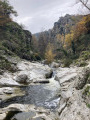
 Between the Cance and Ay rivers
 9.72 mi
 +1,972 ft
 -1,982 ft
 6h 10
6h 10
 Difficult
 Departure from Sarras (Ardèche)
Hike between the Cance and Ay valleys with beautiful views.
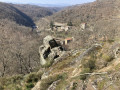
Cance Valley, southern and northern slopes, via Tourtel and Assuis
 11.75 mi
+2,444 ft
-2,461 ft
7h 30
Difficult
Departure from Talencieux (Ardèche)
11.75 mi
+2,444 ft
-2,461 ft
7h 30
Difficult
Departure from Talencieux (Ardèche)
This route follows many unmarked paths along the edge of the Cance Valley. Given the very large number of paths, it is difficult to provide directions at every junction. The use of a GPS is therefore strongly recommended.