(S/E) With your back to the car park, turn left into Rue des Anciens Combattants. Through this urban neighbourhood, continue straight ahead at the roundabout along Rue Corvisart until you reach the junction with Rue Rimbaud.
(1) Turn right onto it, then veer left onto Rue de Massembre. Leave this street shortly afterwards and turn right onto Rue de Mon Plaisir, which then becomes an unpaved track. Head towards the old Mon Plaisir farm.
(2) Carry on along this track, which overlooks the Givet shopping area to your right. Continue as far as the Bois du Pavillon.
(3) Take the path on the left at the edge of the woods and head up to the pylon.
Please note: the path passes in front of a kennel, which may look frightening but is safe as it is securely fenced off.
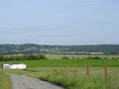
(4) Turn left onto the Chemin Rural de Gyptienne and carry on straight ahead, ignoring all side paths, until you reach the model aeroplane field.
(5) Take the path on the left, which turns at almost a 90° angle, and head down the Chemin de la Vieille Duve to the road, opposite the COSEC. Turn left, then right, and head to the car park (S/E).
5 : mi 2.61 - alt. 518 ft - Model aeroplane flying field
S/E : mi 3.27 - alt. 335 ft - COSEC Charles de Gaulle car park. Near the - Meuse (fleuve)
Worth a visit
You’ll be able to discover:
Between (1) and (2), take a look at the two Trinacria houses; these two adjoining houses bear the symbol of Sicily – the Trinacria – on their pediments. This is evidence of the owners’ Sicilian origins.
(2) The former Mon Plaisir farm.
Between (4) and (5) As you walk along this path, do remember to look to your right from time to time to discover:
- the valley of the Ruisseau de Massembre,
- the Massembre holiday village,
- the old fortified farm at Massembre
- and, at the top of the hill, the silos at Mesnil Sant Blaise in Belgium.
Before (5), stop just past the hedgerows and look to your left:
- the village of Fromelennes,
- further on, a little to the left in the forest, the Belgian village of Feschaux,
- further to the left, the holiday village of Massembre, the wind turbines and the silos at Mesnil Saint Blaise.
(5) take a moment to enjoy the views of:
- Belgium to the north,
- then, from left to right, the old castle of Agimont, the Meuse with the piers of the Heer-Agimont bridge, the village of Agimont and the holiday village of Massembre,
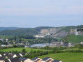
- to the south, take the time to explore the 180° view, from left to right: the Houille Valley, Mont d’Haurs, the Grégoire Tower, Givet Notre-Dame, the Meuse Valley, the Victoire Tower, Givet Saint-Hilaire, the blue stone quarries, Charlemont, the citadel of Givet, Fort Condé, the Maugis Tower and the old Agimont manor house.
Reviews and comments
4.4 / 5
Based on 3 reviews
Reliability of the description 5 / 5
Ease of following the route 4.7 / 5
Route interest 3.7 / 5
mistigri
Overall rating :
4.3 / 5
Date of your route : Jun 07, 2025 Reliability of the description : ★★★★★ Very good Ease of following the route : ★★★★★ Very good Route interest : ★★★☆☆ Average Very busy route : No
A pleasant walk with no difficulties, but it's a shame the panorama is a long way from the route...
Machine-translated
blamal
Overall rating :
4.7 / 5
Date of your route : Feb 18, 2025 Reliability of the description : ★★★★★ Very good Ease of following the route : ★★★★☆ Good Route interest : ★★★★★ Very good Very busy route : No
Hello,
I had a bit of trouble finding Rue de Massembre.
Perhaps you could review the description.
Kind regards, Bernard Lamal
Machine-translated
FerBer
Overall rating :
4.3 / 5
Date of your route : Jan 12, 2025 Reliability of the description : ★★★★★ Very good Ease of following the route : ★★★★★ Very good Route interest : ★★★☆☆ Average Very busy route : Yes
To open this route on your smartphone, you must have the Visorando app installed. If not, got to the Apple Store (iPhone) or Google Play Store (Android) to download the app.



 Country:
 City:
City:



 Visorando Member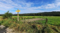
 Moderate
 Difficult