Discovering Waulsort

This route takes you up to the heights of Waulsort and offers a breathtaking view of the brickworks.

Details

69086317
Creation:
Last update:
Last review:
  • Walking
    Activity: Walking
  • ↔
    Distance: 3.60 mi
  • ◔
    Average duration: 2h 00 
  • ▲
    Difficulty: Moderate

  • ⚐
    Back to start: Yes
  • ↗
    Ascent: + 381 ft
  • ↘
    Descent: - 384 ft

  • ▲
    Highest point: 692 ft
  • ▼
    Lowest point: 302 ft

Photos

Description of the walk

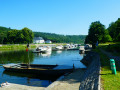
Starts from the picnic area at the Waulsort dam.

(S/E) Cross the Meuse via the dam and then the Waulsort lock.

(1) Walk round the lock building, cross Rue de Meuse with care and follow it to the left.

(2) Take thefirst street on the right until you reach the small bridge over the old railway line. Then turn right into Rue des Villas. Next, take thesecond path on your left. This is a narrow path that runs round the back of the Mosan houses. Carry on straight ahead when you return to a tarmac road and then back onto a footpath, until you reach a junction.

(3) At the junction, turn immediately left, following the signs with a Blue Diamond for the Promenade des Chamias. This road, which starts as a tarmac road, continues as a narrow dirt track. At the end of the dirt track, turn left. Enter a holiday estate and carry on straight ahead until you reach the sign for “Bungalow 30-31-32”. The walk continues immediately after this. Ahead of you, you’ll see a sign reading “Sentier du Chamia”; take this path and walk a good hundred metres until you reach a path on the left.

(4) Take this path and you’ll be rewarded with a magnificent view! Then carry on, following the Blue Diamond.

(5) At the Y-junction with a wide track, turn left. Continue to follow the Blue Diamond and, at the next junction, turn sharply right. Here, the Sentier du Chamia joins the Fond des Vaux walkway. Now follow the Blue Diamond and the Red Diamond. Twice, after a small right-angle bend, turn left downhill and follow the edge of the woods along a grassy path that descends towards the village.

(6) In the old village, turn left and then, straight away, take the first street on the right. After the 90° right-hand bend, turn left onto Rue du Parvis, which leads down towards the church. After the church, carry on straight ahead until you reach a narrow passageway with stone walls. Pass under the old railway line and you’ll find yourself facing the Meuse, near the Passage d’Eau.

(7) At the Passage d’Eau, there are two options: either turn right, then right again.

(8) Turn left, following the old railway line, and follow the Blue Rectangle. Turn left as you leave the small path, then turn right onto Rue des Bassires, until you come back to the lock.

(1) Cross the lock and return to your starting point (S/E). 

Waypoints

  1. S/E : mi 0 - alt. 312 ft - Waulsort Dam - Meuse (fleuve)
  2. 1 : mi 0.51 - alt. 315 ft - Waulsort lock
  3. 2 : mi 0.56 - alt. 318 ft - Rue des Bassires
  4. 3 : mi 0.91 - alt. 348 ft - Y-junction
  5. 4 : mi 1.37 - alt. 502 ft - Viewpoint
  6. 5 : mi 1.55 - alt. 614 ft - T-junction
  7. 6 : mi 2.34 - alt. 469 ft - Former village
  8. 7 : mi 2.63 - alt. 325 ft - The Water Crossing
  9. 8 : mi 2.69 - alt. 325 ft - Railway
  10. S/E : mi 3.6 - alt. 308 ft - Waulsort Dam

Notes

Alternative route:
(7) You can take the path (see timetable under ‘Nearby’), then follow the path to the right on the other side of the Meuse riverbank to return to the starting point (S/E).

Muddy in wet weather; not suitable for pushchairs.

A lovely climb up to the heights of Waulsort between (3) and (4). Otherwise, a fairly flat walk.
Water point between (6) and (7).

Worth a visit

Between (1) and (2), a memorial to 23 August 1914. On that day, the German181st Infantry Regiment crossed the Meuse via a pontoon bridge and by fording. Faced with resistance from a few French soldiers, the attackers shot 14 civilians in front of the Waulsort Lock and set fire to 11 houses.


Between (2) and (3), cross a bridge built over the old railway line dating from 1863, which linked Dinant to Givet. Unfortunately, Line 154 has been closed since 1989. As you explore the village, you will still see some of its remains.

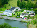
(4) A magnificent panorama overlooking the hillside opposite Hastière-par-delà, with its former brickworks converted into flats and houses, and, higher up, the Domaine du Bonsoi.


(7) Opposite the Passage d’Eau, from 5 April 2025 to 1 October 2025 between 10 am and 6 pm, a ferryman can take you across the Meuse on a ferry using a ‘sabot’. This crossing was established in 1871, following the construction of the railway line linking Dinant to Givet on the left bank (opened in 1863). It enabled the residents of Falmagne and Falmignoul to reach the opposite bank to catch the train to Dinant.

Along the railway line, you’ll pass behind “La Villa 1900”, which, as its name suggests, is a villa dating from 1902, featuring typical Mosan architecture from the Belle Époque. Unfortunately, it has been closed since 2024. Until then, the villa was run by an eco-friendly cooperative which hosted small concerts and served local cuisine in an authentic setting featuring period décor.

Reviews and comments

4.2 / 5
Based on 3 reviews

Ease of following the route
4.3 / 5
Route interest
4 / 5
jamy quintens
jamy quintens

Overall rating : 4 / 5

Date of your route : May 12, 2025
Ease of following the route : ★★★★☆ Good
Route interest : ★★★★☆ Good
Very busy route : Yes

A lovely walk – best done outside of weekends and public holidays

Machine-translated

Bragon_be
Bragon_be

Overall rating : 5 / 5

Date of your route : May 10, 2025
Ease of following the route : ★★★★★ Very good
Route interest : ★★★★★ Very good
Very busy route : No

A lovely walk with some stunning views of the Meuse. Between points 4 and 5, on the climb, don’t hesitate to leave the main path and follow the small tracks to the left… these tracks lead to cliffs overlooking the Meuse and offer splendid views. Be careful – there’s a risk of falling.
A lovely descent towards the Meuse – make sure you follow the path that runs between the houses and the woods.
We were able to make use of the ford to cross the Meuse… a really lovely thing to do.

We didn’t have any problems with mud, but it had been dry for several days.

Machine-translated

jamy quintens
jamy quintens

Overall rating : 3.7 / 5

Date of your route : Mar 04, 2025
Ease of following the route : ★★★★☆ Good
Route interest : ★★★☆☆ Average
Very busy route : Yes

Easy route, muddy in the woodland section. Moderately interesting

Machine-translated

Other walks in the area

For more walks, use our search engine .

The GPS track and description are the property of this route's author. Please do not copy them without permission.