A nod to Belgium from Givet

Discover the border marker between France and Belgium and take a look northwards at it on your way back.

Details

62866317
Creation:
Last update:
Last review:
  • Walking
    Activity: Walking
  • ↔
    Distance: 5.29 mi
  • ◔
    Average duration: 2h 40 
  • ▲
    Difficulty: Easy

  • ⚐
    Back to start: Yes
  • ↗
    Ascent: + 299 ft
  • ↘
    Descent: - 272 ft

  • ▲
    Highest point: 577 ft
  • ▼
    Lowest point: 338 ft
  • ⚐ Country: France
  • ⚐ City: Givet (08600)
  • ⚑
    Start/End: N 50.136744° / E 4.835474°
  • ❏
    IGN map(s): Ref. 3008SB
  • Hour-by-hour weather

Photos

Description of the walk

The walk starts from the car park at the Salle Charles de Gaulle (Cosec).

Follow signpost no. 2.

(S/E) Leave the car park and turn left onto Rue des Anciens Combattants until you reach the roundabout.

(1) Pass thefirst street on the left and take the second one, Rue Corvisart, all the way to the end.

(2) Follow Rue Rimbaud to the right. Pass the cul-de-sac of the same name on your left and you’ll soon reach a junction.

(3) Turn left into Rue de Massembre. Shortly afterwards, turn right onto Rue Mon Plaisir. Follow this street, ignoring the side streets. Note two adjoining houses on the right bearing the symbol of Sicily, the Trinacria, on their gables. You will arrive at the old Mon Plaisir farm.

(4) Continue along the path, passing a retail area on your right. Pass a path on your left and walk alongside a woodland to reach the next junction.

(5) Then turn left at the edge of the woodland. Head uphill, cross a short stretch of woodland and continue through the fields until you reach the Ferme du Bois de l’Abbaye (the large stone is the plinth of a former statue dedicated to Jules Lartigue, a former mayor of Givet in the late 19th century).

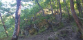
(6) Carry on straight ahead along the path (north-east). Walk alongside a woodland on your left, then enter it. You’ll come to a boundary marker indicating the border between France and Belgium.

(7) Turn left and head west towards Bois Marot. Enter the woodland and continue westwards. When you reach a private pond, the path turns south-west (cross a small bridge). Leave the woods and carry on in the same direction, heading uphill between the fields, ignoring the paths branching off to the right (the old fortified farm of Massembre is on your right). About 500 metres further on, you’ll reach a crossroads near a model aeroplane flying site.

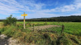
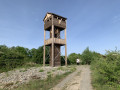
(8) Turn right, heading due west. At the next junction (viewpoint), veer left. Walk downhill to the Stop sign and turn left towards the roundabout you passed at the very start of the walk.

(1) Take the sharp right-hand bend to quickly return to the starting car park (S/E).

Waypoints

  1. S/E : mi 0 - alt. 338 ft - Co-organised by Charles de Gaulle
  2. 1 : mi 0.08 - alt. 364 ft - Roundabout – Junction of the circular loop
  3. 2 : mi 0.24 - alt. 394 ft - Rue Corvisart x Rue Rimbaud
  4. 3 : mi 0.4 - alt. 400 ft - Rue Rimbaud x Rue de Massembre
  5. 4 : mi 0.77 - alt. 410 ft - Mon Plaisir Farm
  6. 5 : mi 1.49 - alt. 417 ft - Junction
  7. 6 : mi 2.26 - alt. 545 ft - Ferme du Bois de l’Abbaye
  8. 7 : mi 2.87 - alt. 574 ft - The fortified farm at Massembre
  9. 8 : mi 4.5 - alt. 541 ft - Crossroads
  10. S/E : mi 5.29 - alt. 338 ft - Co-organised by Charles de Gaulle

Worth a visit

During your walk, you’ll discover:

- Two adjoining houses bearing the symbol of Sicily – the Trinacria – on their pediments. This is evidence of the owners’ Sicilian origins.
- The former Mon Plaisir farm.
- A large stone will catch your eye. It is the plinth of a statue dedicated to Jules Lartigue, former mayor of Givet (1884–1898). It used to stand in the town centre but was destroyed in the 1960s.
- The former fortified farmhouse of Massembre.
- The Domaine de Massembre, a Belgian holiday village.
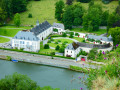
- The former Agimont Castle.
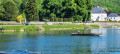
- The River Meuse with the piers of the Heer-Agimont bridge.
- The village of Agimont and the Massembre holiday village.
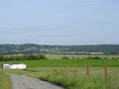
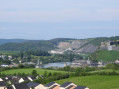
- The Houille Valley, Mont d’Haurs, the Grégoire Tower, Givet Notre-Dame, the Meuse Valley, the Victoire Tower, Givet Saint-Hilaire, the blue stone quarries, Charlemont (the citadel of Givet), Fort Condé, the Maugis Tower and the old manor house of Agimont.
- The village of Fromelennes and the Belgian village of Feschaux.

Reviews and comments

4.8 / 5
Based on 2 reviews

Reliability of the description
5 / 5
Ease of following the route
5 / 5
Route interest
4.5 / 5
SRODA
SRODA

Overall rating : 4.7 / 5

Date of your route : Oct 22, 2025
Reliability of the description : ★★★★★ Very good
Ease of following the route : ★★★★★ Very good
Route interest : ★★★★☆ Good
Very busy route : No

A very easy route offering beautiful views and allowing you to discover the lovely countryside in the hills above Givet. Very pretty in autumn. Very clear route.

Machine-translated

Élodie Coulonval
Élodie Coulonval

Overall rating : 5 / 5

Date of your route : Mar 15, 2025
Reliability of the description : ★★★★★ Very good
Ease of following the route : ★★★★★ Very good
Route interest : ★★★★★ Very good
Very busy route : No

A lovely walk – we didn’t come across many people on this trail

Machine-translated

Other walks in the area

For more walks, use our search engine .

The GPS track and description are the property of this route's author. Please do not copy them without permission.