Country:

 City:
City:


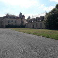
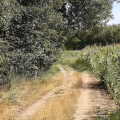
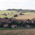
Start from the car park opposite Parentignat Castle or near the post office, which is just nearby.
Follow the white-and-red markings ofthe GR® 300 and the yellow-and-red markings ofthe GRP® Autour d’Issoire
(S/E) Walk past Parentignat Castle on your right, then cross the main road, Place du Château, to join Rue du Vieux Bourg, signposted ‘Aire de Gevillat’. Ignore the side paths and keep left at the Fork in the road to take Rue de Gevillat. Pass a path on your left.
(1) Keep right at the junction, Impasse de Gevillat, then immediately turn right at the first Fork in the road onto a wide lane. After about a hundred metres, keep right at the next Fork in the road so as to follow a hedge on your right. Turn right to go round the property. The path makes a wide left-hand bend, following the contour lines, then heads towards Durette, a beautiful property visible on your right a few hundred metres before you reach its entrance. Turn left onto the narrow Rue de La Voissette, with your back to the entrance to Durette.
(2) As soon as you’ve passed the drive signposted Gevillat (on the left), keep to the right onto a grassy path. This crosses the Ailloux stream, then joins Rue Romaine, onto which you’ll turn right.
No signposting
(3) Leave the tarmac after about fifty metres and take a path on the right. At the crossroads, take the left-hand-most track so that you keep the ancient volcano, on which Usson is built, on your left. At the junction with a cross-track, continue along the Chemin des Prés opposite, followed by a straight road.
White-red and yellow-red markings
(4) Keep to the right at the diagonal junction with Rue des Peupliers, then turn left onto the main street of Varennes-sur-Usson, Rue des Marronniers. At the left-hand bend, take the Chemin du Bois towards the church and cemetery. Pass the cemetery and its pretty chapel, then keep left at the Fork in the road. The track crosses the Eau Mère.
No signposting
(5) Leave theGR® at the junction and continue straight on. Cross the D 999 with care.
(6) At the crossroads, take the widest track on the far right. This track becomes tarmac as it enters the village of Les Pradeaux, becoming the Route de Saint-Rémy. Turn right at the junction with the main street, which is still called the Route de Saint-Rémy.
White-red and yellow-red markings
(7) Turn right onto Rue du Pont, which runs alongside the church; turn left at the cross just past the cemetery, then immediately right onto the small tarmac road. Turn left at the crossroads. The path curves sharply to the right.
(8) Turn left at the junction, cross the D 34, then continue straight on towards the riding centre.
(9) Leave the tarmac and take the first track on the right at the ‘No dumping’ sign. The forest track approaches the departmental road, then moves away from it, widening as it goes, passes under the D 999 (take the underpass) and then becomes the Chemin des Entrades.
(10) Continue straight on until you reach the Route des Pradeaux (D 34) to enter Parentignat. Turn left at the junction on the Place du Château to return to the starting point of the walk (S/E).


 Visorando Member
 Easy
Easy