Country:

 City:
City:


Start from the car park at the Stade de Luminy, Rue Henri Cochet.
(Out and back) Follow Rue Henri Cochet to the roundabout. Then take the cycle path on the left.
(1) At the start of the left-hand bend, take the track leading uphill to the right (barrier). Follow the valley to the next junction.
(2) Take the track leading down to the right. Ignore a turn-off to the right, pass close to the water tower and reach the bottom of the valley.
(3) At the bottom of the descent, stay on the track on the left which leads uphill.
(4) At a water tank, follow the track to the right until you reach the next fork.
(5) Take the track that climbs to the left.
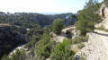
(6) Pass close to the Col Ricard on your left. After a long climb followed by a short, very steep descent, follow the Vallon de Chalabran. The track ends at the junction with the Route Gaston Rébuffat, which is closed to traffic.
(7) Turn right onto the road and arrive at the Col de la Gardiole.
(8) Continue along the track opposite, which is closed off by a barrier, towards the Auberge de la Fontasse.
(9) At the inn, take the track on the left (barrier) and follow it.
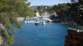
(10) Ignore the tracks on the right and arrive at the Calanque de Port Miou.
(11) Walk along the calanque, with the sea on your left, and at the end of it follow the track up a short but steep climb. This track runs above an old quarry before joining, further on, the track taken on the way out.
(10) Turn left and continue in the opposite direction to the outward journey.
(9) Pass the Auberge de la Fontasse and reach the Col de la Gardiole.
(8) At the pass, leave the route you have already taken and take the path to the right of the road. Cross the road twice; then, thethird time you reach it, turn left to rejoin the route you have already taken.
(7) Head up the Vallon de Chalabran on the right (which you passed through in the opposite direction on the way there). At the end of the valley, head up to the right and rejoin the fork you passed on the way there near the Col Ricard, ignoring the first path on the right.
(6) Leave the route you have already taken and follow the path to the right. After several hairpin bends, join a track.
(12) Continue along the track downhill, pass a concrete-paved section and arrive at the junction with a water tank.
(13) Ignore the track branching off to the right and continue downhill.
(2) This time, reach the junction you passed on the way out, and turn right, heading in the opposite direction to the way out as you descend.
(1) Reach the road, take the cycle path on the left and, at the roundabout, follow Rue Henri Cochet to the right to reach the Luminy Stadium car park (S/E).
 Visorando Member

 Moderate