Country:
 City:
City:


By car, coming from Cassis (D1), on Avenue Barthélémy Andreis, at the traffic light junction with a fountain on the left, turn left (D559A) onto Avenue Fernand Balducci, towards Carnoux/Aubagne. At the roundabout, go straight across towards the emergency services centre and, just after the supermarket on the right, park on the left in the Michelangeli car park.
(S/E) From the car park exit, at the roundabout with two large pine trees, follow the route taken by car to the junction with the traffic lights, where there is a fountain on the right. Cross the junction and follow the D559A towards Toulon/La Ciotat. Pass under the motorway bridge and continue along the D559A towards La Ciotat until you reachthe first hairpin bend on the right.
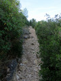
(1) Turn left onto the track, which is closed off by a barrier (start of the concrete climb). Continue for about 2.5 km and, at the three-way junction, turn right. You’ll soon come to a cross-track.
(2) Follow the track to the left.
(3) After the junction of two tracks, carry straight on, passing the Cabanon du Marquis, until you reach thefirst track junction on the left.
(4) Take this track to the left towards the summit of Montounier.
(5) Just before this, take the path on the left. Cross a track and continue down the slope until you reach another cross-track.
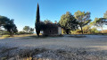
(6) Turn left onto the footpath to visit the Saint-André de Julhans Chapel, then return to the track.
(6) Turn left onto the track and carry on straight ahead until you reach the D3d.
(7) Follow it to the right until you reach the Grand Caunet ranch on the left and a car park on the right.
(8) From this car park, turn right onto the track, which is closed off by a barrier, until you reach a three-way junction.
(9) Follow the track to the right until you rejoin the route you have already taken.
(4) Carry on straight ahead along the track in the opposite direction to the outward journey and pass the Cabanon du Marquis again.
(3) About fifty metres before the junction of the two tracks you passed on the way there, turn left, heading due south; quickly ignore a path branching off to the right and continue along the track for about 100 metres.
(10) Then take the path on the right into the Vallon des Conquettes.
(11) At the junction with the Vallon de Gendame, by the cairn, follow the path on the left and continue down the slope.
(12) Follow the path to the left and continue down the valley.
(13) Where the path joins the track, follow the track to the right until you reach a fork towards the end of the valley, a few metres before a road.
(14) Take the track to the right. After a few hairpin bends, reach the ridge and then a fork.
(15) Turn onto the track on the right, pass in front of the Cabanon des Gardes and reach the next fork.
(16) Follow the track to the left, reaching the Pas d’Ouillier and then a road.
(17) Follow the D559a to the right and reach the junction you passed on the way out.
(1) Continue along the D559a, heading in the opposite direction to the outward journey, to Roquefort-la-Bédoule and the Michelangeli car park (S/E).

 Visorando Member

 Difficult