Country:

 City:


Park in the square in front of Ablain-Saint-Nazaire Town Hall.
(S/E) Take Allée Jules Ferry, which runs down to the right of the town hall. Cross the small bridge, turn right and follow the Saint-Nazaire river. Continue to the junction with Rue Ponthiers.
(1) Turn left here; at the next junction, after passing the football ground, turn right onto the path that forms part of theGR® 127 and 145 routes. You’ll soon reach another junction.
(2) Leave theGR® and turn right onto the path between the fields. Then follow the edge of the woodland until you reach the junction with Rue de Lens. Turn left onto this street, which forms part of theGR®127variant. Follow the red and white markings along the path that continues from this street.
Enter the Grand Pré housing estate
Cross Rue Pasteur (D937), taking great care as it is dangerous. Continue along Chemin de Lens until you reach the Y-junction with Chemin de Lille.
(3) Turn right here and enjoy a lovely view of the Jumeaux de Loos en Gohelle slag heaps
Reach Chemin de Tortillard.
(4) Turn left onto it, walking past the Villa des Roses; on your right is the Parc René Cassin. Continue straight on, then turn right onto Rue de la Résidence du Seigneur du Rietz and you’ll come to a Stop sign.
(5) Turn left onto Rue Jean Jaurès, following the red and whiteGR®127signposts again. Pass under the motorway. Turn right immediately afterwards.
(6) Cross the Souchez. Leave theGR® at the next junction and take the path opposite. Walk alongside the woodland until you reach a junction marked by a memorial stone.
At the bridge, turn left onto the path leading up from the 44th Thbn memorial, ‘The Pimple’.
(7) Keep left, continuing along the edge of the woodland. Carry on along Rue Pasteur. Turn right onto Rue Marcel Sembat, then turn right off it onto Rue Isaïe Pruvost. Continue to the junction at Place Émile Basy.
(8) Turn right, then left to take Rue Florent Evrard on the left. Continue right onto Rue Pierre Curie and, just before it ends, you’ll reach a junction of footpaths.
(9) Take this path heading due south, passing through the hamlet of La Vignette. After the copse, turn right onto the footpath and rejoin the junction with theGR®127alternative route.
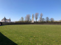
(10) Turn right onto theGR®, keep to the left, walk alongside the Givenchy copse, and arrive at the Canadian War Cemetery (1914–1918) in Givenchy-en-Gohelle.
(11) Continue along theGR®, passing under the motorway once more. You’ll reach the junction with the pumping station and Rue Victor Hugo.
(12) Turn left onto this road, follow it, then turn left onto Rue Raoul Briquet. Continue straight ahead onto Rue Peri Brossolette. Walk alongside the River Souche. You’ll reach the Jonglez de Ligne Chapel.
(13) Turn left onto the track, then take the Sentier des Talus. Walk alongside the Château du Carieul. Pass under the power line. Walk past the Pré Carency and the Prés Molaine. Walk alongside the copse until you reach a Y-shaped junction of paths.
(14) Turn right onto the path, which widens to become Rue Molonne. Turn right onto Rue Marcel Lancino and head towards the junction by the Saint-Nazaire stream.
(15) Take the path on the left, following the stream. Leave the path at a bend to return to the original junction.
(1) Follow the route you took on the way out to return to the car park at the town hall square in Ablain-Saint-Nazaire (S/E).

 Association / Club / Walk leader


 Visorando Member

 Easy