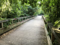
A walk through Bois Raguenet, Le Loret, the Cens and the Cholière pond

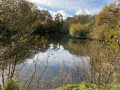
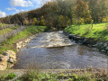
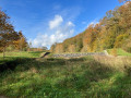
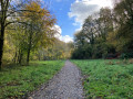
This is a lovely walk that allows you to discover very different aspects of the village of Orvault. After a quick visit to Bois Raguenet and its magnificent park, you’ll take a stroll through the countryside leading to the Château du Loret. Although it’s barely visible as you pass by, it will come into view once you reach the pond of the same name. Next, as you pass through the village of Orvault, you’ll be able to admire a huge wayside cross and a beautiful church. Finally, the route through the Cens valley will take you to the lovely Cholière pond.

Details

42540777
Creation:
Last update:
Last review:
  • Walking
    Activity: Walking
  • ↔
    Distance: 5.77 mi
  • ◔
    Average duration: 2h 50 
  • ▲
    Difficulty: Easy

  • ⚐
    Back to start: Yes
  • ↗
    Ascent: + 243 ft
  • ↘
    Descent: - 240 ft

  • ▲
    Highest point: 200 ft
  • ▼
    Lowest point: 36 ft
  • ⚐ Country: France
  • ⚐ City: Orvault (44700)
  • ⚑
    Start/End: N 47.254669° / W 1.600647°
  • ❏
    IGN map(s): Ref. 1223SB
  • Hour-by-hour weather

Photos

Description of the walk

Orvault (Petit Chantilly), Place d’Auteuil. Parking available.

(S/E) Walk up Rue de Saint-Cloud. At the end of the street, turn left onto Rue de Neuilly.

(1) Turn right onto Rue de la Madonne and walk down to a small square. Take the path that opens up at the far end of this square, then turn right. Cross the footbridge, continue straight ahead to reach Avenue du Pont de la Baronnière. Continue to the right until you reach the large roundabout.

(2) Turn left. Cross the boulevard carefully to go under the ring road bridge. Turn right onto Avenue de la Jalière, cross it immediately at the pedestrian crossing and take the small path leading uphill directly opposite you. Continue straight on until you reach Avenue du Bois Raguenet.

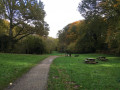
(3) Turn left, pass one street, and continue to a pedestrian crossing to take the entrance to the Bois Raguenet on your right. Follow the path to a junction near a huge sequoia. Turn left to leave the park near a small building on your right. Head towards a ‘Stop’ sign on your left and turn right onto Avenue du Couchant. Cross the road carefully at the first pedestrian crossing, continue to the right, leaving Rue du Tissandier on your left, and walk for about a hundred metres.

(4) Take the path on the left and follow it straight ahead, ignoring any turn-offs to the left or right. After crossing the road, the path takes a wide bend to the left and then to the right, passing between two trees to join a wide path.

(5) Turn left. After a long straight stretch, carry on straight ahead past the junction with the Allée du Plessis. The path then takes a right-angle bend to the right and joins a road, which you should cross very carefully.

(6) Take the road on the left signposted ‘Chemin du Loret’. Follow this road, which climbs slightly and, at the end of a long straight stretch, takes a right-angle bend to the left. Carry on a little further until you reach a Fork in the road.

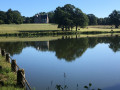
(7) Take the left-hand fork and pass the main entrance to Château du Loret (the château is not very visible). The road slopes down slightly. Carry on until you reach the Loret pond.

(8) Walk along this lovely pond, then carry on straight ahead until you reach a roundabout with a huge wayside cross on the left.

(9) Carry on straight ahead, cross a bridge to reach a large roundabout, where you’ll see Orvault Church directly opposite you. Turn left onto a road that slopes down alongside the church – keeping the church on your right – and continue to a small roundabout.

(10) Turn left into the entrance to the Bois de l’Avenir car park. Cross the garden, following a narrow path that turns into a flight of steps. You’ll come to a small gate in the boundary wall. Turn immediately right onto a fairly wide path, which takes a right-angled left turn and, after crossing two small streams, leads you to a wider path coming from the left.

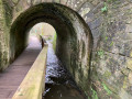
Turn right onto this path, which crosses the Cens and then runs along its right bank. Pass the Rocher du Diable and you’ll reach a small bridge that takes you over to the left bank of the Cens.

(11) Carry on straight ahead. At one point, the track turns sharply right and climbs slightly. Cross over the Cens (barely visible) and you’ll reach a grassy verge with an information sign titled ‘La digue’.

(12) Walk a good hundred metres to the left to pass under the expressway. Then turn right, walk alongside a retention basin, and cross a small stream. Turn right and follow a path that can be quite muddy at times. After a left-hand bend that takes you along the edge of a wood, the path turns left and climbs up to the Cholière pond.

(13) Walk alongside the pond, keeping it on your right. The path climbs and joins Avenue du Général de Gaulle, near the ‘Charmilles’ stop on bus route 79.

(14) Cross carefully at the pedestrian crossing and take the small lane opposite, which climbs slightly. At the end, turn right into Allée des Cèdres. Continue straight on until, on leaving the woods, you reach the Tredegar roundabout. Turn left onto Avenue de la Cholière, then at the next roundabout, turn right onto Rue de Saint-Ouen. You’ll soon reach Place d’Auteuil (S/E).

Waypoints

  1. S/E : mi 0 - alt. 141 ft - Place d’Auteuil, Orvault
  2. 1 : mi 0.39 - alt. 125 ft - Rue de la Madone
  3. 2 : mi 0.79 - alt. 72 ft - Roundabout
  4. 3 : mi 0.97 - alt. 128 ft - Avenue du Bois Raguenet
  5. 4 : mi 1.4 - alt. 154 ft - Path
  6. 5 : mi 1.69 - alt. 157 ft - Path junction, turn left
  7. 6 : mi 2.17 - alt. 151 ft - Allée du Loret
  8. 7 : mi 2.75 - alt. 194 ft - Junction: turn left. Passage close to the - Château du Loret (Orvault)
  9. 8 : mi 3.04 - alt. 118 ft - Étang du Loret
  10. 9 : mi 3.38 - alt. 128 ft - Calvaire
  11. 10 : mi 3.58 - alt. 128 ft - Bois de l’Avenir car park. Towards the - Pont aux Prêtres
  12. 11 : mi 4.32 - alt. 49 ft - Small bridge over the - Cens (rivière)
  13. 12 : mi 4.72 - alt. 59 ft - Information board: The embankment
  14. 13 : mi 5.12 - alt. 79 ft - Étang de la Cholière
  15. 14 : mi 5.36 - alt. 138 ft - Avenue du Général de Gaulle
  16. S/E : mi 5.77 - alt. 144 ft - Place d’Auteuil, Orvault

Notes

  • To reach Place d’Auteuil in Orvault (Petit Chantilly):

. by car: parking available at Place d’Auteuil.
. by bus: alight at the “Petit Chantilly” stop on bus route 79.

  • Follow the route without paying attention to the signposts that appear from time to time. These correspond to various routes that cross and criss-cross one another.
  • There are a few sections on roads, of varying lengths, but most of the route is on roads with little traffic. Do take care, though.
  • The climb up the Cens valley offers numerous (short) alternative routes. For example, just before the small bridge at the point (11), take the path that branches off to the right. Follow it straight ahead; it will take you to the embankment (12), following the right bank of the Cens at varying distances. However, it can be very muddy.

Worth a visit

  • Bois Raguenet Park (4) features several remarkable trees, including a magnificent sequoia.
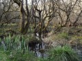
  • Between points (10) and (13), the Cens valley offers plenty of benches where you can rest or admire the scenery.
  • The Étang de la Cholière is a lovely spot for a picnic.

Reviews and comments

3.7 / 5
Based on 4 reviews

Reliability of the description
3.8 / 5
Ease of following the route
3.5 / 5
Route interest
3.8 / 5
User 11793730

Overall rating : 5 / 5

Date of your route : Apr 13, 2026
Reliability of the description : ★★★★★ Very good
Ease of following the route : ★★★★★ Very good
Route interest : ★★★★★ Very good
Very busy route : No

A lovely, varied walk through the neighbourhoods, the Cens Valley, the village of Orvault and Loret Castle.

Machine-translated

DOMYRANDO
DOMYRANDO

Overall rating : 3.3 / 5

Date of your route : Dec 12, 2024
Reliability of the description : ★★★☆☆ Average
Ease of following the route : ★★★☆☆ Average
Route interest : ★★★★☆ Good
Very busy route : No

A walk combining town and countryside, with some truly beautiful scenery whilst still being close to the town. However, there are many details along the route, so you need to pay close attention as it’s easy to go wrong (particularly between sections 3 and 4). We made a mistake involving the ‘castles’, so we returned via the cycle path towards the village (we’d set off from the village). We therefore didn’t try sections 6 to 9. If you’re looking for other walks around Orvault, I highly recommend this part of the route; whether it’s cold or sunny, the scenery is magnificent. For your information, I only use a map and no GPS.
A very varied walk taking in countryside, old neighbourhoods and a stream. BEWARE, however, of flood-prone areas during heavy rain. Well worth a go.

Machine-translated

LMC
LMC

Overall rating : 3 / 5

Date of your route : Sep 10, 2024
Reliability of the description : ★★☆☆☆ Disappointing
Ease of following the route : ★★☆☆☆ Disappointing
Route interest : ★★★★★ Very good
Very busy route : Yes

An interesting suggested route: one major drawback for those who aren’t from the area is that the route through the housing estates isn’t very clear (there aren’t any good landmarks), so you end up getting lost. What a shame!

Machine-translated

Clem382
Clem382

Overall rating : 3.3 / 5

Date of your route : May 09, 2024
Reliability of the description : ★★★★★ Very good
Ease of following the route : ★★★★☆ Good
Route interest : ★☆☆☆☆ Very disappointing
Very busy route : No

If you’re looking for a peaceful country walk where you can switch off: give this one a miss! You can hear the noise from the motorway for at least 80 per cent of the walk, and the numerous stretches through residential areas are of little interest.

Machine-translated

Other walks in the area

For more walks, use our search engine .

The GPS track and description are the property of this route's author. Please do not copy them without permission.