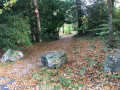
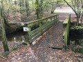
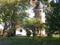
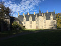
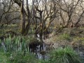
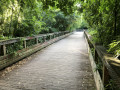
Place d’Auteuil, Bois Raguenet, Château de la Tour, Cens Valley, Orvault

A lovely walk that takes you through the Bois Raguenet park with its splendid trees, on a pleasant country stroll to the Château de la Tour, and back along the Cens Valley.

Details

14516821
Creation:
Last update:
Last review:
  • Walking
    Activity: Walking
  • ↔
    Distance: 9.78 mi
  • ◔
    Average duration: 4h 45 
  • ▲
    Difficulty: Moderate

  • ⚐
    Back to start: Yes
  • ↗
    Ascent: + 305 ft
  • ↘
    Descent: - 305 ft

  • ▲
    Highest point: 236 ft
  • ▼
    Lowest point: 36 ft
  • ⚐ Country: France
  • ⚐ City: Orvault (44700)
  • ⚑
    Start/End: N 47.254588° / W 1.60074°
  • ❏
    IGN map(s): Ref. 1223SB
  • Hour-by-hour weather

Photos

Description of the walk

To get to the starting point at Place d’Auteuil in Orvault (Petit Chantilly):
- by car: parking is available at Place d’Auteuil.
- by bus, get off at the “Petit Chantilly” stop on bus route 79.

(S/E) Walk up Rue de Saint-Cloud. At the end of the street, turn left onto Rue de Neuilly.

(1) Continue to the right onto Rue de la Madonne. Follow this road down to a small square (dead end). Take the path that opens up at the far end of this square, turn right, cross a footbridge and continue straight on to reach Avenue du Pont de la Baronnière. Follow it to the right until you reach a large roundabout on Boulevard Mendès France.

(2) Turn left, cross ( with care) the boulevard and go under the ring road bridge. Turn immediately right onto Avenue de la Jalière, cross it and take a small path leading uphill. Continue straight on until you reach Avenue du Bois Raguenet.

(3) Turn left, pass one street, continue to a pedestrian crossing and turn right into the entrance to the Bois Raguenet.

(4) Follow this path. Turn left at a junction to pass close to a gigantic sequoia, then turn left again to leave the park near a small building. When you reach a Stop sign on your left, turn right onto Avenue du Couchant. At the first pedestrian crossing, cross the road and, a few metres further on, you’ll find a path branching off to the left. Follow this path straight ahead, ignoring any turn-offs to the left or right. After crossing the road, the path takes a wide bend to the left and then right, passing between two trees to join a wide path that runs straight ahead.

(5) Follow this path to the left, then continue straight on at the junction with Allée du Plessis. The path then takes a 90° turn to the right. Follow it to a busy road, which you must cross ( take care).

(6) Take the Chemin de la Bussonnière, a small country lane. Continue along this road as it winds through the fields, then carry on along the Chemin de Clogand, passing a huge equestrian centre.

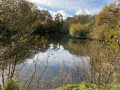
(7) At the Stop sign, take the road on the right (busy road, be careful!) until you come to a wide, descending track on your left, level with the ‘Villiers’ sign. Follow this; a little further on, a short climb leads to a junction where you should turn left. After a steep descent, the track turns right (passing near two ponds).
Leave this path and turn right, opposite a beautiful house, onto a small path through the woodland.

(8) At Château de la Tour, take the main path that opens up opposite the château, leaving the chapel on your left. At the first junction, turn right onto the Chemin des Vallées d’Orvault, heading towards the Gagné stadium.

(9) At the road, turn right onto Chemin de Gagné, then turn left onto Rue des Marcotages. Follow this street until you reach Chemin de la Retardière and turn right onto it.

(10) At La Retardière (old mill on the right), take the wide path that opens up to the left. At the first junction (marked with a cross), turn left onto Chemin de la Croix Durand and continue straight on until you reach a large junction at the hamlet of Beau Soleil.

(11) Turn right, then after a few metres turn left onto the Chemin des Poiriers. Follow this until you cross a road, then take the Chemin de la Nouette opposite. Follow this straight on, ignoring the signpost directing you to take a small path on the left, and continue until you reach the edge of the forest. After a steep descent, you’ll reach a footbridge over the Cens. Cross it and take the small, bumpy, winding path on the left which follows the right bank of the Cens.

(12) When you reach a footbridge on the left, cross it, and, as you come out, turn immediately right then left to find a wide path. Follow this to Pont Marchand (a lovely spot for a picnic).

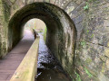
(13) Go straight on and follow the Cens on your right. Go through the underpass beneath the road, cross the river and continue to follow it on your left.

(14) Just before a small bridge, turn right and continue alongside the River Cens.

(15) At the embankment, walk a few metres to the left and go under the dual carriageway. Walk alongside a retention basin; at the corner, turn right and, at the end, turn left. Go under the power line, go round the Étang de la Provotière on the left, then walk alongside the residential area on your left.
At the road, cross over and continue straight ahead along the small lane that starts to the left of a fire hydrant and No. 82. At the end, follow the road to the right (Allée des Cèdres) and, on emerging from the woods, you’ll reach the Tredegar roundabout.

(16) Turn left onto Avenue de la Cholière, then at the next roundabout, turn right onto Rue de Saint-Ouen. You’ll soon reach Place d’Auteuil and the Petit Chantilly bus stop, line 79 (S/E).

Waypoints

  1. S/E : mi 0 - alt. 144 ft - Orvault, Place d’Auteuil
  2. 1 : mi 0.41 - alt. 115 ft - Rue de la Madone
  3. 2 : mi 0.81 - alt. 72 ft - Roundabout
  4. 3 : mi 0.99 - alt. 128 ft - Avenue du Bois Raguenet
  5. 4 : mi 1.11 - alt. 118 ft - Bois Raguenet Park
  6. 5 : mi 1.76 - alt. 157 ft - Wide path
  7. 6 : mi 2.24 - alt. 154 ft - Chemin de la Bussonière
  8. 7 : mi 3.14 - alt. 187 ft - Clogand
  9. 8 : mi 4.28 - alt. 197 ft - Château de la Tour
  10. 9 : mi 4.74 - alt. 197 ft - Gagné Stadium
  11. 10 : mi 5.22 - alt. 223 ft - La Retardière
  12. 11 : mi 5.69 - alt. 233 ft - Beau Soleil
  13. 12 : mi 6.86 - alt. 72 ft - Footbridge over the - Cens (rivière)
  14. 13 : mi 7.28 - alt. 72 ft - Pont Marchand
  15. 14 : mi 8.34 - alt. 52 ft - On the right bank, just before the small bridge
  16. 15 : mi 8.7 - alt. 59 ft - Dike
  17. 16 : mi 9.59 - alt. 167 ft - Tredegar roundabout
  18. S/E : mi 9.78 - alt. 144 ft - Orvault, Place d’Auteuil

Notes

Follow the path, ignoring the signposts that appear from time to time. These mark various routes that cross and criss-cross one another.
There are a few sections on roads, of varying lengths, but most of the route is on roads with little traffic. Do take care, though!

Several shorter alternative routes are possible:

(6) Turn left onto “Chemin du Loret”. Follow the road past the Château du Loret (which isn’t very visible). Continue along the edge of a lovely pond, then arrive in the centre of the village of Orvault near the church. You can then head for the Cens Valley or catch the number 79 bus at the “Mairie” stop.

(8) Head straight to the village centre of Orvault, near the church. You can then head towards the Cens valley or catch bus 79 at the “Mairie” stop.

(11) Just to the left at the end of the path, you’ll find the “Orvault” stop, the terminus of bus 79, which can take you back to Place d’Auteuil (or elsewhere!). But you’ll miss out on the Cens Valley!

Worth a visit

The Bois Raguenet park features several remarkable trees.
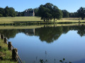
The Château de la Tour is not open to visitors, but the large park offers plenty of spots for a picnic.
The walk back up along the Cens Valley offers plenty of (short) alternative routes.

Reviews and comments

4.4 / 5
Based on 3 reviews

Reliability of the description
4 / 5
Ease of following the route
4.3 / 5
Route interest
5 / 5
User 18722748

Overall rating : 4.7 / 5

Date of your route : Apr 19, 2026
Reliability of the description : ★★★★☆ Good
Ease of following the route : ★★★★★ Very good
Route interest : ★★★★★ Very good
Very busy route : No

A very pleasant walk, with few sections on roads (and on roads with very little traffic).
A lovely discovery of La Tour Castle, where we had a picnic.
A wild boar hunt forced us to take a detour, but the map was a great help.
Thank you for this route

Machine-translated

ranine
ranine

Overall rating : 4.3 / 5

Date of your route : Feb 05, 2022
Reliability of the description : ★★★★☆ Good
Ease of following the route : ★★★★☆ Good
Route interest : ★★★★★ Very good
Very busy route : No

A lovely walk with a wonderful discovery of the Château de la Tour, which appeared as if by magic from a beautiful wooded path. It was tricky to find our way at the start and finish. In fact, we didn’t take the right path when we arrived and we nearly went the wrong way again after passing under the ring road (as there are two reservoirs), but the route map helped us. Thank you for this nature walk!

Machine-translated

plidenantes
plidenantes

Thank you for your comment. Could you please explain the difficulties you’ve encountered, or perhaps suggest some changes? Thank you in advance.

Machine-translated

herve landais
herve landais

Overall rating : 4.3 / 5

Date of your route : Nov 12, 2021
Reliability of the description : ★★★★☆ Good
Ease of following the route : ★★★★☆ Good
Route interest : ★★★★★ Very good
Very busy route : No

A lovely route with some very pretty wooded paths; few roads and little traffic. The arrival at the Château de la Tour is interesting, as is the descent towards the River Cens and the walk along its banks back to the start. There was a slight navigation issue at the start in the Bois Raguenet housing estate.

Machine-translated

Other walks in the area

For more walks, use our search engine .

The GPS track and description are the property of this route's author. Please do not copy them without permission.