


TW3.2
Details
Creation:
Last update:
–
–
-
 Activity: Walking
 -
 Distance: 2.60 mi
 -
 Average duration: 1h 50
 -
 Difficulty: Not specified
 -
-
 Back to start: No
 -
 Ascent: + 778 ft
 -
 Descent: - 538 ft
 -
-
 Highest point: 295 ft
 -
 Lowest point: 30 ft
-
 Country:
United Kingdom
Country:
United Kingdom
-
 Start: N 49.436107° / W 2.536448°
 -
 End: N 49.426548° / W 2.535154°
 -


 Hour-by-hour weather


Waypoints
- S : mi 0 - alt. 30 ft
- E : mi 2.6 - alt. 295 ft
Other walks in the area
From Jerbourg to Petit Bot
 Visorando Member4.53 mi
+830 ft
-955 ft
2h 50
Visorando Member4.53 mi
+830 ft
-955 ft
2h 50
 Moderate
Departure from Guernsey
Moderate
Departure from Guernsey
This coastal walk links Jerbourg to Petit Bot, in the south-east of Guernsey, following the spectacular cliff path as closely as possible. The route alternates between coastal paths, wooded sections, steps and steeper trails, with numerous viewpoints overlooking the English Channel. The route follows the rugged contours of the coastline and passes through several small, unspoilt coves and inlets. After the panoramic views at Jerbourg, the path descends and climbs in keeping with the terrain, before reaching the magnificent bay of Petit Bot. This is a particularly enjoyable walk for exploring the island’s southern coast, amidst cliffs, lush vegetation and seascapes. However, some sections require caution, particularly during the descents and ascents near the seaside.
Grand tour of Saint Peter Port
 6.09 mi
+446 ft
-433 ft
3h 10
Moderate
Departure from Guernsey
6.09 mi
+446 ft
-433 ft
3h 10
Moderate
Departure from Guernsey
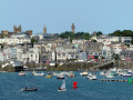
This almost complete tour will introduce you to the different aspects of Guernsey's capital: its ports, monuments, museums, gardens, working-class neighbourhoods and upmarket areas. The city is built on a hill, with numerous steps connecting the different neighbourhoods, which will give your legs a workout but also allow you to discover some beautiful views.
Serk - Southern Circular Route of the Island
 8.83 mi
+1,171 ft
-1,171 ft
5h 05
Moderate
Departure from Guernsey
8.83 mi
+1,171 ft
-1,171 ft
5h 05
Moderate
Departure from Guernsey
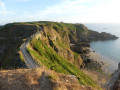
With an area of 5.5 km², a population of 600 and located 35 km off the Normandy coast, Sark is perched on a plateau surrounded by cliffs, 100 m above sea level. Motorised vehicles, cars and motorbikes are banned. Only tractors are permitted and the roads are unpaved. You’ll only come across pedestrians, cyclists, horse-drawn carriages and tractors.With its stunning coastal scenery and unspoilt countryside, it is a paradise for walkers and cyclists.
North-West loop of Sark
 6.50 mi
+958 ft
-958 ft
3h 50
Moderate
Departure from Guernsey
6.50 mi
+958 ft
-958 ft
3h 50
Moderate
Departure from Guernsey
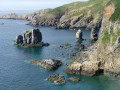
With an area of 5.5 km², 600 inhabitants and located 35 km off the Normandy coast, Sark is perched on a plateau surrounded by cliffs, 100 m above the sea. Motor vehicles, cars and two-wheelers are prohibited. Only tractors are allowed and the roads are unpaved. The only things you'll see are pedestrians, bicycles, horse-drawn carriages and tractors.With its stunning coastal landscapes and unspoilt nature, it is a paradise for walkers and cyclists.
Etacq – Grève de Lecq
 6.00 mi
+804 ft
-810 ft
3h 25
Moderate
Departure from Jersey
6.00 mi
+804 ft
-810 ft
3h 25
Moderate
Departure from Jersey
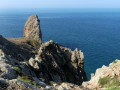
The route starts to the north of Saint-Ouen Bay, runs along a moorland area and then follows the cliffs of the north coast, passing by the popular Plémont beach before ending at the small seaside resort of Grève de Lecq.
Grève de Lecq – Bonne Nuit
 7.87 mi
+1,056 ft
-1,020 ft
4h 30
Moderate
Departure from Jersey
7.87 mi
+1,056 ft
-1,020 ft
4h 30
Moderate
Departure from Jersey
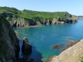
This stretch of rugged coastline passes close to Agois Island, a rock separated from the mainland by just a few metres and inhabited since prehistoric times. Devil’s Hole is a natural crater carved into the sheer cliff face. The walk ends at Bonne Nuit Bay, offering a breathtaking view. Bonne Nuit is so named because of its reputation as a calm and peaceful anchorage.
South-west coast of Jersey
 9.98 mi
+597 ft
-702 ft
5h 05
Moderate
Departure from Jersey
9.98 mi
+597 ft
-702 ft
5h 05
Moderate
Departure from Jersey
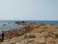
From Pointe de la Corbière to Saint Helier, the hike alternates between paths along the cliffs and steps on the beaches of Saint Brélade and Saint Helier bays.
South-West Coast of Jersey: the St Brelade circuit
 17.27 mi
+1,667 ft
-1,696 ft
9h 25
Moderate
Departure from Jersey
17.27 mi
+1,667 ft
-1,696 ft
9h 25
Moderate
Departure from Jersey
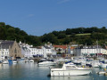
This walk can be done in two stages. The start and finish points are in St Brelade. Given the number of sites worth stopping at, it’s best to spread it over two days (several bus routes serve the route, including at Corbière, St Brelade Bay, Portelet and St Aubin).
The variety and beauty of the different landscapes in the south-west of the island punctuate this route, from the Blanches Banques Dunes and St Ouen Bay to the pink granite coast between Corbière and St Aubin, St Brelade Bay, the port of St Aubin and the shaded Railway Walk.
For more walks, use our search engine .
The GPS track and description are the property of this route's author. Please do not copy them without permission.

