Etacq – Grève de Lecq

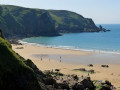
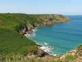
The route starts to the north of Saint-Ouen Bay, runs along a moorland area and then follows the cliffs of the north coast, passing by the popular Plémont beach before ending at the small seaside resort of Grève de Lecq.

Details

107663531
Creation:
Last update:
Last review:
  • Walking
    Activity: Walking
  • ↔
    Distance: 6.00 mi
  • ◔
    Average duration: 3h 25 
  • ▲
    Difficulty: Moderate

  • ⚐
    Back to start: No
  • ↗
    Ascent: + 804 ft
  • ↘
    Descent: - 810 ft

  • ▲
    Highest point: 259 ft
  • ▼
    Lowest point: 10 ft

Photos

Description of the walk

(S) Head west, carefully following the Route des Havres for about 350 metres. After a sharp bend and just past a junction on the left, take the path on the left signposted ‘Cliff path to Gronez’, which climbs towards several former German batteries.

(1) Stay on the path, keeping the batteries on your left. Continue along the coast.

(2) Take in the view of the “Sugar Loaf”-shaped rock towering over the sea: the Pinacle. At its base, you can see the remains of various places of worship that have stood there over the years. Continue along the path, cross a footbridge and head towards a six-storey observation tower. Stay on the main path, keeping the moorland on your left. In the distance, you can make out the ruins of Grosnez Castle. Stay along the coastline.

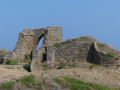
(3) From the ruins of the 14th-century castle , rejoin the coastal path heading east. Then walk past the car park for Plémont Beach on your left – a very popular spot in Jersey.

(4) Don’t hesitate to walk down the 300 steps to the beach, which is only accessible at low tide. You can also walk down the first 180 steps to the café, where you can enjoy a lovely view: see opening times in the Practical Information section.

(5) Return to the car park.

(4) Take the coastal path on the left towards the giant puffins. Pass Creux Gros, Creux Gabourel and then the cove known as Douet de la Mer, continuing to follow the coastal path and ignoring any paths that branch off from it.

(6) At the clay pigeon shooting range, follow the small road on the left down to Grève de Lecq and come out onto a main road at a hairpin bend.

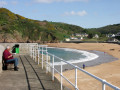
(7) Take the road on the left and walk to the end of this beautiful beach, which is well worth a stop.

(8) Head back the way you came, turn right past the car park and the bus stop. Return to the road, continue to the left andtake a short detour to the right (less than 100 m) towards the old mill with its beautiful waterwheel.

(9) Turn back to reach the bus stop (E).

Waypoints

  1. S : mi 0 - alt. 46 ft - L’Etacq
  2. 1 : mi 0.4 - alt. 220 ft - German batteries
  3. 2 : mi 0.72 - alt. 194 ft - Pinacle
  4. 3 : mi 1.71 - alt. 131 ft - Grosnez
  5. 4 : mi 2.94 - alt. 203 ft - Stairs leading down to the beach
  6. 5 : mi 3.14 - alt. 16 ft - Plèmont
  7. 6 : mi 4.91 - alt. 256 ft - Clay pigeon shooting
  8. 7 : mi 5.26 - alt. 66 ft - Turn left
  9. 8 : mi 5.54 - alt. 13 ft - Grève de Lecq
  10. 9 : mi 5.93 - alt. 43 ft - Lecq Mill
  11. E : mi 6 - alt. 43 ft - Bus stop

Notes

Tide times: Tide Times – St Helier | Jersey Met

Bus timetables and fares: https://libertybus.je/timetables/table/3

(4) Plémont: there’s a lovely café at the top of 180 steps. There are another 120 steps down to the beach.

(8) Grève de Lecq: a lovely beach with two cafés and a pub. A second pub at the edge of the hamlet, housed in a former mill, features a beautiful water wheel: the mechanism serves as a backdrop behind the bar.

Departure and arrival: you can pay by credit card to the bus driver.

Credit cards are accepted everywhere. The local currency is the Jersey pound, but the English pound is also accepted.

Please note that Jersey currency will not be accepted in England.

Worth a visit

(2) The Pinnacle: This rocky spire rising from the cliff face harbours numerous archaeological remains. These include menhirs from the Neolithic, Bronze Age and Iron Age, as well as the foundations of a Gallo-Roman temple.

(3) Grosnez Castle: built in 1330, its position on a cliff sixty metres above the sea meant it was protected on three sides of this headland. A moat hewn into the rock provided protection on the fourth side. The gatehouse is the only significant remnant. The castle had no water supply. Without a well, it could not withstand a siege. It was captured by French troops during the occupation of Jersey and destroyed around 1461.

(5) Plémont:a beautiful sandy cove accessible only at low tide. It provides access to rocky pools and sea caves. A café with a terrace is located 180 steady steps down from the footpath. The beach is a further 120 steps down.

(8) Grève de Lecq: a charminglittle seaside resort. The name Grève de Lecq comes from the Pierres de Lecq, rocky reefs emerging from the sea’s surface, situated nearly 3 km offshore towards the Isle of Sercq. They are known locallyas ‘Pater Noster’, as sailors, upon approaching them, would recite the Lord’s Prayer to seek protection.

Other walks in the area

For more walks, use our search engine .

The GPS track and description are the property of this route's author. Please do not copy them without permission.