Grève de Lecq – Bonne Nuit

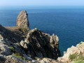
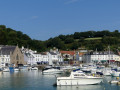
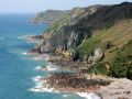
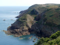
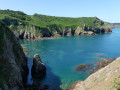
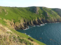
This stretch of rugged coastline passes close to Agois Island, a rock separated from the mainland by just a few metres and inhabited since prehistoric times. Devil’s Hole is a natural crater carved into the sheer cliff face. The walk ends at Bonne Nuit Bay, offering a breathtaking view. Bonne Nuit is so named because of its reputation as a calm and peaceful anchorage.

Details

107663750
Creation:
Last update:
Last review:
  • Walking
    Activity: Walking
  • ↔
    Distance: 7.87 mi
  • ◔
    Average duration: 4h 30 
  • ▲
    Difficulty: Moderate

  • ⚐
    Back to start: No
  • ↗
    Ascent: + 1,056 ft
  • ↘
    Descent: - 1,020 ft

  • ▲
    Highest point: 325 ft
  • ▼
    Lowest point: 10 ft
  • ⚐ Country: Jersey
  • ⚑
    Start: N 49.244993° / W 2.199474°
  • ⚑
    End: N 49.250676° / W 2.121009°
  • Hour-by-hour weather

Photos

Description of the walk

(S) Head slightly uphill towards Saint Mary and take the small road (Chemin du Catel) on the left, just below the ‘Barracks’ (former military barracks).

(1) After 1,200 metres, take Rue de Crabbé on the left. Once past a car park, the path turns right then left towards the coast. At the cliff edge, the coastal path starts on the right.

(2) Note the fault line separating Île Agois from the mainland. This rocky islet has been home to settlements since the Iron Age, and later to hermit monks. Continue along the path, ignoring the other tracks branching off to the right. You’ll arrive at the Priory Inn car park.

(3) Follow the path down to the left towards Devil’s Hole.

(4) Return to the car park and turn left towards the pub.

(5) Walk past the pub and immediately take the road leading uphill to the left. Before the entrance to the second car park, follow the path on the left signposted ‘Cliff Path’. Just before the coastal path turns right, enjoy the beautiful view of Devil’s Hole. Continue to Pointe de Sorel, passing through a large enclosure of Loaghtan sheep (a four-horned breed from the Isle of Man).

(6) At Pointe de Sorel, take in the sight of the large Ronez granite quarry. Return via the small road to the Grande Route du Nord.

(7) Turn right, then left after a right-hand bend onto Rue du Grand Mourier. At the end, turn left to rejoin the Route du Nord near “Les Fontaines Tavern”.

(8) Cross the road carefully and follow it to the right (or take the coastal path (more challenging) until you reach a crossroads marked by a large White Cross.

(9) Carry on and, after 100 m, follow a small road to the left running alongside a quarry, which quickly leads to the coastal path.

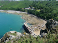
(10) The path opens out onto a panoramic view overlooking the jetty, Bonne Nuit Bay and Giffard Bay. Carry on and descend the headland via a long flight of steps. Once on the road, continue down to the harbour.

(11) Walk along the beach and return to the road, then follow it to the left as far as the bus stop (E).

Waypoints

  1. S : mi 0 - alt. 39 ft - Bus route 9
  2. 1 : mi 0.76 - alt. 269 ft - Rue de Crabbé
  3. 2 : mi 1.58 - alt. 200 ft - The Isle of Agois
  4. 3 : mi 2.6 - alt. 285 ft - Junction
  5. 4 : mi 2.93 - alt. 72 ft - Devil's Hole
  6. 5 : mi 3.31 - alt. 289 ft - Crossroads
  7. 6 : mi 4.78 - alt. 200 ft - Sorel Point
  8. 7 : mi 5.06 - alt. 292 ft - Great Northern Road
  9. 8 : mi 5.61 - alt. 299 ft - Northern Route
  10. 9 : mi 6.19 - alt. 292 ft - Cross (monument)
  11. 10 : mi 7.14 - alt. 259 ft - La Tête de Frémont
  12. 11 : mi 7.53 - alt. 49 ft - Good night
  13. E : mi 7.87 - alt. 95 ft - Bus route 4

Notes

Bus timetables and fares: Liberty Bus

(5) Priory Inn pub (closed on Tuesdays)

Between (6) and (9): Fontain Tavern.

(11) Café and light refreshments at the harbour.

Departure and arrival: you can pay by credit card to the bus driver.

Credit cards are accepted everywhere. The local currency is the Jersey pound, but the English pound is also accepted.

Please note that Jersey currency will not be accepted in England.

Worth a visit

(4) Devil’s Hole: The Devil’s Hole. It measures approximately 30 metres in diameter and plunges to a depth of 60 metres. It was formed by the gradual marine erosion of the ceiling of what was once a cave, leading to its collapse and the formation of a crater. The short descent to the viewing platform is well worth it, if only for the view of the coast and its cliffs.

Other walks in the area

For more walks, use our search engine .

The GPS track and description are the property of this route's author. Please do not copy them without permission.