Country:


You can start your walk from other locations well served by the bus, such as St Aubin, St Brelade Bay and Portelet.
(S) From the bus stop at St Brelade, walk 50 metres down to the left to reach Railway Walk below (the old railway line from St Aubin to Corbière). Continue westwards. Follow the path to the right.
(1) After 700 metres, at the end of the Quennevais sports complex, turn right onto a slightly sandy path between the golf course and the sports complex and follow it for 850 metres.
(2) Turn left onto a wooded path that descends towards the dunes. Keep heading west (no signposts, numerous paths, but you won’t get lost!
(3) On the flat area of the dunes, look out for the small menhirs and head south, then west again. Near the car park, head south to climb a hill offering a panoramic view of St Ouen Bay and the Rocco Tower. (Derived from ‘La Roque Hou’, where ‘Hou’ is a Norman word meaning ‘islet’). It is now a guesthouse;
(4) Head straight south down to another car park and cross the main road carefully, following the coastal path. Join the road again and follow it for 250 m until you reach the large bend. On the right, take a path uphill leading to a small car park (with views over the bay). Heading slightly to the left, you’ll find the Sergenté site near a copse. Retrace your steps and follow the path towards Petit Port. Head back up towards the road, which you’ll follow carefully to the right for 250 m. Pass the large rock on the right and cross the road at the ‘footpath’ which climbs to the left. rejoin the Railway Walk and follow it to the Corbière site, keeping to the right.
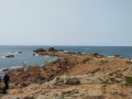
(7) If the tide is out and you have checked the tide times, you can walk along the causeway to the lighthouse (8) (1 km return).
Return to the bend in the main road and follow the coastal path to the right, towards the German observation tower, which has been converted into a guesthouse.
Follow the coastal path to the railway tracks leading to the desalination plant (9). Continue to the prison (10) and walk along its fence on the right-hand side.
(11) Arrive at the Beauport car park. At low tide, the walk down to the beach is well worth it. Continue along the coastal path to the charming St Brelade cemetery (read the surnames on the gravestones). A small jetty below is worth a quick detour. Return to the sand and head back up to the cemetery via the steps at the old Perquage, leading to the chapel and the church (see practical information)
(12) Return to the beach and head towards the promenade lined with cafés, hotels and restaurants.
Head back to the beach and make your way to the foot of the rock that closes off Ouaisné Bay (on the left: the lovely Smugglers’ Inn).
Carefully make your way past the first rocks until you reach the steep path leading up to the summit.
(13) Follow the path as close as possible to the coast to the car park, then turn right onto the Chemin du Portelet. Take the first right until you reach the steps (14) leading down to the superb beach (Beach Café).
(15) Île au Guerdain is accessible at low tide. Head back up via the other flight of steps further to the east.
(16) Walk past the Portelet Inn and, from the public car park, follow the coastal path to the right (ignore the private entrance on the right).
After 250 m, take a small path on the right leading to the viewpoint over Portelet Bay.
(17) Retrace your steps and continue to the Pointe de Noirmont (German Tower)
(18) Carry on through heathland and woodland until you reach the road on the right; follow this for 200 m, then turn right again onto ‘Rue de Haut’.
This is a ‘green lane’; pedestrians and cyclists have priority. The street leads down towards the harbour; turn right onto Mont du Boulevard with its old houses.
(19) At low tide (check the timetables), you can access the Fort (the interior is closed to the public).
(20) Take some time to stroll along the quays and walk up the pretty Rue des Crocquets to the view over the bay. Then retrace your steps.
(21) Take the Railway Walk (a former railway line linking Corbière – now open only to walkers and cyclists). Enjoy a leisurely stroll in the shade of the trees.
(22) Option to take a detour to the left towards the “Jersey Lavender” farm on Rue du Pont Marquet, 300 m away (see “Places to see” section).
Continue for 150 m and leave the lane to rejoin the Route des Quennevais, where you’ll find the bus stop on the left.
 Association / Club / Walk leader
 Easy
Easy 
 Visorando Member