


Free parking at the start.
A few benches to enjoy the view!


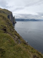
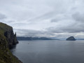
A walk from Sandavágur to the viewpoint overlooking Trøllkonufingur, the ‘Witch’s Finger’ – a 313-metre-high rock pinnacle shaped like an index finger, situated close to the coast. This coastal feature is famous.
Legend has it that a witch, trying to reach Iceland, was caught out by the sun’s rays. She is said to have turned to stone. She was so large that Trøllkonufingur is said to be one of her fingers and the island of Koltur her neck.
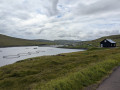
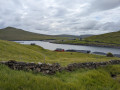
An easily followable, signposted path. A few parking spaces at the starting point. Turn right after the car park. The path offers beautiful views over Sandavágur Bay before you come to Trøllkonufingur.


 Country:
Faroe Islands
Country:
Faroe Islands


Free parking at the start.
A few benches to enjoy the view!
Sørvágsvatn, Trælanípa and Bøsdalafossur 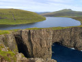 4.37 mi
+272 ft
-269 ft
2h 15
4.37 mi
+272 ft
-269 ft
2h 15
 Moderate
 Departure from Faroe Islands
Pollurin Lagoon and black sand beach at Saksun
Departure from Faroe Islands
Pollurin Lagoon and black sand beach at Saksun 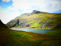 3.11 mi
+249 ft
-230 ft
1h 40
Easy
Departure from Faroe Islands
Fossá Waterfall
3.11 mi
+249 ft
-230 ft
1h 40
Easy
Departure from Faroe Islands
Fossá Waterfall 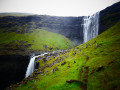 0.91 mi
+272 ft
-272 ft
0h 40
Moderate
Departure from Faroe Islands
Eiðiskollur
0.91 mi
+272 ft
-272 ft
0h 40
Moderate
Departure from Faroe Islands
Eiðiskollur 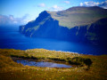 2.50 mi
+1,234 ft
-1,217 ft
2h 15
Moderate
Departure from Faroe Islands
2.50 mi
+1,234 ft
-1,217 ft
2h 15
Moderate
Departure from Faroe Islands
For more walks, use our search engine .
The GPS track and description are the property of this route's author. Please do not copy them without permission.
Scan this QR code with your smartphone's camera.
To open this route on your smartphone, you must have the Visorando app installed. If not, got to the Apple Store (iPhone) or Google Play Store (Android) to download the app.
 Visorando Member
