Three hilltop villages: Corbara, Pigna and San Antonino

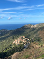
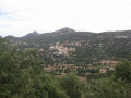
Perched above the Arégno plain, discreet Corbara, artistic Pigna and proud Sant'Antoninu watch over the coastline below. They are linked by a network of ancient paths, which this circuit invites you to explore.

Details

1766201
Creation:
Last update:
  • Walking
    Activity: Walking
  • ↔
    Distance: 8.14 mi
  • ◔
    Average duration: 5h 30 
  • ▲
    Difficulty: Moderate

  • ⚐
    Back to start: Yes
  • ↗
    Ascent: + 1,998 ft
  • ↘
    Descent: - 1,998 ft

  • ▲
    Highest point: 1,601 ft
  • ▼
    Lowest point: 89 ft

Description of the walk

Park near the Cantarettu City campsite (known as "the Ranch" to locals). Limited parking available. You can also start from the San Cipriano shopping area, located along the T30, from where you can rejoin the route.

(S/E) Turn left with your back to the campsite. The path runs along the plain between two stone walls that border sheep pastures on either side. When the road turns right, continue straight ahead along the hedge-lined path. This leads to the rear of the San Cipriano industrial estate (industrial and commercial buildings).
Leave the first path on your right and turn right at the next intersection (1), where you will come to the path coming from the commercial area. Shortly afterwards, the slope begins to steeply and the path winds between hedges and low walls.

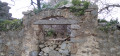
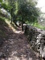
(2) At a bend in the track on the right, take the path that goes straight ahead and, a few metres further on, leave this path and take the steep path that climbs up to the right. Although hidden, this is the entrance to the magnificent, wide path that leads to Corbara. Its layout and excellent paving make it very easy to walk on. You will reach the first gardens, the fountain and the Leccia wash house, which mark the entrance to the village.

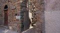
(3) Begin your tour of the village of Corbara by exploring its streets, alleys and stairways. See § During the hike, find the wash house and head towards Pigna.

(3) At the wash house, take the path that passes in front of it. Further on, a restored fountain offers fresh water to walkers, while the foliage forms a canopy that is undoubtedly pleasant in hot weather.
The path continues at almost the same level between the two villages, with no difficulties other than avoiding the scree from the terraces overlooking the path.

(4) Before coming out onto a track that leads to the village of Pigna, the path crosses a stream just downstream from a spring catchment.
Turn left onto the track and follow it uphill until you reach the car park at the foot of the church.

(5) Turn right to go around the village of Pigna. Return to the car park at the foot of the church.

(5) Continue the walk along the Muratello path. Walk past some beautiful properties, a few tombs and the lovely Lazio chapel. Cross the D151 road, go through the small wrought-iron gate that leads to a wooded meadow to reach the convent of Saint Dominic.

(6) Return to the private entrance to the monastery and take the small path that branches off to the left of the road you arrived on. Pass a final escarpment and come out, heading south, onto the grassy plateau in front of the village.

(7) Continue past the cemetery to reach the Sant'Antonino car park.

(8) Go around the village to the south to avoid the busy ramp that connects the car park to the centre.
Descend on the west side of the village until you reach the access road, near the church car park.
(8) Follow the road to the left downhill and turn right into the first small north-facing lane. You will come to a crossroads with a fountain.

(9) Turn left onto the path that goes around them. Start off gently down the slope, keeping the Saint-Dominique convent in sight, then dive into the chestnut grove. After going down the wooded slope, join the road that leads to Pigna.

(10) Take it to the left for about 100 metres, then turn immediately right to reach the village.

(11) Just before you reach the square in front of the church in Pigna again, turn left onto the path that descends between the first houses in the village. Alternating between gentle and steep sections, this beautiful path leads easily down to the plain, passing old sheepfolds in varying states of repair.
about 500 metres after Pigna, the path comes out onto a track suitable for vehicles. Follow it to the next crossroads and turn right to reach a sheepfold that has been converted into a house.

(12) Go around it on the left and follow the path that continues along the track. It turns left shortly after this building and then runs between two tree-lined embankments. After passing another isolated building, the path comes out onto an unpaved track.

(13) Turn left to follow this track, go around a right-hand bend, and at the second left-hand bend, leave the track and take the small path between the embankments that has been maintained parallel to it.
When this path joins the small concrete road, turn right to reach the Cantarettu City campsite car park. (S/E)


Waypoints

  1. S/E : mi 0 - alt. 121 ft - Parking near Cantarettu City
  2. 1 : mi 0.39 - alt. 115 ft - Access from the commercial area of San Cipriano
  3. 2 : mi 0.71 - alt. 203 ft - Start of the paved path
  4. 3 : mi 1.44 - alt. 709 ft - Fontaine di a Leccia (outward journey)
  5. 4 : mi 3.23 - alt. 597 ft - Captured water source
  6. 5 : mi 3.42 - alt. 702 ft - Parking in Pigna
  7. 6 : mi 4.5 - alt. 991 ft - Private entrance to the convent of St Dominic
  8. 7 : mi 5.22 - alt. 1,447 ft - Arrival on the Sant'Antoninu plateau
  9. 8 : mi 5.53 - alt. 1,473 ft - Sant'Antonino
  10. 9 : mi 6.26 - alt. 1,355 ft - On the plateau above Praoli
  11. 10 : mi 6.81 - alt. 748 ft - Pigna road
  12. 11 : mi 6.95 - alt. 719 ft - Pigna church square
  13. 12 : mi 7.54 - alt. 469 ft - Old sheepfold
  14. 13 : mi 7.93 - alt. 240 ft - Campu Vallinu trail
  15. S/E : mi 8.14 - alt. 121 ft - Parking near Cantarettu City

Notes

This circuit follows the ancient paths that linked the villages. They have been improved to make them easier to use and provide welcome shade. Although they are in excellent condition up to the convent and below Pigna, they are sometimes poorly maintained on either side of Sant'Antoninu, particularly on the descent to Pigna. So be careful on the few sections that are loose or poorly maintained.

There are places to rest and refuel in each of the villages.

Worth a visit

(3) Corbara: there are two places worth visiting in the village: the small ochre chapel perched on the highest promontory to the left above the village (for its magnificent view) and the square in front of the collegiate church of Nunziata. The discreet village of Corbara, nestled in its hilly cirque, offers opulence and tranquillity that validate the adage "to live happily, live hidden".
(5) Pigna: Many artists and artisans have taken up residence on the ground floors of this village renowned for its strong cultural involvement. The shops are much more interesting than those in Sant'Antoninu.
(6) Convent of Saint Dominic: This monastery is still occupied by a community of monks. Only the church is open to visitors.
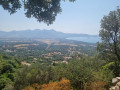
(8) Sant'Antonino: Lose yourself in the narrow streets that climb up to the rocky peak. The view from the top offers a breathtaking 360° panorama.

Home to artist Toni Casalonga, the village of Pigna benefits from the artistic impetus he brought to it, which has been very well continued by the successive female mayors. Don't miss a visit to the auditorium of the Casa Musicale during one of the many cultural events organised throughout the year by the Centre National de Création Musicale Voce.

Reviews and comments

4.6 / 5
Based on 19 reviews

Reliability of the description
4.6 / 5
Ease of following the route
4.5 / 5
Route interest
4.8 / 5
pareige
pareige
• Edited:

Overall rating : 5 / 5

Date of your route : Aug 05, 2025
Reliability of the description : ★★★★★ Very good
Ease of following the route : ★★★★★ Very good
Route interest : ★★★★★ Very good
Very busy route : No

Very beautiful hike. As with previous hikers, the start was a little complicated. Google Maps suggested an unsuitable route to reach the starting point. We parked in the small shopping area along the T30, near the Four'Fouille, and found the hiking trail. We loved the villages of Pigna and Sant'Antonino, where we ate at the Taverne Corse. We highly recommend it. We walked for 3 hours and 45 minutes, not including our lunch break. The hike, the route and the paths are very pleasant. What beautiful views of the villages, the convent, the mountains and the sea!

Machine-translated

User 15820860
• Edited:

Overall rating : 5 / 5

Date of your route : Aug 04, 2025
Reliability of the description : ★★★★★ Very good
Ease of following the route : ★★★★★ Very good
Route interest : ★★★★★ Very good
Very busy route : Yes

A beautiful hike with no difficulty. Very beautiful view of Algajola Bay.

Machine-translated

User 23846957
• Edited:

Overall rating : 4.3 / 5

Date of your route : Jun 16, 2025
Reliability of the description : ★★★★☆ Good
Ease of following the route : ★★★★☆ Good
Route interest : ★★★★★ Very good
Very busy route : No

The start is a bit tricky to find because the GPS directs us to places where we have to turn around.
But once we find it, everything is well signposted. The descent from St Antonin is a bit technical; you just have to place your feet carefully to avoid slipping. There are lots of shaded areas except when you reach the top. The three villages are truly magnificent. A stop in St Antonin is a must as there are some really local products.
A very beautiful hike.

Machine-translated

eljo91
eljo91
• Edited:

Overall rating : 5 / 5

Date of your route : May 07, 2025
Reliability of the description : ★★★★★ Very good
Ease of following the route : ★★★★★ Very good
Route interest : ★★★★★ Very good
Very busy route : No

We decided to start from Corbara to connect the three villages.
Magnificent views, especially the path overlooking Saint Antonin and the Corbara convent.
The coastline on the way out of Pinna is very steep...
The three villages are very pretty, with Saint Antonin being my favourite.

Machine-translated

Fgx
Fgx
• Edited:

Overall rating : 4.3 / 5

Date of your route : Aug 27, 2024
Reliability of the description : ★★★★★ Very good
Ease of following the route : ★★★☆☆ Average
Route interest : ★★★★★ Very good
Very busy route : No

Superb hike through the Balagne
Not always easy to follow

Machine-translated

Linda50
Linda50
• Edited:

Overall rating : 4.7 / 5

Date of your route : Jul 22, 2024
Reliability of the description : ★★★★★ Very good
Ease of following the route : ★★★★☆ Good
Route interest : ★★★★★ Very good
Very busy route : No

A fairly easy hike to reach the first two villages, which are magnificent, and a little steeper to reach San Antonio.
In San Antonio, you can take a break and eat at one of the welcoming and inexpensive restaurants (the Corsican tavern).
However, remember to take plenty of water, especially when it's hot.
A very beautiful walk!

Machine-translated

Fifi et Van
Fifi et Van
• Edited:

Overall rating : 4.3 / 5

Date of your route : Jul 16, 2024
Reliability of the description : ★★★★☆ Good
Ease of following the route : ★★★★★ Very good
Route interest : ★★★★☆ Good
Very busy route : No

We took a walk from the Algajola Ranch to the village of Pigna with our Australian Shepherd.

Machine-translated

bab
bab
• Edited:

Overall rating : 5 / 5

Date of your route : Apr 19, 2024
Reliability of the description : ★★★★★ Very good
Ease of following the route : ★★★★★ Very good
Route interest : ★★★★★ Very good
Very busy route : No

Hike completed at the beginning of the week. Not many people around in April, which is unlikely to be the case during the tourist season. The walk is really beautiful, the hilltop villages each have their own unique character, but Pigna is the liveliest at this time of year. I highly recommend it.

Machine-translated

Gigi333
Gigi333
• Edited:

Overall rating : 4.3 / 5

Date of your route : Oct 15, 2023
Reliability of the description : ★★★★☆ Good
Ease of following the route : ★★★★☆ Good
Route interest : ★★★★★ Very good
Very busy route : No

A magnificent hike in October with very few people around. Magnificent landscapes. Well worth the detour!!!

Machine-translated

hestrike
hestrike
• Edited:

Overall rating : 5 / 5

Date of your route : Oct 02, 2023
Reliability of the description : ★★★★★ Very good
Ease of following the route : ★★★★★ Very good
Route interest : ★★★★★ Very good
Very busy route : No

A very beautiful hike with a good elevation gain. Nice villages along the way. We recommend the restaurant Le Belle Vu in San Antonin. Home-style meals, a €17 menu with no frills in an atmosphere that seems to defy time.
Please note that there is no parking at the start of the hike! The ranch and the local campsite are the only places to park, so ask the owner for permission, which he will grant if you buy something from him... Otherwise, it is impossible to park at the indicated spot.

Machine-translated

Gene59.33
Gene59.33
• Edited:

Overall rating : 4 / 5

Date of your route : Sep 16, 2023
Reliability of the description : ★★★★☆ Good
Ease of following the route : ★★★★☆ Good
Route interest : ★★★★☆ Good
Very busy route : Yes

Very nice hike

Machine-translated

Régis14
Régis14
• Edited:

Overall rating : 4.7 / 5

Date of your route : Aug 04, 2023
Reliability of the description : ★★★★★ Very good
Ease of following the route : ★★★★☆ Good
Route interest : ★★★★★ Very good
Very busy route : No

Beautiful panoramic sea views.
Small, very typical villages to visit

Machine-translated

h.szeflinski
h.szeflinski
• Edited:

Overall rating : 4.3 / 5

Date of your route : Jul 16, 2023
Reliability of the description : ★★★★☆ Good
Ease of following the route : ★★★★☆ Good
Route interest : ★★★★★ Very good
Very busy route : No

Be careful at the starting point: you must go to the exact starting point on the map, i.e. follow the road that climbs up alongside the campsite to its end, otherwise the starting instructions will be unclear. In the car park, during the high season, it is best to park lower down than the campsite, near a horse riding centre 500 m before
the route to follow through the villages is very approximate and there are few or no signs
otherwise, it's a beautiful route with lovely views

Machine-translated

Doudadouda
Doudadouda
• Edited:

Overall rating : 4.7 / 5

Date of your route : Jun 24, 2022
Reliability of the description : ★★★★★ Very good
Ease of following the route : ★★★★★ Very good
Route interest : ★★★★☆ Good
Very busy route : No

Hike completed in June
Very good directions, we never got lost
It's enjoyable to discover the different villages on foot rather than by car
However, be careful at the very end of the route, as we encountered some aggressive dogs
We first came across three dogs that seemed to be guarding their flock: we didn't have too much trouble with them, they barked but didn't come towards us
Just before returning to the starting point, we came across a stray dog, and it seemed we were on its territory. It was more frightening than dangerous, but the animal was aggressive and came dangerously close to us
So be careful!

Machine-translated

Hervé paris
Hervé paris
• Edited:

Overall rating : 5 / 5

Date of your route : May 14, 2022
Reliability of the description : ★★★★★ Very good
Ease of following the route : Not used / Not applicable
Route interest : ★★★★★ Very good
Very busy route : No

A superb, varied hike with shaded paths and stunning views.
We started from Pigna, which allowed us to stop halfway in the same village and enjoy a drink in one of the charming narrow streets. What's more, parking is available (out of season)
The San Antonio loop is more difficult but not to be missed. A feast for the eyes

Machine-translated

Other walks in the area

For more walks, use our search engine .

The GPS track and description are the property of this route's author. Please do not copy them without permission.