A circular walk around the three peaks of the Monts d’Orb from Serviès

From Serviès, ascend via the Col de Faou to Pic Ségala, then on to Pic de Serviès, followed by a round trip to Mont Véduscle before returning via the Col de Serviès and the GRP°°®.

Details

42534390
Creation:
Last update:
Last review:
  • Walking
    Activity: Walking
  • ↔
    Distance: 5.47 mi
  • ◔
    Average duration: 3h 50 
  • ▲
    Difficulty: Moderate

  • ⚐
    Back to start: Yes
  • ↗
    Ascent: + 1,470 ft
  • ↘
    Descent: - 1,460 ft

  • ▲
    Highest point: 3,136 ft
  • ▼
    Lowest point: 1,939 ft

Photos

Description of the walk

Hikers’ car park at the entrance to Serviès when approaching from Avène.

(S/E) Set off along the path uphill behind the car park and, about twenty metres further on, take the left-hand path at the Fork in the road. Continue along the path climbing through a chestnut copse which runs alongside a fence on the right, turns right along a steep embankment and is blocked by fallen trees obstructing the way.

(1) Continue by eye at the stream below, which you’ll need to cross to rejoin the path leading opposite towards the Bergerie de Paul.

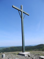
(2) In front of this large building, turn right onto a wide track. Keep to the left about fifty metres further on, passing a large wooden cross (2022). The track climbs gently up to the Col du Faou, which is a crossroads of paths.

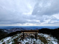
(3) On the left, a steep path climbing through the meadows leads to the summit of Pic Ségala (853 m), offering a beautiful panoramic view stretching all the way to the sea.

(4) Head back down to the pass via the same route.

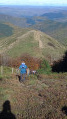
(3) Opposite, there are two paths to choose from to continue climbing towards the peaks. On the right, a new firebreak path (built after the fires) climbs steeply directly to the summit of Pic de Serviès, whilst the classic path to its left climbs more gently in switchbacks to reach the saddle between Pic de Serviès and Mont Véduscle. Here, the route climbs straight up to Pic Serviès (892 m).

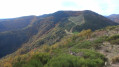
(5) From the peak, descend carefully down a steep slope to the saddle, then climb just as steeply up to the foothills of Mont Véduscle (942 m).

(6) For the clearest view to the north and of the summit of the mountain at 957 m, you’ll need to open the electric fence (handle) and, without disturbing the cows tucking into the lush grass, follow the ridge due west to the rocky summit of Mont Véduscle (957 m).

(7) There are lovely views all round; return via the same route, taking care to close the gate behind you.

(6) Continue straight ahead along a path skirting the ridges, which eventually joins a track suitable for vehicles and theGR® 653 (alsoGRP®), marked with red and white signposts.

(8) Follow it to the right to reach the crossroads of tracks at the Col de Serviès (838 m).

(9) Keep to the right on theGR® track, which leads gently back to Serviès along a small road, arriving at the car park (S/E).
You can take this opportunity to have a look at the hamlet, which stretches along the small road towards Graissessac.

Waypoints

  1. S/E : mi 0 - alt. 1,939 ft - Serviès car park
  2. 1 : mi 0.62 - alt. 2,251 ft - Tree fallen across the path
  3. 2 : mi 0.79 - alt. 2,388 ft - Paul’s Sheepfold
  4. 3 : mi 1.24 - alt. 2,579 ft - Col du Faou. Round trip to Pic Ségala
  5. 4 : mi 1.47 - alt. 2,799 ft - Pic Ségala
  6. 5 : mi 2.01 - alt. 2,923 ft - Pic de Serviès
  7. 6 : mi 2.3 - alt. 3,097 ft - Junction. Return walk to Mont Véduscle
  8. 7 : mi 2.51 - alt. 3,136 ft - Mont Véduscle
  9. 8 : mi 3.2 - alt. 2,841 ft - GR® junction
  10. 9 : mi 3.5 - alt. 2,749 ft - Col de Serviès
  11. S/E : mi 5.47 - alt. 1,939 ft - Serviès car park

Notes

Walking poles are a good idea, especially in wet weather, both on the way up and down.

Worth a visit

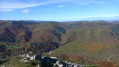
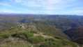
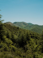
Stunning panoramic views on a clear day from the three peaks.

Always be cautious and plan ahead when you're outdoors. Visorando and the author of this route cannot be held responsible for any accidents occurring on this route.

The GR® and PR® markings are the intellectual property of the Fédération Française de Randonnée Pédestre.

Reviews and comments

4.7 / 5
Based on 2 reviews

Reliability of the description
4.5 / 5
Ease of following the route
4.5 / 5
Route interest
5 / 5
maxcaviso
maxcaviso

Overall rating : 5 / 5

Date of your route : May 30, 2025
Reliability of the description : ★★★★★ Very good
Ease of following the route : ★★★★★ Very good
Route interest : ★★★★★ Very good
Very busy route : No

A pleasant walk. There’s a good, steep climb to reach the Pic de Servies. The return journey from the Col de Servies may seem a bit long.

Machine-translated

Marc noel
Marc noel

Overall rating : 4.3 / 5

Date of your route : May 26, 2025
Reliability of the description : ★★★★☆ Good
Ease of following the route : ★★★★☆ Good
Route interest : ★★★★★ Very good
Very busy route : No

A lovely walk with some stunning views. Best avoided on very windy days, or make sure you put some stones in your shoes when climbing the three peaks.

Machine-translated

Other walks in the area

For more walks, use our search engine .

The GPS track and description are the property of this route's author. Please do not copy them without permission.