


 Country:

 City:
City:


No description
Tour Lac Annecy Jour 2 - L'Empreinte Baroudeuse
Details
Creation:
Last update:
-
 Activity: Walking
 -
 Distance: 10.70 mi
 -
 Average duration: 7h 25
 -
 Difficulty: Moderate
 -
-
 Back to start: No
 -
 Ascent: + 2,825 ft
 -
 Descent: - 3,993 ft
 -
-
 Highest point: 5,446 ft
 -
 Lowest point: 2,946 ft
Description of the walk
Waypoints
- S : mi 0 - alt. 5,446 ft
- E : mi 10.7 - alt. 4,278 ft
This route passes through a protected area, which may be subject to special regulations:
Other walks in the area
Tour of the Semnoz plateau
 Visorando Member
 5.07 mi
+1,204 ft
-1,201 ft
3h 25
Moderate
5.07 mi
+1,204 ft
-1,201 ft
3h 25
Moderate
 Departure from Leschaux (Haute-Savoie)
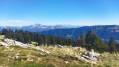
A beautiful, easy hike on the Semnoz plateau. Numerous panoramic views throughout the hike.
From Semnoz Station to Crêt de l'Aigle
5.11 mi
+761 ft
-787 ft
3h 00
 Easy
Departure from Viuz-la-Chiésaz (Haute-Savoie)
Easy
Departure from Viuz-la-Chiésaz (Haute-Savoie)
This is an easy hike, suitable for families, offering beautiful views of the valley and surrounding mountain ranges.Note: this hike can also be done on touring skis or snowshoes: if using snowshoes, most of the route can be done on groomed trails.
The Semnoz
 9.24 mi
+2,513 ft
-3,406 ft
6h 25
Moderate
Departure from Leschaux (Haute-Savoie)
9.24 mi
+2,513 ft
-3,406 ft
6h 25
Moderate
Departure from Leschaux (Haute-Savoie)
Crossing the Semnoz between the villages of Leschaux and Machevaz.
Le Semnoz via the Grotte des Fours
 8.24 mi
+4,150 ft
-4,170 ft
7h 25
8.24 mi
+4,150 ft
-4,170 ft
7h 25
 Very difficult
Departure from Viuz-la-Chiésaz (Haute-Savoie)
Very difficult
Departure from Viuz-la-Chiésaz (Haute-Savoie)
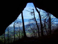
The Semnoz is not just a gentle summit visited by car. Here is an interesting and varied route from Viuz-la-Chiésaz, with a steady climb through the forest, caves to visit and cliffs to overcome, leading to an alpine pasture that takes you to the Crêt de Châtillon, with sweeping views of the Alps and Pre-Alps.
The Saint-Jacques Towers loop
5.77 mi
+2,431 ft
-2,411 ft
4h 45
Moderate
Departure from Allèves (Haute-Savoie)
The Saint-Jacques Towers are a group of three monoliths that have broken away from the cliff and continue to slide 2 to 3 cm per year.
The suggested route allows you to see them from different angles, from above and below.
Along the way, note the paved road and the massive log barns.
Tour of the Montagne de Bange
 12.60 mi
+4,094 ft
-4,072 ft
9h 20
12.60 mi
+4,094 ft
-4,072 ft
9h 20
 Difficult
Departure from Cusy (Haute-Savoie)
Difficult
Departure from Cusy (Haute-Savoie)
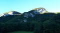
This walk takes you round this mountain, situated between the Semnoz to the north and the Revard massif to the south. Initially, you’ll follow theGRP® trail, which will take you to the summit (Crêt de la Dolca) and on to the Col de la Cochette (orientation table).
Moderator’s note : reviews of this walk indicate that from (14) onwards, the path no longer exists. The only alternative is to follow the D911 for 4 km. See details in the description
Le Roc des Bœufs
 4.99 mi
+2,480 ft
-2,480 ft
4h 25
Moderate
Departure from La Chapelle-Saint-Maurice (Haute-Savoie)
4.99 mi
+2,480 ft
-2,480 ft
4h 25
Moderate
Departure from La Chapelle-Saint-Maurice (Haute-Savoie)
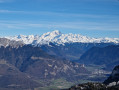
The Roc des Bœufs ridge offers magnificent views of the Bauges peaks and the Annecy basin.
Le Semnoz par le chalet de Bénévent
 6.77 mi
+1,831 ft
-1,808 ft
4h 40
Moderate
Departure from Sévrier (Haute-Savoie)
6.77 mi
+1,831 ft
-1,808 ft
4h 40
Moderate
Departure from Sévrier (Haute-Savoie)
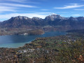
Une jolie balade dans la forêt du Semnoz, montagne surplombant le Lac d'Annecy sur sa rive Ouest, avec quelques échappées visuelles intéressantes sur ce lac. Cette balade peut être réalisée par temps chaud et ensoleillé, la totalité du parcours étant à couvert.
For more walks, use our search engine .
The GPS track and description are the property of this route's author. Please do not copy them without permission.

