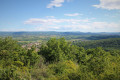
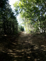
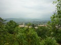
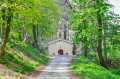
The Marsanne Forest as seen from Les Tourrettes

A circular route through the Marsanne Forest along paths and tracks, in peaceful surroundings with a steady gradient.

Details

n°26923779
Creation:
Last update:
Last review:
  • Walking
    Activity: Walking
  • ↔
    Distance: 14.17 mi
  • ◔
    Duration according to the author: 6 hrs 
  • ▲
    Difficulty: Very difficult

  • ⚐
    Back to start: Yes
  • ↗
    Ascent: + 2,612 ft
  • ↘
    Descent: - 2,612 ft

  • ▲
    Highest point: 1,926 ft
  • ▼
    Lowest point: 453 ft

Photos

Description of the walk

(S/E) From the Chapelle Saint-Didier car park, take the tarmac road due north for about 300 m.

(1) At the junction, take the stony path leading uphill to the right (with a view of the castle, which will be behind you).

(2) At the junction where there is a dog shelter, turn left and continue climbing up the path.

(3) When you reach the three-way junction, head up towards the Col de Papillère.

(4) At the Col de Papillère, take the path on the right which leads into the forest.

(5) At the end of the path at Gros Fayard, turn right onto the wide track towards Le Creux des Alexis.

(6) At the Creux des Alexis, take the track on the right.

(7) At the old hut by the track, head down towards La Laupie.

(8) At the bottom of the descent, turn right onto the path that climbs back up to just below the high-voltage power line.

(9) Carry on straight ahead along the narrow path leading into the woods.

(10) When you reach the ‘Borne Rousse’ sign, carry on along the narrow path and head back down to the Col de Papillère, passing through Gros Fayard again.

(4) Back at the Col de Papillère, take the small path on the left (which is not very visible) that leads into the woods.

(11) As you emerge from the woods, at the pile of wood, carry on straight ahead along the wide path.

(12) Once you reach the top of the final hill, walk alongside the field marked by an old fence.

(13) At the ‘Allée Léon’ sign (visible on a tree high up), take the path on the left.

(14) On the path, take a small track on the right (be careful, it’s barely visible).

(15) At the end of the track, turn right onto the path leading back down.

(16) At the crossroads, turn right.

(17) Cross the stream and head back up the track, which turns into a tarmac road a little further on, leading back to the Chapelle Saint Didier car park (S/E).

Waypoints

  1. S/E : mi 0 - alt. 472 ft - Chapelle Saint Didier car park
  2. 1 : mi 0.3 - alt. 499 ft - Crossroads with a stone path
  3. 2 : mi 1.01 - alt. 912 ft - Shelter for stray dogs
  4. 3 : mi 2.62 - alt. 1,483 ft - Three-way junction at La Patte d’Oie
  5. 4 : mi 2.86 - alt. 1,526 ft - Col de Papillere
  6. 5 : mi 3.53 - alt. 1,909 ft - Gros Fayard
  7. 6 : mi 3.95 - alt. 1,765 ft - Creux des Alexis
  8. 7 : mi 4.88 - alt. 1,601 ft - Old hut
  9. 8 : mi 6.02 - alt. 971 ft - Track junction on the right
  10. 9 : mi 6.72 - alt. 1,467 ft - The trail starts in the woods
  11. 10 : mi 7.69 - alt. 1,617 ft - Red marker post
  12. 11 : mi 10.74 - alt. 1,165 ft - Crossroads with a pile of wood
  13. 12 : mi 11.68 - alt. 1,152 ft - High point
  14. 13 : mi 12.13 - alt. 1,076 ft - Allée Léon
  15. 14 : mi 12.51 - alt. 1,024 ft - Path on the right
  16. 15 : mi 12.73 - alt. 1,004 ft - Unnamed pass
  17. 16 : mi 13.23 - alt. 745 ft - Path to the right
  18. 17 : mi 13.69 - alt. 489 ft - Stream crossing
  19. S/E : mi 14.17 - alt. 469 ft - Chapelle Saint Didier car park

Notes

There are no water sources along the route.
An old hut where you can take shelter in case of rain.

Worth a visit

Between points (6) and (7), there are views of Les Trois Becs and the Drôme Provençale mountain ranges.
Before and up to point (10), from the ridges there are views of the Massif Central and the Rhône Valley.

Reviews and comments

4.3 / 5
Based on 2 reviews

Reliability of the description
4 / 5
Ease of following the route
4.5 / 5
Route interest
4.5 / 5
HD07000
HD07000

Overall rating : 4.3 / 5

Date of your route : Oct 16, 2025
Reliability of the description : ★★★★☆ Good
Ease of following the route : ★★★★☆ Good
Route interest : ★★★★★ Very good
Very busy route : No

Easier hike than advertised. Only the length of the hike, nearly 24km, may be a challenge for someone who is not used to walking. The significant elevation gain is offset by its gradual nature and the quality of the trails and paths.

Machine-translated

Adryan
Adryan

Overall rating : 4.5 / 5

Date of your route : Apr 27, 2025
Reliability of the description : Not used / Not applicable
Ease of following the route : ★★★★★ Very good
Route interest : ★★★★☆ Good
Very busy route : No

A lovely walk in the woods. What’s more, everything was green and in bloom… A lovely day! Thank you for this walk!

Machine-translated

Other walks in the area

For more walks, use our search engine .

The GPS track and description are the property of this route's author. Please do not copy them without permission.