Country:
 City:
City:


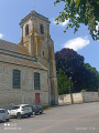
Start from the church car park, Rue de Grosville.
(S/E) Leave the car park, turn left, then go straight on (take care when crossing the D34E1) until you reach a Fork in the road.
(1) Take the path on the right and continue straight on.
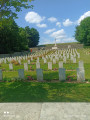
(2) Walk past the British cemetery, cross the D7 and continue straight on to the bridge over the Crinchon.
(3) Turn left, cross the bridge, then turn right and take the second left up a slight incline. Continue through the woodland and, further on, rejoin the lower path and carry on straight ahead, heading south-west, until you reach a crossroads.
(4) Take the hairpin bend to the right, then turn into the first street on the left and continue to a T-junction.
(5) Turn left and then immediately right, then carry on straight ahead along Rue d’en Bas.
(6) Just past the first houses, turn left onto the grassy track, then take a right-angle turn to the right and then left again. Keep to the right at the end, then turn left at the bend until you reach a fork in the road.
(7) Take the path on the right, turn right onto the road you come to and carry on straight ahead. Ignore the turnings on the left and right, heading straight on until you reach the fourth junction (narrow path).
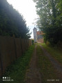
(8) Take the path on the right (be careful: there’s barbed wire fencing on both sides), pass the water tower, then arrive at the Basseux crossroads.
(9) Turn left onto Rue de Beaumetz, then at the Fork in the road, head off along Chemin des Bouleaux, turn left and continue on theGPR® until you reach a junction at La Voie Brûlée.
(10) Turn sharply right, then further on, take the path on the right and walk alongside the woodland before crossing through it. At the end, turn left across the platform, then cross the D7 with care and stay well on the verges until you reach the recycling centre.
(11) Immediately afterwards, take the path on the right and continue straight on until you reach Rue de Beaumetz.
(12) Keep to the right, then turn into the first street on the left, Chemin des Croix, until you reach the first junction.
(13) Turn right across the car park and then right again to return to the starting point (S/E).


 Association / Club / Walk leader
 Visorando Member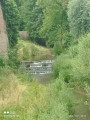
 Difficult