Country:

 City:
City:


(S/E) From the Vorbruck car park, cross the road and take the path marked with a Red Cross. Turn right. Cross a track.
(1) Turn right onto the unmarked path and, shortly afterwards, take a path up to the left.
(2) Turn right onto the path (Blue Saltire) towards Saegmühlmattel. At the fork, continue straight ahead. Join another path, then immediately turn right towards Dreistein Castle. At the fork in the bend, continue to the right. Please note: the signposted path further down shown on the IGN map no longer exists. You must take the circular route via the track.
(3) Take the path up to the left, then continue along the track veering slightly to the right. Shortly afterwards, at the junction, take the track to the left (Red Saltire). You’ll reach Dreistein Castle on your right. You can walk around it. Continue along the track (Red Saltire) towards Hagelschloss. Take the path up to the right and cross a track.
(4) Turn off onto the path on the right (Red Cross). Shortly afterwards, at the bend to the left, you’ll have a view of Dreistein Castle. Continue along the path. At the junction, take the path on the right.
(5) At the three-way junction, take the path on the right (Red Cross). Turn left onto the path towards Saegmühlmattel. Turn left towards Saint Odile. Cross a track.
(6) At the junction just before Grossmatt, turn sharp right. Return to the car park via the path marked with a Yellow Saltire and a Blue Cross. Cross the car park and the road. Continue along the path that runs alongside the road.
(7) A path on the left leads to the Merovingian tombs. Return to the junction and continue along the path (Blue Cross). Turn left at the junction (Red Ring), then right.
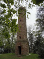
(8) Cross a road and take the path opposite (Red Disc) towards Jadelot. At the three-way junction, continue along the middle path. At the Jadelot gazebo, there is a beautiful view over the Rhine plain.
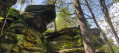
(9) From the Jadelot gazebo, take the path on the left towards the ‘mur païen’ (Red Rectangle). Cross a track. Continue to the Wachstein viewpoint (Rocher de Veille). After the Wachstein, turn right, walk as far as the Schafstein rock, then retrace your steps and continue towards the Grotte des Druides (Yellow Saltire).
(10) At the next Fork in the road, go straight on to the Grotte des Druides.
(1) Retrace your steps back to the Fork in the road.
(10) Take the path on the left (Red Disc) towards the Panorama Rock. You’ll pass close to the memorial to the crash of 20 January 1992, a place of remembrance. Turn left. At the junction, continue straight on (Red Rectangle).
(12) At the Rocher du Panorama, there is a lovely view over the Rhine plain and Strasbourg. You can also take a look at the ‘Rocher du Canapé’, situated 50 metres away. From the Rocher du Panorama, follow the path to the left below the cliffs (Yellow Saltire). You’ll pass the Beckenfels or Rocher du Bassin.
(13) At Mont Sainte-Odile, climb the steps on the left, cross the terrace, go down the steps, cross the road and continue down the Sentier des Pèlerins (Yellow Cross). Cross a path. Turn right at the bottom of the steps. At the junction, carry on straight ahead towards Stollhafen (Yellow Saltire). Cross a path and follow the path uphill towards Hagelschloss.
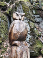
(14) Viewpoint at Rocher Oberkirch or Saufelsen. Beautiful view of the monastery and the Alsace plain. Continue along the Sentier des Merveilles (Yellow Saltire). Remarkable rock formations and wood carvings. Pass in front of the Grotte d’Etichon. Ignore a path on the left.
(15) Turn left towards Hagelschloss (Yellow Saltire). You can take a detour by continuing along the ‘Sentier des Merveilles’ to the Rocher des Géants and returning via the path overlooking the cliffs (1.3 km round trip). Cross a track and carry on straight ahead. Ignore the paths on the left.
(16) Turn right. At Hagelschloss Castle (the ‘Hail Palace’), take the path down to the right (Red Cross). Return to the junction you passed on the way out.
(2) Cross the track and follow the unmarked path back in the opposite direction to the outward journey to reach the car park (S/E).



 Visorando Member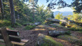
 Difficult
 Tourism professional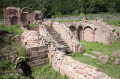
 Easy
Easy