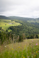
Markstein Circuit from the Refuge des Vosges Trotters, Mulhouse

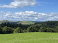
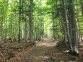
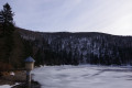
Circular loop around the Trehkopf, passing the Auberge du Steinlebach, the old Franco-American cemetery at the Col d’Oberlauchen, the Hahnenbrunnen mountain hut and the Jungfrauenkopf (above the Markstein summer toboggan runs).

Details

n°72470738
Creation:
Last update:
Last review:
  • Walking
    Activity: Walking
  • ↔
    Distance: 9.39 mi
  • ◔
    Average duration: 5h 30 
  • ▲
    Difficulty: Moderate

  • ⚐
    Back to start: Yes
  • ↗
    Ascent: + 1,362 ft
  • ↘
    Descent: - 1,352 ft

  • ▲
    Highest point: 4,157 ft
  • ▼
    Lowest point: 3,635 ft

Description of the walk

(S/E) Start at the Refuge des Vosges Trotters Mulhouse, by the roadside on the right, about 600 m before Markstein; there is a car park just before it on the left-hand side of the road. At the Fork in the road, head to the right of the building and continue uphill past three junctions before turning right onto the road (D430).

(1) Follow it to the right until you reach a junction.

(2) Continue straight on along the D430 until you reach the centre of the resort.

(3) Turn immediately left after the main building, then keep left. At the next Fork in the road, continue straight ahead.

(4) At the junction, keep straight ahead until you reach the fourth Fork in the road.

(5) Head up to the right towards the ridge, then keep to the left along the ridge to reach the Trehkopf.

(6) Turn left. At the star-shaped junction, take the second path on the right to reach a track. Follow it to the right, go through the gate and head straight on at the Fork in the road. Continue straight on until you reach the Route des Crêtes.

(7) Cross with care, take the road straight ahead and follow it to the Steinlebach farmhouse inn.

(8) Go round it on the right to continue to the Col d’Oberlauchen. Just past the farm, take the middle path and follow it to the stream.

(9) Stay on the track, then follow it to the right until you reach an open four-way junction.

(10) Turn left onto the path leading up to the Col d’Oberlauchen, where there is a memorial stone from the former Franco-American cemetery.

(11) Turn left onto the track towards the Col du Breitfirst.

(12) First turn left then right, and carry on straight ahead past the Hahnenbrunnen mountain hut.

(13) Walk back a few metres and head towards the road. Immediately turn left onto the GR®5 to reach the D27.

(14) Cross it carefully and continue straight on. Then keep going straight until you reach the junction you passed on the way out on the Route des Crêtes.

(7) Cross the D430, again taking care, and head straight on along a path above the road. After a left-hand bend, turn right onto a path towards the Jungfrauenkopf, above the summer toboggan runs.

(15) Go round the toboggan runs on the right and continue straight ahead to the junction from the outward journey.

(4) Head straight on, then keep left on the road (D430).

(2) First turn right then left and continue along the D430 to the original junction.

(1) Leave the road and follow it on the left, then continue straight ahead to the refuge (S/E).

Waypoints

  1. S/E : mi 0 - alt. 3,796 ft - Vosges Trotters Mulhouse mountain refuge - Markstein (le)
  2. 1 : mi 0.41 - alt. 3,871 ft - Common junction for out-and-back route - Markstein (le)
  3. 2 : mi 0.56 - alt. 3,885 ft - Common junction for out-and-back route
  4. 3 : mi 0.69 - alt. 3,904 ft - Markstein (le)
  5. 4 : mi 0.83 - alt. 3,924 ft - Junction for both outward and return journeys
  6. 5 : mi 1.21 - alt. 4,006 ft - Fork in the road
  7. 6 : mi 1.59 - alt. 4,140 ft - Trehkopf
  8. 7 : mi 2.59 - alt. 3,967 ft - Route des Crêtes. Common junction for outward and return journeys
  9. 8 : mi 3.18 - alt. 3,730 ft - Ferme Auberge du - Ferme auberge du Steinlebach
  10. 9 : mi 3.74 - alt. 3,760 ft - Stream
  11. 10 : mi 4.52 - alt. 3,635 ft - Four-way junction
  12. 11 : mi 4.87 - alt. 3,953 ft - Col d'Oberlauchen
  13. 12 : mi 5.57 - alt. 4,098 ft - Breitfirst Pass - Le Breitfirst
  14. 13 : mi 6.24 - alt. 3,888 ft - Refuge du Hannenbrunnen
  15. 14 : mi 6.75 - alt. 4,140 ft - D27
  16. 15 : mi 8.35 - alt. 4,154 ft - Summit of the - Jungfrauenkopf
  17. S/E : mi 9.39 - alt. 3,796 ft - VTM mountain hut - Markstein (le)

Worth a visit

Markstein Ski Resort.

Always be cautious and plan ahead when you're outdoors. Visorando and the author of this route cannot be held responsible for any accidents occurring on this route.

The GR® and PR® markings are the intellectual property of the Fédération Française de Randonnée Pédestre.

Reviews and comments

4.2 / 5
Based on 2 reviews

Reliability of the description
4 / 5
Ease of following the route
4 / 5
Route interest
4.5 / 5
Nature57
Nature57

Overall rating : 4.7 / 5

Date of your route : Nov 09, 2026
Reliability of the description : ★★★★★ Very good
Ease of following the route : ★★★★☆ Good
Route interest : ★★★★★ Very good
Very busy route : No

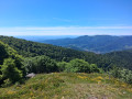
A lovely walk around the Markstein with several magnificent views of the surrounding valleys.
Thank you to the author for this lovely route.

Machine-translated

VosgesTrotters
VosgesTrotters

Hello,
I’ve clarified the starting point. Thank you for your comment.

Machine-translated

muttinad
muttinad
• Edited:

Overall rating : 3.7 / 5

Date of your route : May 14, 2025
Reliability of the description : ★★★☆☆ Average
Ease of following the route : ★★★★☆ Good
Route interest : ★★★★☆ Good
Very busy route : No

A lovely walk, but it’s hard to find the starting point

Machine-translated

Other walks in the area

For more walks, use our search engine .

The GPS track and description are the property of this route's author. Please do not copy them without permission.