Pointe Joanne

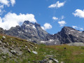
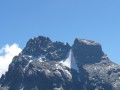
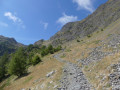
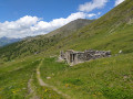
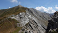
A border peak offering an exceptional view of Mount Viso.

Details

12785
Creation:
Last update:
Last review:
  • Walking
    Activity: Walking
  • ↔
    Distance: 13.41 mi
  • ◔
    Duration according to the author: 10 hrs 
  • ▲
    Difficulty: Very difficult

  • ⚐
    Back to start: Yes
  • ↗
    Ascent: + 4,764 ft
  • ↘
    Descent: - 4,734 ft

  • ▲
    Highest point: 9,928 ft
  • ▼
    Lowest point: 5,863 ft

Photos

Description of the walk

At Abriés, take the road to Ristolas and park at the bottom of the valley in the large car park at a place called La Roche Ecroulée.

(S/E) Take the botanical trail, which is also a variant of the Tour du Queyras (GR®58c), and head towards the Guil. Continue to the Petit Belvédère du Viso.

(1) Cross the Guil torrent via a new footbridge and head for the Grand Belvédère du Mont Viso.

(2) Leave the path leading to the Viso refuge on your left and take the path on your right that runs along the right bank of the Guil. You’ll reach a crossroads of paths.

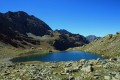
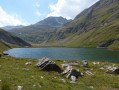
(3) Continue along the stream to reach Lake Lestio.

(4) Here, rejoin theGRP® route for the Tour du Pain de Sucre and Mont Viso. Begin the ascent up the Valante and reach the top.

(5) Follow thisGR® to the right, go round the rocky outcrop and reach an Italian bunker where a sign points to Pointe Joanne.

(6) Take this path on the right and follow it to the summit of Pointe Joanne.

(7) Then descend via the cairn-marked path which winds through the scree and joins the ascent path downstream of Lake Lestio.

(3) Turn left and follow the same path you took on the way up back to the car park (S/E).

Waypoints

  1. S/E : mi 0 - alt. 5,863 ft - La Roche Ecroulée car park - Guil (rivière)
  2. 1 : mi 0.36 - alt. 6,204 ft - Petit Belvedère du Viso
  3. 2 : mi 2.87 - alt. 7,133 ft - Crossroads: Viso Refuge – Valante Pass - Grand Belvédère du Mont Viso
  4. 3 : mi 4.72 - alt. 8,009 ft - Crossroads marking the return route from Pointe Joanne
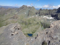
  5. 4 : mi 5.14 - alt. 8,258 ft - Lac Lestio
  6. 5 : mi 6.12 - alt. 9,295 ft - Col de Valante
  7. 6 : mi 7.34 - alt. 9,268 ft - Pointe Joanne crossroads
  8. 7 : mi 7.65 - alt. 9,928 ft - Pointe Joanne
  9. S/E : mi 13.41 - alt. 5,892 ft - La Roche Ecroulée car park

Notes

Water is present throughout the route, particularly at Lake Lestio, where it emerges from beneath a rock to form the Guil.
The Viso mountain hut is very close by, as is the Valante mountain hut on the Italian side.

This route passes through a protected area, which may be subject to special regulations:

Worth a visit

A very interesting hike through the Roche Ecroulée valley. It takes you into Italy and then back to France at the summit of the peak. In fine weather, the view of the nearby Mount Viso is breathtaking, but you need to set off early as, from midday onwards, clouds roll in over this Italian summit, the source of the River Po.

Always be cautious and plan ahead when you're outdoors. Visorando and the author of this route cannot be held responsible for any accidents occurring on this route.

The GR® and PR® markings are the intellectual property of the Fédération Française de Randonnée Pédestre.

Reviews and comments

4.7 / 5
Based on 2 reviews

Reliability of the description
4.5 / 5
Ease of following the route
4.5 / 5
Route interest
5 / 5
isa13
isa13

Overall rating : 5 / 5

Date of your route : Jul 25, 2020
Reliability of the description : ★★★★★ Very good
Ease of following the route : ★★★★★ Very good
Route interest : ★★★★★ Very good
Very busy route : No

A lovely walk with magnificent views.
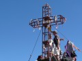
There is indeed no longer a sign pointing to Pointe Joanne, but the bunker mentioned in the description is clearly visible. As for the descent, a large cairn marks its start very close to the cross, but there are no further cairns afterwards. The presence of snowfields can make the route a bit tricky at times, as this path is very rarely used. You need to pay close attention to finding your way.
For the rest of the return journey, I chose to go via the Viso refuge to avoid retracing my steps. This little detour allows you to see the scenery from a different perspective.
My only regret: a stretch along the road that was a little too long for my liking.
Thank you for this route.

Machine-translated

Robert B2.
Robert B2.

For those who are less adventurous or less fit, Pointe Joanne and its magnificent panoramic views can be easily reached via the GR58c route, setting off from the Italian side of the Col Agnel, at the large hairpin bend where you simply must buy some cheese from the sheepfold.
From Pointe Joanne, if you’ve got time, a stop at the 5-star Gagliardone mountain refuge is well worth it.
You can even head down to Pontechianale, tuck into some pastries at Maddalena and hitch a lift or take a taxi back to the car :-)

Machine-translated

pridu83
pridu83

Overall rating : 4.3 / 5

Date of your route : Sep 06, 2014
Reliability of the description : ★★★★☆ Good
Ease of following the route : ★★★★☆ Good
Route interest : ★★★★★ Very good

A lovely hike that the more adventurous can complete in one go, or spread over two days with a stop at the Viso mountain hut or by camping.
Wildlife enthusiasts will be in for a treat with marmots, ibex and even foxes (for those who want to sleep under the stars!!)
Just be careful once you’ve passed the Col Valante – I couldn’t find the signpost for Pointe Joanne. So I followed the GR route. It adds a bit to the distance, and above all, you need to keep a close eye out to the right, up high, where you’ll see the Italian bunker. That’s the only landmark I found to help you join the path leading to the peak! Enjoy the hike!

Machine-translated

Other walks in the area

For more walks, use our search engine .

The GPS track and description are the property of this route's author. Please do not copy them without permission.