Tour du Grand Bérard

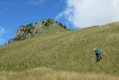
Le Grand Bérard is situated in the Parpaillon Massif and overlooks two rocky valleys where
transhumant herds. Circular walk.

Details

n°24678873
Creation:
Last update:
Last review:
  • Walking
    Activity: Walking
  • ↔
    Distance: 10.65 mi
  • ◔
    Duration according to the author: 6 hrs 
  • ▲
    Difficulty: Very difficult

  • ⚐
    Back to start: Yes
  • ↗
    Ascent: + 3,281 ft
  • ↘
    Descent: - 3,284 ft

  • ▲
    Highest point: 9,275 ft
  • ▼
    Lowest point: 6,024 ft

Photos

Description of the walk

From La Condamine-Châtelard, head towards the Sainte-Anne ski resort via the D29 and, at a bend just before reaching Sainte-Anne, continue towards Les Pras and the Parpaillon Tunnel road. Follow the road leading to the tunnel – initially tarmac, then a dirt track – a 4x4 vehicle is strongly recommended. Park at Pont de Bérard at the side of the track.

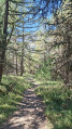
(S/E) Cross the bridge and take the path which climbs up the slope of the track to the left, following the yellow markings. Wind your way through the woodland, more or less following the course of the Bérard torrent. You’ll reach a wooden bridge.

(1) Cross the bridge and continue along the right bank of the stream. Leave the last larch trees behind and continue gradually until you reach the Cabane de Bérard, situated on the left bank in the mountain pasture.

(2) Continue along the right bank, following the markings, until you reach a flat area.

(3) From here, begin a climb via tight hairpin bends until you reach a spot near a stream.

(4) Take care here: follow the signposts closely and ignore the cairns leading off to the left. Continue up the switchbacks to reach the Pas de Reverdillon, situated between La Chalanche and the Grand Bérard.

(5) Begin the descent down the western slope along a steep and somewhat tricky path. Pass between small rock outcrops and then large scree slopes. Take great care on this section, which is made slightly easier by clearly visible cairns. You will then reach a flatter, greener area where a sign indicates theGR®56.

(6) Turn right onto this path and follow its red and white markings. Continue the descent until you reach the Cabane du Petit Parpaillon.

(7) Continue along the Ruisseau de Parpaillon until you reach the track at the Cabane du Grand Parpaillon. Turn right onto it, cross the stream and arrive at the edge of the woodland.

(8) Enter the woods; you’ll soon come to a designated rest area. Carry on to reach the Pont de Bérard car park via a gentle descent (S/E).

Waypoints

  1. S/E : mi 0 - alt. 6,027 ft - Pont de Bérard car park
  2. 1 : mi 0.67 - alt. 6,539 ft - Wooden bridge
  3. 2 : mi 1.68 - alt. 7,044 ft - Bérard Hut
  4. 3 : mi 2.34 - alt. 7,457 ft - Flat stretch
  5. 4 : mi 3.81 - alt. 8,540 ft - Path junction
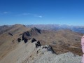
  6. 5 : mi 4.45 - alt. 9,275 ft - Reverdillon Pass
  7. 6 : mi 5.65 - alt. 8,248 ft - GR56
  8. 7 : mi 7.38 - alt. 7,057 ft - Petit Parpaillon hut
  9. 8 : mi 8.8 - alt. 6,673 ft - Grand Parpaillon Hut
  10. S/E : mi 10.65 - alt. 6,024 ft - Pont de Bérard car park

Notes

One downside: the return journey along the track leading to the Tunnel is long and uninteresting; you’ll come across quite a few motor vehicles (noise and dust).
Watch out for herds (keep dogs on a lead).

Worth a visit

The area is renowned for its distinctive rocks and folds.
There is a chance of spotting mouflons – wild sheep – whilst climbing up to the pass on the high, stony slopes; we observed a group of females and their young. A useful tip: you can clearly hear the mouflon’s bleating, which sounds like that of a goat, and immediately catches your attention.
You may also spot Alpine honeysuckle plants with their bright red berries.

Always be cautious and plan ahead when you're outdoors. Visorando and the author of this route cannot be held responsible for any accidents occurring on this route.

The GR® and PR® markings are the intellectual property of the Fédération Française de Randonnée Pédestre.

Reviews and comments

4.7 / 5
Based on 1 review

Reliability of the description
4 / 5
Ease of following the route
5 / 5
Route interest
5 / 5
icathou
icathou
• Edited:

Thank you for your feedback, particularly regarding the difficulty. I had classified this hike as difficult, not very difficult. Change made by the moderator...Similarly, changes have been made to the description, including the removal of the reference to the shepherd's hut located between points 3 and 4 – you pass it by and there is now a reference to Berard's hut instead – just a glimpse on the other bank...!

Machine-translated

beajouan
beajouan

Overall rating : 4.7 / 5

Date of your route : Aug 02, 2025
Reliability of the description : ★★★★☆ Good
Ease of following the route : ★★★★★ Very good
Route interest : ★★★★★ Very good
Very busy route : No

A very beautiful hike, quite demanding due to its length and elevation gain. The climb before reaching the Pas de Reverdillon (the highest point) is steep and the descent after this pass requires caution. However, there are no technical sections (no need to use your hands or navigate scree) and no difficulty in finding your way (the trail is well marked in yellow until it joins the red and white GR trail).
The landscapes are majestic, somewhat austere due to their mineral character.

Machine-translated

Other walks in the area

For more walks, use our search engine .

The GPS track and description are the property of this route's author. Please do not copy them without permission.