Country:

 City:
City:


Access:
- From Gap, head towards Serres then Nyons. Cross Les Pilles (small road tunnel in the village) via the D94 departmental road. After 1.8 km, you will reach the village of Aubres. Cross the village via the D94. Turn right towards the old village of Aubres (access opposite the L'Or Vert campsite). Park in the car park behind the cemetery.
- From Valréas/Vaison-la-Romaine, head towards Nyons. Bypass Nyons by following Rémuzat/Gorge de Saint-May via the D94 departmental road. You will soon reach the Or Vert campsite (atthe first traffic lights), turn left to go up to the Old Village of Aubres. Park in the car park behind the cemetery.
(S/E) From the cemetery, turn left onto the small tarmac road (D57, Montée du Vieux Village).
You will soon arrive near the wash house on Place de la Fontaine. Continue to the right, passing under the inn and crossing the cobbled street. At the end of the street, turn left onto Chemin de la Coste. Descend the winding road, following the small tarmac road.
(1) At the bottom of the descent, you will reach a small stream. Cross the ford via a small wooden footbridge. Continue to the right and then, about 60 metres further on, turn left onto Chemin de la Combe. Walk slightly uphill along the small tarmac road. At the intersection, continue straight ahead, following "La Combe". After a 90° turn, you will find yourself on Chemin de la Cascade, which is slightly uphill.
(2) You will come across a small, inconspicuous path on the left, which you will take on the way back. Stay on the tarmac road until you reach the bridge over the Ravin de Cougoir.
(3) Continue straight ahead (on the right bank of the stream) on Chemin de la Cascade to make a round trip to the waterfall. The waterfall has a beautiful tuff wall.
Return to the bridge and take the small path on the left (wooden sign for Col de l'Aubres). You will soon come out onto the small road above. Continue straight ahead on this road.
(4) At the first fork, continue straight ahead on the road towards Col de l'Aubres (wooden sign).
Initially, walk along the Ravin de Courigne on your right. There are two possible fords.
After 1.5km, you will come to a fork in the track. Continue straight ahead. The climb is very gentle. Continue until you reach the end of the track at Col de l'Aubres. This marks the start of the Coucou national forest (sign).
(5) From Col d'Aubres (area at the edge of the forest), ignore the path leading off to the left. Continue straight ahead on the path entering the forest. After about 100 metres, take the small, slightly eroded path downhill on the left (be careful, as the more obvious path marked on the ground encourages you to continue straight ahead). Descend and approach the small stream, then cross it.
You will then come to a path that is better marked than the other one. Continue northwards. You may have to cross several small streams. After about 1.2 km, leave the Coucou forest and pass at the foot of a ravine on your left.
(6) You will come out at the small hamlet of Les Crozes (spelled Croses on the IGN map). The path runs alongside a small villa.
Follow the carriage road on the left (Chemin des Crozes). It leads to a fork in the carriage roads. Continue left on the gravel track, which climbs slightly. Continue for about 650m on this wide track until you reach the path leading to a villa numbered 1560.
(7) Then turn left to go uphill and follow the small track leading to the villa (the private property boundary is along the lawn on the right, with a visible sign).
Go to the end and then take the path through a boxwood hedge. At the exit, turn right and then immediately left onto the small path through the boxwood and broom. There is a small wooden sign in very poor condition with the inscription "Cougoir" (route differs from the IGN map).
(8) You will reach a crossroads marked by a cairn. Continue along the path on the right. Walk along the side of a slightly sloping gravel area until you reach a track below.
(9) At the fork in the tracks, turn left. Follow the track for about 100 metres, then take the grassy path (small cairn present) on the left. This path quickly begins to climb. Although narrow in places, the trail is well marked. Follow it until you reach Pas du Loup, arriving below the cliffs of Rochers du Clos du Buis.
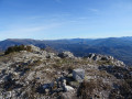
(10) At the exit of Pas du Loup, quickly cross the small box trees. Keep completely to the left to climb, quite steeply at first, to the ridges of the Rochers du Clos du Buis. You will find yourself on the side of the cliff, crossing the pasture area. Follow the cliffs until you reach a well-marked path on the ground.
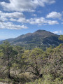
(11) You will arrive below the summit of Montagne de la Croix. Continue towards it, then cross a short vegetated area (elevation 1221).
Join the marked trail (yellow) coming from the west (from Col de la Pause), then continue to the left.
Descend slightly and reach the "Cougoir" marker below. Then climb straight up towards the summit.
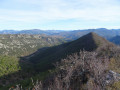
(12) Arrive at the summit of Cougoir, marked by its IGN marker. The promontory offers a beautiful 360° panorama.
Turn around, descend and then climb back up to the summit of Montagne de la Croix (elevation 1221). Head towards the Rochers du Clos du Buis on the right after crossing the small vegetated area of Montagne de la Croix.
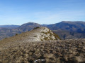
(11) Veer slightly left across the pastures. When you see it, head for the summit at elevation 1069. You will quickly reach Clos du Puits (altitude 1091m). Stay on the ridge line, marked by several cairns. Continue to the end of the ridge.
(13) Descend, veering to the right. The trail is not very well marked (a few small cairns) at the beginning in the small hairpin bends (rocky and gravelly in places). Then reach the ridge of Montagne de Sauveginoux in the undergrowth (boxwood, holm oak). Follow the good path descending to the north-east to the track at Col de Fonturière.
(14) At the Col de Fonturière, marked by a crossroads of tracks suitable for vehicles, take the track on the left (marked with yellow mountain bike signs). Descend for almost 1 km, heading north-north-west, to the Auberge de Miélandre. During the descent, ignore any other tracks you come across.
(15) When you reach the sign for "Auberge de Miélandre", follow Teyssières to the left. Take the D130 road to the bridge.
Continue straight ahead on the slightly uphill dirt track (yellow mountain bike signposting), heading west. You will arrive at a three-way junction.
(16) Continue on the right, following the wide path. Reach a field, then go around it on the left, following the path and crossing a small marly passage.
Reach the bottom of the valley, which follows a stream. Then turn left, crossing the stream at the ford. Continue westwards. The path then turns south-west to reach the intersection with theGRP®® Tour du Pays de Dieulefit at the "Pied Pourtier" signpost.
(17) Take the gravel track on the left towards Les Pignes/Cougoir. Yellow/red markings forthe GRP®® Tour du Pays de Dieulefit. After a few bends on the track, you will reach the "Les Pignes" signpost.
(18) Continue east for 400 metres towards Adret de la Lionne via Col du Bouton. Yellow markings. The route then heads south to Col du Bouton (partly along a pasture fence in the undergrowth). The route on the IGN map deviates to the east from the actual route. Continue south and arrive at the "Adret de la Lionne" marker on a wide stony path.
(19) Turn left towards Le Cougoir. The route heads due south. Follow the yellow/red markings ofthe GRP®® Tour du Pays de Dieulefit again.
(20) You will reach a fenced-in meadow shortly before the Col de la Pause (the corresponding marker is on the right below as you enter the meadow). Cross the meadow diagonally, following the grassy trail to the undergrowth (close the gates behind you). Yellow markings are present in the undergrowth.
(21) At the "Petit Herme" marker, turn right towards Col de Venterol. Yellow markings point in a south-westerly direction.
(22) At the "Col de Venterol" marker, turn right towards Pied Moutas, then left when you reach the gravel track.
Pass below the small house, then turn right to cross the meadow, following the fence. There is an opening between two tree trunks. Take a small grassy track and, 150 metres further on, turn right into the small pine trees onto the narrow path.
Follow the single track heading generally south (there is an "unofficial" fluorescent green marker) for about 1.8km.
(23) You will arrive at a small rocky ridge. Continue to the left (be careful, the fluorescent green markings encourage you to turn right). Walk along the ridges of La Veyronne. The path is fairly well marked. There are a few faint traces on either side. In any case, stay on the ridge line, heading south-east for about 2.8 km. There is a fence on the last third of the route; walk along it on your left.
At the end of La Veyronne, descend steeply onto Route de la Cascade (several small white arrows are attached to tree trunks in places).
(2) You will arrive at a small tarmac road. Turn right onto the path you took on the way up, towards the hamlet of La Rochette, then climb back up to the old village of Les Aubres to return to the starting point (S/E).

 Visorando Member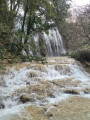
 Easy
Easy 
 Moderate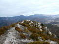
 Difficult