Val de Consolation

In the heart of the Watchmaking Region, a walk around the source of the Dessoubre and the Notre-Dame de Consolation monastery

Details

1807607
Creation:
Last update:
Last review:
  • Walking
    Activity: Walking
  • ↔
    Distance: 9.67 mi
  • ◔
    Average duration: 6h 10 
  • ▲
    Difficulty: Moderate

  • ⚐
    Back to start: Yes
  • ↗
    Ascent: + 2,018 ft
  • ↘
    Descent: - 2,021 ft

  • ▲
    Highest point: 2,697 ft
  • ▼
    Lowest point: 1,621 ft

Photos

Description of the walk

Montbéliardot Bridge

(S/E) Walk down the road to the D20. At the junction, take the road on the left, then the first path on the right towards the pumping station, which you’ll leave on your right.
Head uphill (yellow and blue markings) to reach the Chaucheux farm.

(1) Take the small road (D369) on the right until you reach the junction with a forest track.
Head downhill to the left and enter the woods
Keep to the left all the way to the village of Mont-de-Laval.

(2) At the crossroads after the church, take Rue Au-dessus-du-Village.
At the sharp left-hand bend, turn onto the path on the right, which is not very well signposted.
Cross the pasture in its entirety, following the signposts to reach the forest.

(3) Follow the path to Laval-le-Prieuré, taking care to follow the signposts.
Join the small road and turn left, passing between two buildings.

(4) Immediately after these, leave the road and take the path on the left.
Follow the route and the signposts, along the edge of the forest, to reach the D377.

(5) Turn left and follow the road. Take care. Pass the hamlet of Consolation-Maisonnette and
head towards La Roche du Prêtre along the road

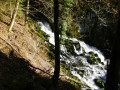
(6) At the bend, turn right onto the path which climbs alongside the Dessoubre to its source.

(7) Walk past the inn on the left, then turn left onto the path that climbs towards the start of the zip line.
Join the D39 at the oratory.

(8) As you come out of the bend, turn left up the embankment onto the small path leading to the top of the cliff.
Follow this path – some of the descents are a bit tricky (take care) – whilst following the signposts.
Leave the forest and walk down through the pasture to the path.

.(9) Turn right, head down to the bottom of the Parc de Consolation and turn left.

(10) At the bottom, turn left and cross the bridge.
After the bridge, head straight up towards the Source Noire.
After the viewing platform, carry on straight along the track – which is no longer really a path – as it climbs steeply to join a track suitable for vehicles.

(11) Turn left and climb for about 1 km to the Côte de la Consolation.

(12) Turn right onto the hairpin bend, then left onto the steep path.
Leave the forest and follow the track to the left, which will take you back to Mont-de-Laval.

(2) Follow Rue du Chêne to the right, then the D369 to the Chaucheux farm. Take care.

(1) Turn left, then immediately right onto the path you took on the way there, and head back to Montbéliardot (S/E).


Waypoints

  1. S/E : mi 0 - alt. 2,638 ft - Montbéliardot Bridge
  2. 1 : mi 0.94 - alt. 2,638 ft - Les Chaucheux
  3. 2 : mi 1.6 - alt. 2,644 ft - Mont-de-Laval
  4. 3 : mi 2.05 - alt. 2,618 ft - Path leading into the forest
  5. 4 : mi 2.72 - alt. 1,952 ft - Path on the left
  6. 5 : mi 4.15 - alt. 1,631 ft - Turn left onto the D377
  7. 6 : mi 4.88 - alt. 1,732 ft - Path around the bend
  8. 7 : mi 5.08 - alt. 1,936 ft - Path on the left after the inn
  9. 8 : mi 5.23 - alt. 2,090 ft - Path on the left. Source of the - Dessoubre (rivière)
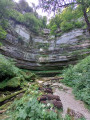
  10. 9 : mi 5.73 - alt. 1,877 ft - Cirque de Consolation
  11. 10 : mi 6.12 - alt. 1,680 ft - Turn left to cross the bridge
  12. 11 : mi 6.32 - alt. 1,867 ft - Turn left at the fork
  13. 12 : mi 6.99 - alt. 2,149 ft - The Côte de Consolation
  14. S/E : mi 9.67 - alt. 2,635 ft - Montbeliardot Bridge

Notes

There are no water points along the route.
Please note: the picnic area shown on the topographical map near the bridge over the Dessoubre no longer exists.
There are some lovely picnic tables on the way back before Mont-de-Laval.
Picnic shelter at Place du Chêne in Mont-de-Laval (next to the church)

Worth a visit

Consolation Park, which can be visited (allow 1 hour and 3 euros per person)
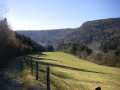
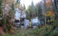
Beautiful scenery, particularly around Laval-le-Prieuré and Consolation.
Source du Dessoubre zip line (500m long and 135m high) open in July/August and on Sundays and public holidays. Check online or at the Auberge de la Source. The start and finish points are directly accessible from the path you’ve been following.
A beautiful bell tower in Mont-de-Laval.
Interesting wildlife (chamois, roe deer, birds)

Reviews and comments

3.8 / 5
Based on 5 reviews

Reliability of the description
3.8 / 5
Ease of following the route
3.6 / 5
Route interest
4 / 5
gilberlou
gilberlou

Overall rating : 2.7 / 5

Date of your route : Aug 12, 2024
Reliability of the description : ★★★☆☆ Average
Ease of following the route : ★★☆☆☆ Disappointing
Route interest : ★★★☆☆ Average
Very busy route : No

Hello,
I completed this route yesterday with a view to suggesting it to my walking club. I have a few comments:
- As the destination is the Cirque de Consolation, why start the walk at MONTBELIARDOT? There are plenty of parking spaces available near the church at MONT DE LAVAL, which would avoid the 2 km round trip – partly on tarmac and along the roadside – or crossing uninteresting pastures, which risks disturbing the livestock,
- At point 5, do not cross the bridge to join the road; stay on the forest track, which continues safely all the way to the site (arriving via the car park).
- The route via the ridges (from the site of the old zip line) and La Roche Sainte-Catherine is of little interest; it is dangerous in places. To get to the viewpoint, you might as well take the path leading to the waterfall and back,
-Regarding the question about how easy the route is to follow, I marked it as ‘disappointing’; the directions are often basic, such as ‘turn left’, whereas following the route on the app is sufficient. It would be better to specify your current location and, if applicable, the point of interest, as at point 4 ‘LAVAL LE PRIEURÉ – a must-see’, for example.
This comment applies to many other walks as well.
-Finally, I think it’s a shame to head all the way down to LAVAL LE PRIEURÉ, when there’s more to see on the site and near the waterfall; there’s not even any mention of the Roche du Prêtre.
In summary, this is a walk I would recommend, but one that needs revising so that visitors can experience all the facets of this magnificent site – which extend far beyond the footpaths to include the history of the site, its park and its buildings.

Machine-translated

foifoi jungfrau
foifoi jungfrau

Overall rating : 3.7 / 5

Date of your route : Jun 17, 2024
Reliability of the description : ★★★☆☆ Average
Ease of following the route : ★★★★☆ Good
Route interest : ★★★★☆ Good
Very busy route : No

A lovely walk, alternating between sections of limited interest and superb views. A few notes: the car park opposite the entrance to the pumping station is highly recommended; the forest track between points 1 and 2 is very bumpy; before point 3, turn right 50 metres before the forest to reach the path via a small ladder in the fence (at the end of the meadow); at point 5, stay on the same bank of the Dessoubre, then at the ford, carry on by taking the lower track (the upper one, which runs almost parallel, takes you straight to point 11! That’s what we did, so we skipped the section between 6 and 10); at point 12, the single track runs parallel to the track, climbing very steeply, then, after a hairpin bend, crosses a dead-end track and continues to climb very steeply!

Machine-translated

Maryse BB
Maryse BB

Overall rating : 4 / 5

Date of your route : Apr 30, 2024
Reliability of the description : ★★★★☆ Good
Ease of following the route : ★★★★☆ Good
Route interest : ★★★★☆ Good
Very busy route : No

A route offering great variety in terms of scenery and the type of path.
You can start at the pumping station, where there are more parking options (and this avoids having to walk along the road).
The descent between points 8 and 9 can be tricky in wet weather.
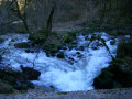
We have added a return trip to point 10 to the route to get closer to the waterfalls, which are abundant at this time of year. This is not a major detour.

Machine-translated

richardd
richardd

Overall rating : 4 / 5

Date of your route : Sep 17, 2023
Reliability of the description : ★★★★☆ Good
Ease of following the route : ★★★★☆ Good
Route interest : ★★★★☆ Good
Very busy route : Yes

A lovely walk with superb views from the three lookouts. We spotted some wildlife – hares, chamois and wild boar. The sun was shining.
Well worth doing time and time again.

Machine-translated

PHerrmann
PHerrmann

Overall rating : 4.7 / 5

Date of your route : Feb 08, 2021
Reliability of the description : ★★★★★ Very good
Ease of following the route : ★★★★☆ Good
Route interest : ★★★★★ Very good
Very busy route : No

A hike full of surprises. The Dessoubre river bursting its banks, large numbers of chamois, incredible panoramic views and waterfalls with plenty of water.
Perfect for any time of year

Machine-translated

Other walks in the area

For more walks, use our search engine .

The GPS track and description are the property of this route's author. Please do not copy them without permission.