Tour of the Chabrières Stones

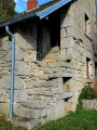
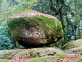
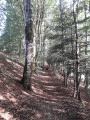
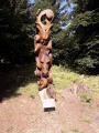
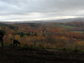
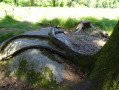
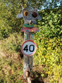
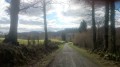
A walk that is largely through woodland, offering the chance to discover the many listed rock formations of the Chabrières Massif as well as tree sculptures.

Details

2289718
Creation:
Last update:
Last review:
  • Walking
    Activity: Walking
  • ↔
    Distance: 8.83 mi
  • ◔
    Average duration: 5h 00 
  • ▲
    Difficulty: Moderate

  • ⚐
    Back to start: Yes
  • ↗
    Ascent: + 1,086 ft
  • ↘
    Descent: - 1,066 ft

  • ▲
    Highest point: 2,149 ft
  • ▼
    Lowest point: 1,716 ft

Photos

Description of the walk

Park in the car park just before the village of Badant, on the side of the D33 departmental road when coming from Guéret.

(S/E) Take the road leading downhill to the right and head towards the village of Badant. Turn right at the first junction. Carry on, passing under the power line; at the end of this road, you’ll reach a junction where a track meets a footpath.

(1) Head up the footpath on the left; you’ll soon come to a wider track. Take it to the left, then turn right straight away onto a footpath that climbs through the woods. You’ll come to a road again.

(2) Cross it and follow the fence of the Parc aux Loups. At the right-angled junction, turn right onto the footpath which rejoins the previous road.

(3) Continue straight ahead, heading generally south. After a few bends on a slight descent, you’ll reach the Ruisseau du Bois crossroads.

(4) Take the path on the left and continue to the small village of Savennes.

(5) Walk round the chapel, then take the road that goes straight down at the back and continue along a narrow path, crossing the road. Cross a bridge, then take the path on the right. Walk alongside a pond until you reach a crossroads with roads leading in several directions.

(6) Turn left, then right onto a path, head towards the village of Les Vergnes, walk through it and then continue along a path through the woodland. You’ll reach the junction with the Route du Mas Foreau.

(7) Leave this road and turn right onto the track leading to Pierre Chabranle, then on to Pierre Casse-Noisette.

(8) Turn left to reach the ‘Trois Amis’ – two oaks and one beech that have grown from the same root. Continue to the right to discover the ‘Pierre du Trésor’. You’ll come back onto the previous road.
Cross it and take the small path opposite, which slopes down slightly. Cross the Ruisseau du Châpitre and reach the edge of the D940, a three-lane road.

(9) Head up the hairpin bend to the right, which joins another road.
Take care here: cross the D940 with caution to take a path on the left that passes under some fir trees. At the end of the path, turn right to pass in front of the Pierre la Grosle and then the wooden sculptures. You’ll come to a wooden barrier closing this road to vehicles.

(10) Turn left after the wooden barrier, then right; head up the track on the right and continue to the right again. Head down to the right along a small path, then rejoin the D940.

(11) Take care when crossing here too. Turn left onto the road running parallel to the D940, then leave it very quickly to the right to join the path. Head towards the Cabane à Parrain, passing the Pierre de la Tribune. Follow the winding path down to reach the Pierre du Loup. Cross the Ruisseau de la Fontaine aux Sangliers. Join the D33 road. Keep to the right along it for a few metres until you reach another junction with a path.

(12) Take this path to the right, which climbs gently. Continue to the left at the highest point to return easily to the car park at the entrance to Badant (S/E).

Waypoints

  1. S/E : mi 0 - alt. 1,998 ft - Car park before the village of Badant
  2. 1 : mi 0.38 - alt. 1,998 ft - Uphill path through the woodland
  3. 2 : mi 0.71 - alt. 2,110 ft - 1st junction with the road
  4. 3 : mi 1.1 - alt. 2,129 ft - 2°°e°° Road junction
  5. 4 : mi 1.86 - alt. 1,857 ft - Crossroads by the stream
  6. 5 : mi 2.82 - alt. 1,962 ft - Savennes Chapel
  7. 6 : mi 3.56 - alt. 1,811 ft - Crossroads by the pond
  8. 7 : mi 4.65 - alt. 1,775 ft - Path through the rocks
  9. 8 : mi 5.03 - alt. 1,965 ft - Pierre Casse-Noisette
  10. 9 : mi 5.96 - alt. 1,932 ft - D940
  11. 10 : mi 6.97 - alt. 2,087 ft - Crossroads with barrier
  12. 11 : mi 7.57 - alt. 2,077 ft - D940
  13. 12 : mi 8.27 - alt. 1,903 ft - Turn right onto the path leading uphill
  14. S/E : mi 8.83 - alt. 1,998 ft - Car park before the village of Badant

Worth a visit

Guéret Mountains Wildlife Park (wolves)

Reviews and comments

3.5 / 5
Based on 8 reviews

Reliability of the description
2.9 / 5
Ease of following the route
3.6 / 5
Route interest
3.9 / 5
danièle31
danièle31

Overall rating : 4.7 / 5

Date of your route : Jul 26, 2026
Reliability of the description : ★★★★★ Very good
Ease of following the route : ★★★★★ Very good
Route interest : ★★★★☆ Good
Very busy route : No

Very pleasant, mainly through woodland. Ideal in hot weather.

Machine-translated

Xhristophe
Xhristophe

Overall rating : 3.3 / 5

Date of your route : Mar 17, 2025
Reliability of the description : ★★★☆☆ Average
Ease of following the route : ★★★☆☆ Average
Route interest : ★★★★☆ Good
Very busy route : No

The whole of the end of the walk has to be done all over again! Part of the hill has collapsed and the path no longer exists.

And once you’ve managed to get out of that and find the path again, you come across a huge timber-felling site that completely blocks your way along the path

And I’d forgotten that the route follows a trial route that’s regularly used…

In short… be prepared for a bit of a let-down towards the end of the route

Machine-translated

Jean-Pierre Déchoz
Jean-Pierre Déchoz

Overall rating : 5 / 5

Date of your route : Oct 14, 2023
Reliability of the description : Not used / Not applicable
Ease of following the route : ★★★★★ Very good
Route interest : ★★★★★ Very good
Very busy route : No

A really lovely walk. Woodland, rocks, hardly any tarmac. I’m surprised by the number of negative reviews this route has received. I think you need to follow the route on your phone, as there are lots of changes in paths, tracks and even directions.

Machine-translated

balou17
balou17

Overall rating : 3 / 5

Date of your route : Aug 18, 2023
Reliability of the description : ★★★☆☆ Average
Ease of following the route : ★★★★☆ Good
Route interest : ★★☆☆☆ Disappointing
Very busy route : No

From Pt 8, I headed back to S/E. The walk was entirely through woodland, with no panoramic views and no villages of note.

Machine-translated

didier Barrault
didier Barrault
• Edited:

Overall rating : 2.3 / 5

Date of your route : Jun 17, 2021
Reliability of the description : ★★☆☆☆ Disappointing
Ease of following the route : ★★☆☆☆ Disappointing
Route interest : ★★★☆☆ Average
Very busy route : No

The signposting between the mountain bike routes was really poor – we ended up doing 19 km instead of 14. We only saw the wolf park, a few rocks and a lot of road as we tried to get back onto the routes. It’s a shame.

Machine-translated

henri57
henri57 ★

Hello,

The route is very poorly signposted, which is a shame.

The signposting is the responsibility neither of Visorando nor of the author.
Visorando provides a route description and an IGN map at a scale of 1:25,000. The route description and the route map can be viewed separately.

However, if signposting is essential for you, Visorando provides, in addition to the route description and the 1:25,000 IGN route map, a virtual signposting tool: a GPS app.

This tool, offered free of charge by Visorando, allows you to verify waypoints and thus resolve any doubts regarding your direction.

Kind regards

Machine-translated

Pascale Bouteille
Pascale Bouteille

Overall rating : 2.7 / 5

Date of your route : Mar 21, 2021
Reliability of the description : ★★☆☆☆ Disappointing
Ease of following the route : ★★☆☆☆ Disappointing
Route interest : ★★★★☆ Good
Very busy route : No

The route is very poorly signposted – it’s a shame.
Luckily I’d taken a paper map – that really helped us!

Machine-translated

hikegailmike
hikegailmike

Overall rating : 4 / 5

Date of your route : Jul 29, 2020
Reliability of the description : ★★★☆☆ Average
Ease of following the route : ★★★★☆ Good
Route interest : ★★★★★ Very good
Very busy route : Yes

The directions for the trails weren’t always very clear, and the trails weren’t always easy to find, which meant we set off in the wrong direction a few times. A lovely walk all the same.

Machine-translated

MLABER
MLABER

Overall rating : 3.3 / 5

Date of your route : Jun 01, 2020
Reliability of the description : ★★☆☆☆ Disappointing
Ease of following the route : ★★★★☆ Good
Route interest : ★★★★☆ Good
Very busy route : No

Hello,
We went on a hike yesterday; the description is a bit lacking in detail because there were no signposts on the ground, and we were so confused that we ended up walking 19 km; it’s not a big deal, as we’re keen walkers, but it could be a problem for casual walkers.

Machine-translated

Other walks in the area

For more walks, use our search engine .

The GPS track and description are the property of this route's author. Please do not copy them without permission.