Le Puy de Chiroux

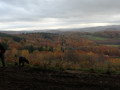
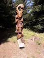
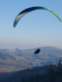
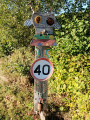
A walk in the Chabrières massif offering lovely views, rocky outcrops and chainsaw-carved sculptures. A family-friendly walk featuring sections through the woodland and along forest tracks.

Details

2942880
Creation:
Last update:
Last review:
  • Walking
    Activity: Walking
  • ↔
    Distance: 3.73 mi
  • ◔
    Average duration: 2h 05 
  • ▲
    Difficulty: Easy

  • ⚐
    Back to start: Yes
  • ↗
    Ascent: + 463 ft
  • ↘
    Descent: - 433 ft

  • ▲
    Highest point: 2,247 ft
  • ▼
    Lowest point: 1,916 ft

Photos

Description of the walk

Park in the Chabrières Forest car park.

(S/E) Take the path on the right and cross the platform; you’ll soon come to a junction of paths.
Take the small path on the left, leading to a wider tarmac track.

(1) Turn left onto it; at the Y-junction, keep right. At the end of this track, continue along the path that follows on from it. You’ll reach another junction.

(2) Turn left onto a small path through the woodland and, a little further on, you’ll come to another track.

(3) Take this track to the left to reach the summit of Puy de Chiroux. Continue downhill along the path heading due south. You’ll come to a junction with a path running at right angles.

(4) Take the left-hand branch, then keep to the right at the next junction. After two hairpin bends – first to the right, then to the left – you’ll reach another track.

(5) Turn right onto it and follow it to its end, marked by a wooden gate. Take the path on the left, make a wide left-hand circular loop to join the track running parallel to the road, which ends once again at a track.

(6) Turn left and continue along this track until you reach the gate. Turn right to return to the Chabrières Forest car park (S/E).


Waypoints

  1. S/E : mi 0 - alt. 2,060 ft - Chabrières Forest car park
  2. 1 : mi 0.4 - alt. 2,146 ft - Tarmac track to the left
  3. 2 : mi 1.05 - alt. 2,162 ft - A narrow path through the woodland on the left
  4. 3 : mi 1.4 - alt. 2,142 ft - Turn left towards the Puy de Chiroux
  5. 4 : mi 1.88 - alt. 2,047 ft - Turn left towards the rocks
  6. 5 : mi 2.4 - alt. 1,995 ft - Track
  7. 6 : mi 3.13 - alt. 2,037 ft - Tarmac track
  8. S/E : mi 3.73 - alt. 2,060 ft - Chabrières Forest car park

Worth a visit

Giant maze.
Courtille lake.

Reviews and comments

3.8 / 5
Based on 4 reviews

Reliability of the description
3.8 / 5
Ease of following the route
3.5 / 5
Route interest
4.3 / 5
Eliadubruc
Eliadubruc

Overall rating : 3.7 / 5

Date of your route : Sep 18, 2024
Reliability of the description : ★★★★☆ Good
Ease of following the route : ★★★★☆ Good
Route interest : ★★★☆☆ Average
Very busy route : Yes

An easy walk, but not particularly interesting as it’s mainly through conifer plantations. Except at the end, where there are sculptures and the ‘Forêts folies’ event takes place! There are some lovely views here and there thanks to the gaps left by felled trees!
La Chabrière has plenty of other, more interesting spots to explore!

Machine-translated

Vacri
Vacri

Overall rating : 3 / 5

Date of your route : Sep 10, 2024
Reliability of the description : ★★★☆☆ Average
Ease of following the route : ★☆☆☆☆ Very disappointing
Route interest : ★★★★★ Very good
Very busy route : No

It’s a beautiful spot. However, there are no signposts. We’re not even sure we’ve taken the right walk!

Machine-translated

balou17
balou17

Overall rating : 3.7 / 5

Date of your route : Aug 18, 2023
Reliability of the description : ★★★☆☆ Average
Ease of following the route : ★★★★☆ Good
Route interest : ★★★★☆ Good
Very busy route : No

A lovely walk in the woods. A panoramic view, two nice climbs.

Machine-translated

Azimut71
Azimut71

Overall rating : 5 / 5

Date of your route : Sep 04, 2020
Reliability of the description : ★★★★★ Very good
Ease of following the route : ★★★★★ Very good
Route interest : ★★★★★ Very good
Very busy route : No

A little shortcut:

  • after the 4th bend, at the first hairpin bend on the right, you can take a marked path lined with red markers, which crosses an area devastated by clear-cutting and joins the route described below, which you should follow to the left. You won’t regret it – the route along the track is just as dreadful.

Fortunately, the rest of the route is very pleasant, especially towards the end.

Machine-translated

Other walks in the area

For more walks, use our search engine .

The GPS track and description are the property of this route's author. Please do not copy them without permission.