Country:
 City:
City:


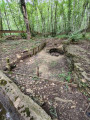
Park your car next to the Cestres washhouse.
(S/E) With your back to the washhouse, set off straight ahead along Rue de l’Abreuvoir (D103). Keep to the right onto the D130x at the three-way junction and continue to the junction with Chemin des Anglais on the right.
(1) Follow this path down to a pond situated behind the boundary walls of a farmstead. Continue to the crossroads.
(2) Go straight on to climb up to the beautiful church of Saint-Martin-du-Mont, surrounded by old lime trees and visible from the valley.
(3) Follow the road (marked path) to the right as it leaves the village and descends towards the D16, which runs up from Saint-Seine-l’Abbaye towards the hamlet of Bordes-Bricard. Stop halfway down the slope at the pretty washhouse in Saint-Martin-du-Mont, known as the Lavoir de la Fontaine.
(4) Carry on until you reach the D6, cross it carefully and continue straight ahead to the bridge over the Ougne.
(5) Keep to the left without crossing the bridge and take the path that climbs up the valley floor to the Bordes-Bricard wash house.
(6) Turn left onto the tarmac road which climbs up to the hamlet and joins the junction of the D16 and the D103.
(7) Cross at the pedestrian crossing set back to the right, turn left and carry on straight ahead along the D103 for about twenty metres. Turn at a right angle onto the tarmac road leading off to the right across the fields, and follow it for about 400 metres, until you reach a T-junction in the open countryside.
(8) Turn left to follow the path heading due north across the fields. Continue to the junction with a track at a place called Champs du Chêne.
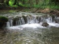
(9) Turn left onto this track and continue to the Froideville wash house and its pretty pond. Take a moment to enjoy the spot.
(10) Turn right after the wash house and follow the tarmac road for about 200 m, until you reach the three-way junction where the route joins the GR®2.
(11) Head slightly to the left to follow it, walk for about 300 m, then turn left, staying on the GR®, towards a small hill overlooking Cestres. Take the climb, then walk gently back down, passing two aerial masts on your left. Return to where you parked at the Cestres washhouse (S/E).
 Visorando Member
 Moderate
 Difficult