Circular Washhouses Tour, starting from Saint-Martin-du-Mont

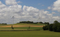
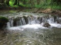
A pleasant walk starting from Saint-Martin-du-Mont, taking in wash houses, wind turbines and a beautiful abbey.
This discovery route takes you gently through green hills and vast fields.

Details

44054496
Creation:
Last update:
Last review:
  • Walking
    Activity: Walking
  • ↔
    Distance: 11.52 mi
  • ◔
    Average duration: 6h 05 
  • ▲
    Difficulty: Moderate

  • ⚐
    Back to start: Yes
  • ↗
    Ascent: + 909 ft
  • ↘
    Descent: - 915 ft

  • ▲
    Highest point: 1,896 ft
  • ▼
    Lowest point: 1,483 ft

Description of the walk

Head to Saint-Martin-du-Mont via the D971, then the D103 via Cestres. Park in the car park behind the town hall.

(S/E) Set off towards the church, on the right as you leave the car park. Take a look at the church entrance and the Maltese crosses in the cemetery, then retrace your steps, going round them on the left. Head down the grassy path until you reach the junction with a road. Cross a stream, then head uphill alongside a wall (keeping to the right), go round a pond and, after a fairly steep climb, reach the four-way junction.

(1) Turn left facing the wayside cross and head up Rue de l’Abreuvoir, which is also the D103. Follow this road as far as the Cestres washhouse.

(2) Turn right onto the grassy path – this is theGR®2, marked in white and red. Pass by a telecoms mast and continue across the field. Head back down to where it joins a white track, opposite a small pond. You’ll reach a crossroads with a telecoms mast. Leave theGR® here and turn right to quickly reach the pond and the Froideville washhouse.

(3) Cross the D103 and head straight on down Rue de Borgeron, starting from the cross. Join the D103x at a Fork in the road marked by a wayside cross and a statue of the Virgin Mary. Turn left until you reach the next crossroads, opposite a cross on the wall. Turn left onto the D103x and leave the village. This quiet road winds its way through a lovely rolling landscape. You will then reach the Fontaine washhouse.

(4) Continue along the D103x until it joins the busier D16. Cross it carefully and head down the opposite side, across the fields. You’ll reach the right bank of the Ourgne and come out at a bridge.

(5) Do not cross the bridge, but carry on along the right bank on the grassy path leading uphill and marked in yellow. You’ll reach the wayside cross, the fountain and washhouse, and the Bordes Bricard picnic area.

(6) Continue to the right and stay on the grassy path marked in yellow as it climbs. At the first Fork in the road, turn left; after a few bends, you’ll reach a T-junction on the Coteau Paillot.

(7) Turn right onto a tarmac road. Carry on straight ahead, ignoring any side roads. You’ll reach a junction with a sign warning of ‘Danger: Falling Ice’.

(8) Turn left onto a grassy path through fields and past wind turbines. At a wind turbine, cross a dirt track. Keep to the right, following the yellow markings of the Discovery Trail. You’ll reach a junction with a signpost for Champcourt.

(9) Turn left onto the Sentier des Alizées. Walk alongside the woods until you reach another junction marked by a yellow signpost on the left.

(10) Take care here: turn right, towards more wind turbines, across the fields. Cross the Charme de Champ Court. Continue along a straight stretch. You’ll reach a crossroads of four tracks with a concrete storage area opposite. Continue straight ahead along the grassy path towards the Mont des Dames, then reach the junction with a tarmac road.

(11) Turn left to reach the designated rest area.

(12) Then head back in the opposite direction to return to the previous junction.

(11) Carry on straight ahead along the road, staying on it and ignoring all turn-offs to the right or left. You’ll reach a junction with four arms that are almost perpendicular to one another.

(13) Carry on straight ahead, keep to the right at the next junction and, a few hundred metres further on, you’ll come to a T-junction, where there’s a wooden post on the right.

(14) Leave the tarmac and turn onto a dirt track on the right. At the watchtowers at the entrance to a small wood, take a sharp left-hand bend and stay on the main track, which descends steeply.

(15) Cross the Ougne via a small bridge to come out onto the D16, a short stretch of tarmac road.

(16) Cross it carefully and take the path opposite that runs parallel to the D16. At the garage, cross this road again carefully. Walk on the left-hand side of the carriageway to reach the village of Saint-Seine-l’Abbaye safely. Walk downhill to the ‘Stop’ sign at the junction with the D971. Turn left towards Chatillon. Cross at the pedestrian crossing and continue on the right-hand pavement. At the Fork in the road, Fontaine au Centre, turn right into Rue Sonnois. Enjoy the lovely views of the typical old houses frozen in time. Turn right to reach Place de l’Église Abbatiale.

(17) Go down the steps on the right between the administrative buildings. Take the street running alongside the church on the left and walk past the War Memorial on Place de la Halle.
Follow theGR®2® to the right as you head up Rue Haute.

(18) Turn right and walk alongside the abbey grounds (private property). Over the low wall on the right or via the private entrance, you can catch a glimpse of the old cloister – now home to the Maison de l’Enfance – which features a beautiful carved pediment. At the bend to the right, there is a wayside cross on the left. Walk down the alley to reach the departmental road.

(19) Cross the road at the pedestrian crossing on the left and take the road leading uphill opposite, which turns into a dirt track. Walk past the stables and the farmhouse on your right, follow the bend to the left and climb more steeply until you see the Church of Saint-Martin-du-Mont opposite and the car park behind the Town Hall (S/E).

Waypoints

  1. S/E : mi 0 - alt. 1,736 ft - Car park at Saint-Martin-du-Mont Town Hall
  2. 1 : mi 0.5 - alt. 1,762 ft - D103x
  3. 2 : mi 0.85 - alt. 1,801 ft - Cestres wash house
  4. 3 : mi 1.65 - alt. 1,811 ft - Froideville wash house and pond
  5. 4 : mi 2.34 - alt. 1,699 ft - La Fontaine washhouse
  6. 5 : mi 3.02 - alt. 1,588 ft - Ponr on the Ourgne
  7. 6 : mi 3.62 - alt. 1,736 ft - Bordes Bricard wash house
  8. 7 : mi 4.2 - alt. 1,788 ft - Coteau Paillot
  9. 8 : mi 4.61 - alt. 1,834 ft - Sign warning of falling ice
  10. 9 : mi 5.22 - alt. 1,781 ft - Champcourt signpost
  11. 10 : mi 5.54 - alt. 1,801 ft - Crossroads
  12. 11 : mi 6.79 - alt. 1,785 ft - Crossroads after Mont des Auges
  13. 12 : mi 7.19 - alt. 1,818 ft - La Rochotte picnic area
  14. 13 : mi 8.78 - alt. 1,778 ft - Four-way junction
  15. 14 : mi 9.39 - alt. 1,801 ft - T-junction
  16. 15 : mi 9.88 - alt. 1,509 ft - Cross the - Ougne (cours d'eau) - Affluent de l'Ignon
  17. 16 : mi 10.11 - alt. 1,568 ft - D16
  18. 17 : mi 10.58 - alt. 1,499 ft - Abbey Church
  19. 18 : mi 10.76 - alt. 1,552 ft - Abbaye Wall
  20. 19 : mi 11.1 - alt. 1,509 ft - D971
  21. S/E : mi 11.52 - alt. 1,736 ft - Car park at Saint-Martin-du-Mont Town Hall

Notes

Picnic areas (one table with two benches) at the fountains and wash houses in Froideville (3), Saint-Martin-du-Mont (4) and Bordes Bricard (6).
(12) Well-equipped picnic area: 4 tables and benches, rubbish bin, on the Route de la Rochotte, shaded in summer.
Bring walking sticks in wet weather; they’re also useful on the sometimes steep ascents and descents.
Also bring hats and sun cream in hot weather.

Worth a visit

Visit the wash houses and the pretty villages of Cestres (2), Froideville (3), Saint-Martin-du-Mont (4) and Les Bordes Bricard (6), all dating from the early 19th century.
(S/E) Saint-Martin-du-Mont: a parish church dating from the 12th century. Of particular note is its unusual entrance, adorned with columns.
The parish of Mont-Saint-Martin remained under the control of the powerful neighbouring Abbey of Saint-Seine until the Revolution. From 1793, the parish’s name was secularised to Martin-du-Mont.
When the municipalities were established, the inhabitants refused to merge with Saint-Seine-l’Abbaye, as this would have meant falling once again under the control of that village.
The village’s name became Saint-Martin-du-Mont under Napoleon’s Concordat.
There are 15 16th-, 17th- and 18th-century wayside crosses, all in good condition, within the municipal boundaries.
A monument to airmen is situated near La Casquette.
Six wind turbines were installed in the commune in 2008, out of the 25 in the canton.
(2) Cestres: from the Celtic ‘Sego’ (meaning ‘fort’), it was a Gallic defensive post, surrounded by a shallow ditch. Its purpose was to guard the road leading from Dijon to the source of the Seine, a major centre of Druidism. The Cêtre plain was gradually cleared and cultivated, leading to a period of significant economic prosperity during the Gallo-Roman era.
In 374, Saint Martin, the great evangeliser of Gaul, is thought to have passed through here; he left his mark by erecting a cross on the site where the village of Saint-Martin-du-Mont now stands.
In the 12th century, a church was built on this site; it was remodelled in 1588 and restored in 1769. Mont-Saint-Martin (first mentioned in 1178) became the heart of the parish and a proper village, eclipsing Cestres.
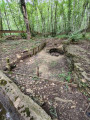
Since 2004, archaeological excavations of an abandoned medieval village have been carried out in the woods of Cestres
(3) Froideville: a hamlet neighbouring Saint-Martin, first mentioned in 1371. Around 1550, the ‘Grande Germaine’ was built, named after the woman who commissioned it. It was renamed ‘Métairie de Champcourt’ in 1728 by its new owner.
(6) Bordes Bricard: the Jardin Bienveillant in Bordes Bricard. At the entrance to the village, take the first small street on the right, at the bottom of the slope leading into the village (Rue au Devant de Roches). Signs are in place and clearly visible.
A superb vegetable garden, ponds, a flower-filled meadow, happy animals, original structures and clever upcycled features – there are a thousand things to discover as you wander along the paths. Everything is ready; they’re waiting for you.
Practical information: Admission donation per person: €4, in aid of the charity. contact@jardins-sante.org
(17) Saint-Seine-l’Abbaye: near the source of the Seine, one of the prettiest villages in the Côte-d’Or has sprung up on the limestone plateau surrounding the abbey founded in the 6th century by Saint Sequanus. All that remains of the famous Benedictine abbey, which was granted royal status under Louis XIV, is the private abbey grounds with two wings of the cloister and the 18th-century palace, now the headquarters of the Tourist Office; but it is above all the abbey church, with its single tower, that attracts visitors.
In medieval times, the development of Saint-Seine-l’Abbaye was closely linked to the activities of the neighbouring abbey. Several buildings dating from the late Middle Ages bear witness to the wealth of this Burgundian market town. This trend is also evident in other monastic market towns such as Flavigny-sur-Ozerain, Tournus and Cluny.
During the revolutionary period of the National Convention (1792–1795), the commune was known as Seine-en-Montagne.
The Abbey Church: this abbey stands as a true testament to history and the Burgundian Gothic style: founded in the 6th century by Sigo, a monk from Moutiers-Saint-Jean, it has been home to important figures such as Benedict of Aniane, the reformer of the Benedictine Order, who took his vows there in the 8th century. During the Middle Ages, Saint-Seine Abbey flourished, expanded, and even became one of the most important in Burgundy. All that remains from this period today is the choir and the transept – the rest of the building was destroyed by fire in 1255, and work did not resume until the turn of the 14th and 15th centuries. The porch is decorated with vine shoots. Take a close look at them: a snail is hiding in one of them.
Like many abbeys, Saint-Seine had a mill and a hydraulic system, traces of which can be seen in plans and surveys dating from the 17th century. The carved choir stalls, dating from the 18th century, are the work of the Luxembourg craftsman Guillaume Theiss. The exceptional 16th-century murals depict, on the north wall, the legend of Saint Seine in 22 panels (1504) and, on the south wall, the Tree of Jesse, Saint Christopher and the Litany of the Virgin Mary in a style influenced by the Renaissance. Every Sunday in summer, Mass is still celebrated here (from 1 May to 1 November). Concerts are held here. The acoustics of the venue are indeed exceptional. The church is listed as a historic monument under the 1862 register.

Always be cautious and plan ahead when you're outdoors. Visorando and the author of this route cannot be held responsible for any accidents occurring on this route.

The GR® and PR® markings are the intellectual property of the Fédération Française de Randonnée Pédestre.

Reviews and comments

4.5 / 5
Based on 2 reviews

Reliability of the description
5 / 5
Ease of following the route
5 / 5
Route interest
3.5 / 5
cuzcodom
cuzcodom

Overall rating : 4.7 / 5

Date of your route : Mar 09, 2026
Reliability of the description : ★★★★★ Very good
Ease of following the route : ★★★★★ Very good
Route interest : ★★★★☆ Good
Very busy route : No

We weren't lied to: wash houses? There are some... Wind turbines? There are some...
A pleasant, easy walk (best avoided in hot weather).
Check whether it's possible to visit the abbey, as it was closed when we were there (Sunday): worth looking into...
Thanks to the creator.

Machine-translated

apatenotte
apatenotte

Overall rating : 4.3 / 5

Date of your route : Jan 29, 2024
Reliability of the description : ★★★★★ Very good
Ease of following the route : ★★★★★ Very good
Route interest : ★★★☆☆ Average
Very busy route : No

An easy route with plenty of points of interest, despite the predominance of tarmac roads: perhaps best done by bike?

Machine-translated

Other walks in the area

For more walks, use our search engine .

The GPS track and description are the property of this route's author. Please do not copy them without permission.