Tour de Liers towards Longechenal

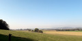
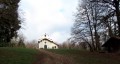
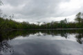
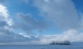
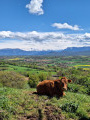
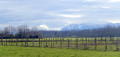
A walk that takes place mainly in open country with little change in altitude. It’s ideal in autumn, as it’s away from the forests frequented by hunters. You’ll walk along the hills and copses of the eastern part of the Liers plain. Here and there, you’ll catch glimpses of the surrounding hills and peaks.

Details

1575876
Creation:
Last update:
Last review:
  • Walking
    Activity: Walking
  • ↔
    Distance: 9.19 mi
  • ◔
    Average duration: 4h 35 
  • ▲
    Difficulty: Moderate

  • ⚐
    Back to start: Yes
  • ↗
    Ascent: + 367 ft
  • ↘
    Descent: - 341 ft

  • ▲
    Highest point: 1,985 ft
  • ▼
    Lowest point: 1,634 ft

Photos

Description of the walk

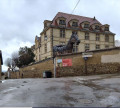
(S/E) You leave the square in front of Longechenal Church heading due north along Rue de la Soierie, the road that runs past the village’s only shop. Take the first street on the left (Rue du Piconnet), then the first on the right (Rue de la Gaillardière).

The entire route is marked with a yellow line

(1) Walk past the cemetery without stopping, unless you need to top up your water supplies… Ignore the path coming from the left (Chemin de la Jeanne). Your small road curves to the left. Ignore the path coming from the right (Chemin de la Pépinière).

(2) You pass the GAEC and take the first path leading off to the right (north-west). After a while, this path turns right of its own accord (elevation 502). You follow it, ignoring any paths coming from the right or left. You pass under a power line and go past two copses consisting mainly of chestnut trees.

(3) You’ll reach a T-junction. Turn left.

(4) Very soon, you’ll reach the sign for “Le Grand Liers – Alt. 540m”. Turn right towards Bizonnes. Cross a small tarmac road in four strides and carry on straight ahead. When you reach a second small road, take it to the right.

(5) The track curves naturally to the left. Carry on along it, ignoring any paths branching off to the right or left. You’ll come out onto a small tarmac road; take this to the left.

(6) You’ll come to a fork in the road; take the right-hand branch. At the first junction, turn right (Chemin du Knoll), then take the first left (Chemin des Hebrayes). When your lane bends to the left, take the lovely shaded path opposite, blocked by a large stone. You’re now on the outskirts of Bizonnes. Your path crosses a tarmac lane. Carry straight on. High up on your right, there are rubbish bins. You’ll reach the Route du Mont Pelat, which you take to the left.

(7) Very soon, you’ll reach a crossroads. There’s a cross in the centre of it. You’ll see a sign for ‘Javetière – Alt. 580m’. Turn right, towards Les Charpennes. Your small road climbs slightly. When you see farm buildings above you, ignore the path branching off to the right and carry on straight ahead.

(8) Your path leads out onto a tarmac road. (Signpost: “Les Charpennes – Alt. 574m”). Head uphill straight ahead, alongside a woodland. Turn slightly left to reach a dirt track, which you follow to the right.

(9) You’ll reach the sign for “Bois de la Brassière – alt. 570m”. Turn left, then immediately turn right, heading towards Les Violettes.

(10) At the sign for “Les Violettes – Alt. 565m”, turn right towards Petit Liers/Longechenal. Ignore a path branching off to the left and another to the right.

(11) You’ll reach the D51b, which you cross in a few strides before continuing straight ahead. Ignore a path on the right.

(12) At the sign for “Le Petit Liers – Alt. 545m”, head straight ahead towards Longechenal. Ignore a path on the left leading to some buildings. You’ll come out onto the D51g (altitude 530). Turn right. Caution! Traffic moves fast. Walk on the left-hand verge of the road so you can see vehicles approaching you. You’ll pass under a high-voltage power line.

(13) When you reach the sign for “La Vie Pierre – Alt. 525m”, turn left towards Longechenal. You’ll face the first (and last) steep climb. It’s gentle but becomes quite noticeable towards the end. At a crossroads, on the edge of the woods, turn right and follow the path alongside the woods. The path runs along this edge until you reach the outskirts of Longechenal. You’ll come out onto a small road where you turn right.

(14) You’ll come to a sign for “Chemin de Combe Noire – Alt. 505m”. Turn right. Continue along the road running parallel to the hillside. It becomes “Rue de la Paroisse” and takes you back to your starting point (S/E).

Waypoints

  1. S/E : mi 0 - alt. 1,647 ft - Car park at Longechenal Church
  2. 1 : mi 0.27 - alt. 1,647 ft - Longechenal Cemetery
  3. 2 : mi 0.49 - alt. 1,634 ft - Path leading off to the right
  4. 3 : mi 1.8 - alt. 1,749 ft - T-junction
  5. 4 : mi 1.96 - alt. 1,765 ft - Sign for Le Grand Liers 540m
  6. 5 : mi 2.56 - alt. 1,765 ft - The road bends to the left
  7. 6 : mi 3.37 - alt. 1,854 ft - Turn right at the fork in the road
  8. 7 : mi 3.92 - alt. 1,903 ft - Sign for Javetière 580m
  9. 8 : mi 4.65 - alt. 1,886 ft - Signpost Les Charpennes 574m
  10. 9 : mi 5.03 - alt. 1,870 ft - Signpost: Bois de la Brassière 570m
  11. 10 : mi 5.69 - alt. 1,837 ft - Signpost: Les Violettes 565m
  12. 11 : mi 6.26 - alt. 1,818 ft - Crossing the D51b
  13. 12 : mi 6.74 - alt. 1,785 ft - Signpost Le Petit Liers 545m
  14. 13 : mi 7.69 - alt. 1,722 ft - Sign for La Vie Pierre 525m
  15. 14 : mi 8.73 - alt. 1,673 ft - Sign: Chemin de Combe Noire 505m
  16. S/E : mi 9.19 - alt. 1,647 ft - Car park at Longechenal Church

Notes

Longechenal is a small village in central Isère, situated north-east of La Côte-Saint-André, not far from the Lyon–Grenoble A-road.

You can park in the church car park.

There is a small general shop. Otherwise, the nearest towns are La Côte-Saint-André (to the west) or Le Grand Lemps (to the east).

The entire route is signposted in yellow. At every major junction, there is a directional sign.

The ‘Medium’ difficulty rating is based solely on the distance. Otherwise, there are no difficulties to worry about.

Between the waypoints (8) and (9), the Lyon–Grenoble motorway runs below you. It’s quite noisy, but it doesn’t last long.

Eighty per cent of the route is on good stony tracks, with the remainder on small tarmac roads (apart from a short stretch on a departmental road).

Worth a visit

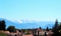
During the walk, you’ll be able to enjoy views of the Liers plain, the surrounding hills and a few mountain peaks.

The village of La Côte-Saint-André, with its Hector Berlioz Museum, is 13 kilometres away.

Not far away, you’ll find the educational trail through the Grand Lemps peat bogs (see the walking route described on Visorando).

Reviews and comments

4.3 / 5
Based on 3 reviews

Reliability of the description
4.3 / 5
Ease of following the route
4.7 / 5
Route interest
4 / 5
philomene595
philomene595

Overall rating : 4.7 / 5

Date of your route : Sep 30, 2024
Reliability of the description : ★★★★★ Very good
Ease of following the route : ★★★★★ Very good
Route interest : ★★★★☆ Good
Very busy route : No

perfect for brisk walking

Machine-translated

Yannick_Josset
Yannick_Josset

That’s done. Thank you.
Yannick

Machine-translated

danamarie
danamarie

Overall rating : 4 / 5

Date of your route : Nov 19, 2018
Reliability of the description : ★★★★☆ Good
Ease of following the route : ★★★★☆ Good
Route interest : ★★★★☆ Good

Just a small mistake at the start of the route:
on the left, it’s not Rue du Violet; the main thing is to head towards the cemetery
Please could you correct this?

Machine-translated

EtienneF38
EtienneF38

Overall rating : 4.3 / 5

Date of your route : Nov 14, 2018
Reliability of the description : ★★★★☆ Good
Ease of following the route : ★★★★★ Very good
Route interest : ★★★★☆ Good

A lovely route well suited to Nordic walking, easy going, in open country (best avoided in the height of summer), with a clear path consistently marked in yellow and signposts at the main junctions; there are a few discrepancies between the route description and the actual terrain at the entrance to Bizonnes (you should follow the markings); magnificent autumn colours, it’s worth noting the stunning views of Mont Blanc and the Belledonne range in the background. Thank you.

Machine-translated

Other walks in the area

For more walks, use our search engine .

The GPS track and description are the property of this route's author. Please do not copy them without permission.