From the moraine to Le Not

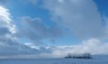
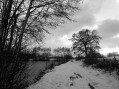
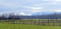
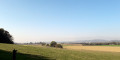
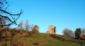
A lovely walk through the heart of the Bièvre plain.
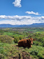
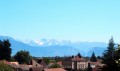
To the east, you can admire the peaks of the Chartreuse; to the south, those of the Vercors; and to the west, Le Pilat.
You’ll be cycling along small tarmac roads or well-maintained stony tracks.

Details

172128
Creation:
Last update:
Last review:
  • Walking
    Activity: Walking
  • ↔
    Distance: 6.24 mi
  • ◔
    Average duration: 3h 05 
  • ▲
    Difficulty: Easy

  • ⚐
    Back to start: Yes
  • ↗
    Ascent: + 220 ft
  • ↘
    Descent: - 240 ft

  • ▲
    Highest point: 1,453 ft
  • ▼
    Lowest point: 1,234 ft

Photos

Description of the walk

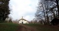
You can easily park in the large car park to the north of the church.

(S/E) You are halfway up the hillside; start your walk by following the small tarmac road eastwards. 100 metres further on, turn right onto the fairly steep path that leads down towards the plain.
You’ll pass a first junction and come out onto the D73.

(1) Cross the road and continue southwards until you reach a Fork in the road. Take the left-hand fork (signposted ‘Le Marais’).

(2) Take the second road on the left to cross the hamlet of Le Marais (sign: Chemin du Bois Baragne). At the end of the lane, turn right (sign: Chemin du Marais). When you reach a junction, carry on straight ahead along a grassy path, then turn left.

(3) Walk alongside the ponds of Le Marais. When you reach the last one, the path branches off to the left and joins the tarmac road. Continue straight ahead along a stony path. At the next Fork in the road, take the most obvious path on the right. Follow this until you reach a “T” junction.

(4) Turn right and walk alongside a stream, which may or may not be flowing, depending on the season. When you reach another T-junction, turn right again, then take the first path on the left. You’ll walk alongside a woodland and the ‘Not’ hillside.

(5) At the crossroads, carry straight on. Ignore a path on the left and, when you reach a T-junction, turn right, then very quickly left.

(6) You walk alongside the small Bois Barelle. Ignore a path coming from the right and, very quickly, take the next one to the right. At the first Fork in the road, turn left; at the next one, turn right. Ignore a path coming from the right.

(7) Go round the edge of the Molly woods. Carry on straight ahead. Cross a small tarmac road.
You’ll then come out onto the D73 again.

(8) Cross the road.

(9) At the crossroads, turn right (Chemin de Cerisière) and follow this road, which climbs quite steeply. It will take you back to the church car park (S/E) if you carry on straight ahead.

Waypoints

  1. S/E : mi 0 - alt. 1,450 ft - Church car park
  2. 1 : mi 0.53 - alt. 1,309 ft - D73 – 1st crossing
  3. 2 : mi 1.14 - alt. 1,332 ft - The hamlet of Le Marais
  4. 3 : mi 1.49 - alt. 1,332 ft - The Marais lakes
  5. 4 : mi 2.22 - alt. 1,316 ft - Turn right
  6. 5 : mi 3.3 - alt. 1,276 ft - Go straight on at the crossroads
  7. 6 : mi 3.95 - alt. 1,240 ft - Bois Barrelle
  8. 7 : mi 4.84 - alt. 1,296 ft - Bois Molly
  9. 8 : mi 5.35 - alt. 1,263 ft - D73 – 2nd crossing
  10. 9 : mi 5.52 - alt. 1,286 ft - Chemin de Cerisière
  11. S/E : mi 6.24 - alt. 1,450 ft - Church car park

Notes

Picnic tables by the ponds in the Marais.

Worth a visit

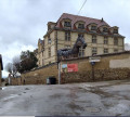
The mansions of the Dauphiné.
The Bièvre plain is surrounded by the peaks of the Chartreuse, Vercors and Pilat mountains. In fine weather, it’s a real treat.
On Saturdays in winter, during the winter sports season, there is a high volume of traffic at Saint-Geoirs Airport and, if you like, you can watch the planes taking off and landing. Outside of these days and this period, there is very little traffic and you won’t be bothered by the airport noise.
In La Côte-Saint-André, you can visit the Berlioz Museum, the church and the market halls.

Reviews and comments

4.3 / 5
Based on 3 reviews

Reliability of the description
4.3 / 5
Ease of following the route
4.3 / 5
Route interest
4.3 / 5
collet annie
collet annie

Overall rating : 4 / 5

Date of your route : Jun 22, 2020
Reliability of the description : ★★★★☆ Good
Ease of following the route : ★★★★☆ Good
Route interest : ★★★★☆ Good
Very busy route : No

Please note that the route is not signposted.

Follow the directions carefully
At level 4, turn right and do not follow the yellow arrows.

Machine-translated

Dany MS
Dany MS

Overall rating : 5 / 5

Date of your route : Jan 24, 2016
Reliability of the description : ★★★★★ Very good
Ease of following the route : ★★★★★ Very good
Route interest : ★★★★★ Very good

We followed the advice of an online user and did the walk in the opposite direction so that we could enjoy having the Belledonne range in view throughout the route, rather than having it behind us. A lovely, easy walk across the plain, perfect for soaking up the winter or spring sunshine. Thanks, Yannick.

Machine-translated

Yannick_Josset
Yannick_Josset

Good evening,
For this walk across the Bièvre plain, I’ve made sure that the only steep section is a downhill stretch at the start of the walk. And that we have a gentler climb at the end.
As for the view of the mountains… they surround us, whichever way you walk, I think…
The advantage of a route is that everyone is free to walk it in whichever direction they like and to start wherever they like, isn’t it?
Enjoy your walks.
Yannick

Machine-translated

gazok54
gazok54 ★

Thank you, marrie.emadali@orange.fr.
Are you angry when you write to us?

Machine-translated

marrie.emadali@orange.fr

Overall rating : 4 / 5

Date of your route : Dec 01, 2015
Reliability of the description : ★★★★☆ Good
Ease of following the route : ★★★★☆ Good
Route interest : ★★★★☆ Good

A LOVELY HIKE, BUT TO GET THE MOST OUT OF BELLEDONNE, CHARTREUSE AND VERCORS, YOU NEED TO DO IT IN REVERSE.

Machine-translated

Other walks in the area

For more walks, use our search engine .

The GPS track and description are the property of this route's author. Please do not copy them without permission.