


 Country:

 City:
City:


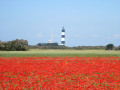
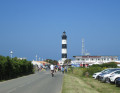
Head to the Chassiron Lighthouse, at the very north of the Île d’Oléron. There is a large car park, part of which is accessible to motorhomes, and overnight parking is also permitted.
(S/E) Head towards the lighthouse, take the street that runs to the right of the lighthouse entrance and passes through the shops. Go round the lighthouse and the semaphore station on the right.
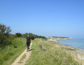
(1) Turn right onto the coastal path and follow the coastline all the way round the headland, then continue southwards along the cliffs and beaches, staying on the coastal path, which is perfectly suitable for bikes. Soon the road will come closer to the coast and run alongside the path; stay on the path.
(2) Just as the path turns left to join the road, leave the path and cycle directly along the beach, off-road.
(3) Take the path on the left which joins the road. Once on the road, turn right and follow it for about 300 m.
(4) Turn right onto Rue Jean Bart and, after the first few houses, turn right onto Rue Aliénor d’Aquitaine, until you reach the Ranch des Huttes.
(5) In front of the ranch, turn right and follow Rue des Huttes for about 300 m.
(6) Opposite the campsite, turn right onto the dirt track signposted as a dead end, which leads to the beach (Chemin du Casseron).
Once you reach the beach, turn left and follow the track alongside it, which soon joins Rue des Dunes. Follow this street to the end, then take the dirt track that leads back to the beach near the Diabolo Fun surf school.
(7) Turn back and take a path on the right which leads back to the road (Rue des Seulières).
(8) At the exit of a car park, turn right onto Rue des Seulières, pass a group of campsites, then continue for about 500 m before you come to a car park on the right.
(9) At the car park and the Line Up surf school, head towards Plage des Seulières by crossing the dunes.
Turn back and rejoin the road, following it to the right for about 100 m.
(10) On the right, towards the dunes, there is a large car park equipped for bicycles. Opposite (on the left), take the small street which very quickly gives way to the beautiful white dirt track – the Chemin de la Hutte du Curé cycle path. Follow this for about 1.5 km, cross a road and continue straight on for about 150 m.
(11) The track then turns sharply right and soon crosses another road.
(12) Leave the cycle path and take this road on the left, then ride past the Moulin de la Brée. Continue to the next junction.
(13) When you reach the D273E1, take the cycle path running alongside it on the left, towards La Brée, until you reach the roundabout.
(14) At the roundabout, carry on straight ahead to the right along the street called “Route du Moulin”, then continue along its extension, Rue du Général de Gaulle, and then Rue de la Plage, until you reach the beach.
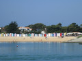
When you reach the beach, turn left and cycle along the beachfront, parallel to the Allée de la Digue, which is pleasantly shaded by pine and cypress trees.
(15) When you reach the junction with a large beach access point, take the cycle path straight ahead which runs alongside Boulevard d’Antioche, then Boulevard de l’Océan, for over 2 km.
(16) The cycle path ends and joins Boulevard de l’Océan just before a large white building with blue trim, which is a hotel residence (Le Neptune). Follow the boulevard for about 500 metres until you reach the first junction.
(17) Turn right onto Rue Émile Glaudon, then, level with the Les Lauriers campsite, turn right onto Rue de la Plage, then at the junction turn right onto Rue du Port, and finally onto the very start of Boulevard d’Antioche (this time the one in Saint-Denis – the previous one of the same name was in La Brée).
(18) At the pedestrian crossing, turn right onto the promenade along the quays, passing the shops, and walk all the way round the marina to the end of the jetty.
Head back the way you came, cross the harbour car park, and at the exit take Rue Pierre Métayer, following it until you return to Boulevard d’Antioche. Turn right onto it and follow it alongside a large campsite until the end, where, at a hairpin bend, it gives way to an unpaved track; turn left at a right angle onto this track, with your back to the beach.
At the next junction, turn left onto the track (Chemin de la Bréchette), then right onto Chemin de la Motte Bossée for about 150 m.
(19) After the last houses on the right, turn right at a right angle onto Rue du Bois (unpaved and signposted as a dead end), and follow it straight on until you reach the coast. There, follow the coastal path to the next junction.
(20) The path joins the Chemin du Sabia, which ends on the beach at a boat ramp. Cross it and take the path opposite, crossing a small footbridge over a stream. Follow this path as it runs along the coast, then turn left after passing the houses in the Morelière neighbourhood.
(21) After crossing a dirt car park equipped with recycling bins, turn right onto the road (D734) leading to Chassiron Lighthouse, which can be seen in the distance as you leave the village, and turn left into the lighthouse car park (S/E).

 Association / Club / Walk leader
 Visorando Member
 Moderate
