


yssappey

 Visorando Member
- Gender: man
Sign up:
Published route(s)
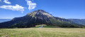
 From Sappey-en-Chartreuse to Émeindras de dessus via the high ridges
 5.69 mi
 +1,877 ft
 -1,873 ft
 4h 15
4h 15
 Moderate
 Departure from Le Sappey-en-Chartreuse (Isère)
This hike takes you to the top of the Sappey ridges, where you can enjoy beautiful panoramic views (the Belledonne mountain range, Dent de Crolles, Saint-Hugues, Chamechaude and the series of ridges).
On 28/12/18, I modified the route between the new points (1) and (2) to take into account the 2018 logging operation that destroyed the previous hiking trail (shown as a dotted line on the map).
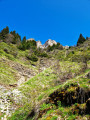
Roche Rousse
 5.89 mi
+2,077 ft
-2,077 ft
4h 30
Moderate
Departure from Le Sappey-en-Chartreuse (Isère)
5.89 mi
+2,077 ft
-2,077 ft
4h 30
Moderate
Departure from Le Sappey-en-Chartreuse (Isère)
A lovely walk offering views of the entire Sappey-en-Chartreuse valley and the surrounding mountains.
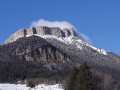
Tour de l’Écoutoux
 6.63 mi
+2,008 ft
-2,031 ft
4h 50
Moderate
Departure from Le Sappey-en-Chartreuse (Isère)
6.63 mi
+2,008 ft
-2,031 ft
4h 50
Moderate
Departure from Le Sappey-en-Chartreuse (Isère)
An ideal forest walk in hot weather for those looking to cool off a little.
The plus: you can go for a swim halfway along the route.
Downside: you have to cross the road on the way back (if anyone knows an ‘easy’ route through the rocky outcrop at Le Bret to avoid the road, I’d love to hear about it).