Country:

 City:
City:


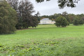
Car park at the foot of Rue de la Rolée in Nandrin.
(S/E) Leave the car park and head down to the right towards Place Ovide Musin. Keep to the left on the square and turn onto Thiers des Raves (to the left of the town hall). The street continues as a path leading towards the Bois de Soheit. Walk through this woodland.
(1) On leaving the woodland, turn left onto a path between the edge of the woodland and the fields. It takes a 90° left-hand bend after about a hundred metres.
(2) When you reach the tarmac road, first turn left then right onto the Tige de Favennes. This leads to a woodland (Bois de Bouhaye), which you cross. Continue along a small tarmac road. Follow it to the junction between Rue de la Haie Monseu and Rue de Favence.
(3) Then head down Rue de Favence to the right. After the bend, the road gradually climbs, then takes a 90° bend to the right and then to the left.
(4) When the street turns left, shortly after No. 1a, carry on straight ahead along a footpath between the woodland and a tall hedge. At the end, after 200 m, take the forest track on the left and follow it for 200 m.
(5) At the junction, turn right onto the Chemin du Facteur. After a few houses, this path continues as a track through the woods and descends a steep slope (take care!). Once at the bottom, carry on straight ahead, still through the woods (Bois des Gottes). As you emerge from the woods, the track becomes a road and leads onto Rue Houchnée.
(6) Follow this street to the left. After about a hundred metres, when the road bends to the right, carry on straight ahead along a path. Walk for about 2 km along this path. After skirting and then crossing a section of woodland, the path begins a descent and soon takes a bend to the left.
(7) At the bottom, take a path on the left towards a woodland (before entering it, you can see Baugnée Castle, higher up on the right).
(8) After about 2.5 km, the path takes a 90° left-hand bend: carry on for another thirty metres or so and turn right onto a gravel track. This becomes tarmac shortly afterwards (Rue de Favence). Turn right then left, skirting a woodland on one side and houses on the other.
(5) At a junction you have passed earlier, near No. 25, keep to the right and continue along Rue de Favence. This road takes a wide bend to the right. Ignore the two streets branching off to the left and carry on straight ahead, downhill, into Rue Faftu.
(9) At the bottom, after the stream (which is barely visible!), turn left; Rue du Faftu becomes Chemin du Faftu. Follow the path across the fields to the next junction, which you have also passed through before.
(3) Then turn right onto Rue de la Haie Monseu, which continues as Rue de la Rolée. At the bottom of this street is the starting car park (S/E).
 Visorando Member
 Easy
Easy 
 Difficult