Country:

 City:
City:


Rotheux swimming pool car park, 11 Rue Biens Lefèvre, 4120 Neupré
(S/E) From the car park, walk along the right-hand side of the swimming pool and continue straight ahead between the hedges. When you reach the housing estate, take the street on the left and follow it up to the cross street (Rue des Moges), which you should turn right into. At the end of the street, carry on straight ahead along the forest track. After half a kilometre, the track descends and leads to the end of a tarmac road, opposite a sewage treatment plant.
(1) Take the path opposite, which very quickly curves to the left. At the junction shortly afterwards, keep to the left to follow the path running (at a distance) alongside the stream. After 700 metres, the path joins a tarmac road lined with a few houses (Chemin de Sottrez).
(2) Turn left onto it. At the end, carry straight on along the farm track towards the woods (passing vineyards and the Sottrez farm).
(3) As soon as you enter the woods, head down the path to the right. It branches off to the left, under the medium-voltage power lines, joins a stream and then climbs back up to meet a tarmac lane leading to a road (Rue Jean Damard): turn right onto it and follow it for 250 metres. At the next house (No. 10, electricity pole), take the grassy path on the left, running alongside the house’s hedge and a field.
(4) At the end, cross the road and continue straight ahead into Baugnée (yellow sign). At the end of the street (large square farmhouse), carry on straight ahead along the roughly gravelled farm track. Follow it for a good kilometre towards the woods (ignore the two paths branching off to the right).
(5) Take the farm track on the left after the woods. At the junction in the middle of the fields (isolated tree, cross, stone stools), carry on straight ahead along the path leading down towards the village of Tavier. At the bottom, once you reach the road, turn right towards the church. Take the street on the left, walk past the church, then take the path on the left before the stream.
(6) Before the first house, climb out of the ditch towards a boundary wall, follow it until you reach the upper road. Turn left onto it, then turn right up Voie di Messe. This road soon leads into the countryside and then into a wood. At the chapel, carry on straight ahead between the quarry and the fields. After the quarry, the track turns into a footpath. It eventually runs alongside pastures and joins a tarmac road.
(7) Cross the road and take the farm track opposite. This takes a wide bend to the right and then runs alongside the rear of some properties. At the end, it joins a village street (Rue Jean Damard).
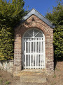
(8) Keep to the right and take the second street (gravel track) on the left (small chapel). This track turns into a footpath after the houses. It runs through a deep ravine and descends towards a stream (sometimes dry), which you must cross by wading or via the footbridge.
(9) Shortly after the stream, take the forest track to the right, then immediately left uphill onto the footpath, and left again at the next junction, continuing uphill. Further up, the path leaves the woods and runs alongside them and a meadow.
(10) As the path follows a contour line, still running alongside the meadow, take the path leading uphill to the left (there are a few steps). This straight path runs alongside a woodland (on the left) and meadows (on the right), going uphill and then downhill. It leads onto a small tarmac road (Rue du Petit Moulin, sign for ‘Moulin du Petit-Rotheux’).
(11) Turn left onto this street. The road curves to the right, passes the cemetery and climbs towards the former town hall (now the CPAS).
(12) Cross the street and go round the CPAS on the right, taking the footpath. This bends to the left and heads towards the two churches. Cross Rue des Deux Églises and continue straight ahead into Rue des Moges. At No. 8b, take the tarmac path on the right, leading to the rear of the sports centre. Go round the sports centre on the right to reach the car park (S/E).
 Visorando Member
 Easy
Easy 
 Difficult