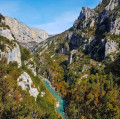
The Véroncle mills

The route leads up the Véroncle canyon then down the south-facing slopes of the Monts de Vaucluse.

Technical sheet

62832
Creation:
Last update:
Last review:
  • Walking
    Activity: Walking
  • ↔
    Distance: 10.00 km
  • ◔
    Average duration: 3h 45 
  • ▲
    Difficulty: Difficult

  • ⚐
    Return to departure point: Yes
  • ↗
    Vertical gain: + 302 m
  • ↘
    Vertical drop: - 303 m

  • ▲
    Highest point: 496 m
  • ▼
    Lowest point: 193 m

Photos

Description of the walk

The car park is beside the road D2 from Gordes to Saint-Saturnin-lès-Apt, about 3km from Gordes. Go past the fork for the D156 (which bears right towards Goult) and continue about 200m further along the D2. You will see the entrance of a house with a lovely stone wall on your right. The car park is opposite this wall on the left (signs for Mas de Véroncle and La Lézardière).
If the car park is full, you can park 300m further up the lane.

(S/E)From the car park on the edge of the D2, take the GR6-GR97 on the left which leads up alongside some oak trees. After passing some houses, you will reach the sign for "Les Grailles"

(1)Leave the GR path and continue straight on towards "Les gorges de Véroncle", along a small footpath.
Shortly after, ignore the path waymarked in Red and Yellow which climbs to the left above the canyon. Instead, take the path to the right, (without waymarks and not marked on the map) which leads immediately into the gorges. After 300m, you will reach Cabrier mill.

Ignore a path that leads up to the left and continue straight on, alongside the walls of the mill. You should follow the Yellow or Red/Yellow waymarks which lead up the canyon, sometimes in the bed of the Véroncle and sometimes overlooking the ravine on the right or left.

N.B. Take care: the waymarks are not always very apparent. In any case, the aim is to climb up through the canyon as best one can.

After Cabrier mill, the route uses the mill-race cut out of the rock.
Later, another 10-rung ladder leads to the "Pas de Marie-Hélène" overhang. The route continues, alternating sections in the floor of the canyon, obstacles to be negotiated and corniche sections as far as a narrow gully fitted with steps and ladders, leading back down to the river bed.
The waymarks lead up again, through vegetation that is sometimes dense, coming out into a wide canyon to arrive at the Jean de Marre mill 2, below a holed rock. (This was a mill used to produce fine flour).
Preferably take the path to the left of the mill until you reach the area above it with signage for "Jean de Marre" (if you took the path around the ruins to the right, you will need to head a few metres to the left to reach the sign).

(2)Take the path to the right towards Murs. Shortly after, ignore the path heading right across the canyon and instead continue straight on through the canyon, then climb up left to overlook it. The route leads past a few more ruined mills and then passes through a pleasant meadow to reach the mill Moulin des Etangs, which has been converted into a house.
N.B. Just before the mill, the path marked in purple on the map does not exist any more.

(3)Continue up around the mill to the right, and then you will emerge onto a lovely lane opposite the holiday cottage "Au temps jadis". Take the lane to the very right marked with a yellow cross (no further waymarks). Continue up to the first crossing, and then bear left and pass a gate. Follow a bend around to the right and then at the next bend, leave the track and turn right along a path (not very visible at the start). After about 100m, continue past a ruin on the left and a fork (not marked on the map), and follow the path to the right. You will come out onto the Bois d'Audibert track 400m further.

(4)Take the track to the right at cistern N°117 and head down, enjoying the views of the Luberon (yellow waymarks).
150m lower, at the signpost for "Lauzière", follow the sign for "Borne des Trois Evêchés", continuing along the track. The waymarking then leaves this track and bears left to join the signposting again.

(5)Head right towards ""L'Auvières", still following the Yellow waymarking. The footpath runs alongside the track and then heads off to the left again to join the signs for "L'Auvières".

(6)Continue straight on towards "Gordes" "Borne de Baume Brune". Be sure to take the path to the right at the next fork (the left-hand path leads to Joucas).

(7)On reaching the "Borne de Baume Brune" head right towards "Bois d'Audibert". There is a short, fairly steep descent on a stony path, which then levels out among the pines. It comes out onto a wide track, which you should continue straight along.

(8)About 200 m further, the track leads off to the left, but you should bear right into the forest to reach the "Bois d'Audibert" intersection. At this point, head straight on towards "Les Grailles".

(1)At the "Les Grailles" signpost, head left back down the route taken at the start of the walk (the GR path), to return to the car park.(S/E)

Waypoints

  1. S/E : km 0 - alt. 194 m - Car park by the D2
  2. 1 : km 0.59 - alt. 204 m - Les Grailles . Follow the path along the - Véroncle (rivière)
  3. 2 : km 3.17 - alt. 367 m - Jean de Marre
  4. 3 : km 4.68 - alt. 430 m - Moulin des Étangs
  5. 4 : km 5.88 - alt. 490 m - Piste du Bois d'Audibert
  6. 5 : km 6.71 - alt. 430 m - Three Bishoprics milestone
  7. 6 : km 7.64 - alt. 336 m - L'Auvières
  8. 7 : km 8.02 - alt. 314 m - Baume Brune bollard
  9. 8 : km 9.01 - alt. 219 m - Leaving the track
  10. S/E : km 10 - alt. 194 m - Car park by the D2

Practical information

There are some tricky sections in the canyon: rock scrambling, ladders and ropes.

In the nearby area

 Always stay careful and alert while following a route. Visorando and the author of this walk cannot be held responsible in the event of an accident during this route.

The GR® and PR® markings are the intellectual property of the Fédération Française de Randonnée Pédestre.

Reviews and comments

4.6 / 5
Based on 116 reviews

Reliability of the description
4.5 / 5
Clarity of route map
4.4 / 5
Route interest
4.9 / 5
Ginyboo
Ginyboo

Overall rating : 4.3 / 5

Date of walk : May 17, 2025
Reliability of the description : ★★★★☆ Good
Clarity of route map : ★★★★☆ Good
Route interest : ★★★★★ Very good
Busy trail : No

What a wonderful discovery! It was a lovely walk, starting at around 1pm and enjoyed from start to finish. It has to be said that the season, with all its flowers, was particularly suited to it. The only frustration was that we had to miss it because we couldn't find the chimney!

Automatically translated

Amirandos
Amirandos

Overall rating : 4.3 / 5

Date of walk : May 28, 2024
Reliability of the description : ★★★★☆ Good
Clarity of route map : ★★★★☆ Good
Route interest : ★★★★★ Very good
Busy trail : No

A very nice hike, spectacular, but with some slightly vertiginous overhanging sections, the necessary use of ropes, rungs fitted out on site...
It was very difficult to climb back up "le puits de Cata" despite the help of the rope: recent rain = slippery rock and a bag that was a bit too heavy and unbalanced. My 1st attempt ended with a fall and a splash in a pot with 40 cm of water. It was more fun than it was worth, but the climb was only possible with the help of a 2nd rope, which fortunately I'd brought with me. This 2nd rope was also useful before going through the "chimney" a little further on to hoist the bags (impossible to go through with it).
It was a reconnaissance done by 3 people, and even though it's a very nice walk (even on the way back - beautiful panoramic views + choice of nice paths to be preferred, with the IGN map, to wide paths), I would only recommend it in my group to walkers with a bit of experience, particularly in climbing, and not prone to vertigo. But thank you very much for this discovery. The 5/6 m rope is very useful.

Automatically translated

bernardjeanmartin
bernardjeanmartin

Overall rating : 4.3 / 5

Date of walk : Apr 21, 2024
Reliability of the description : ★★★★☆ Good
Clarity of route map : ★★★★☆ Good
Route interest : ★★★★★ Very good
Busy trail : No

A lovely walk despite the mistral. A little technical at first, but still accessible even for children aged 8 or 10.
More exposed to the sun on the way back, possible in April but undoubtedly difficult in summer. 3h45 without exerting yourself.

Automatically translated

Sylvie Dessales Fazio

Overall rating : 4.7 / 5

Date of walk : Oct 30, 2023
Reliability of the description : ★★★★★ Very good
Clarity of route map : ★★★★☆ Good
Route interest : ★★★★★ Very good
Busy trail : Yes

Carried out on 28 October 2023
This was a very pleasant hike.
The ladders, ropes and small steps were very useful for the more perilous sections.
It's classed as difficult, but I'd say it's more of a medium+.
Once you reach the Moulin de l'Etang the route is very easy.
I recommend this hike.

Automatically translated

laure et christophe
laure et christophe

Overall rating : 4.7 / 5

Date of walk : Sep 04, 2023
Reliability of the description : ★★★★★ Very good
Clarity of route map : ★★★★☆ Good
Route interest : ★★★★★ Very good
Busy trail : No

The "chimney" section is impressive but totally doable!!! good shoes are essential. Thanks for the ropes and ladders available to allow you to pass over certain sections.

Automatically translated

ClaireH84
ClaireH84

Overall rating : 4.7 / 5

Date of walk : Aug 04, 2023
Reliability of the description : ★★★★★ Very good
Clarity of route map : ★★★★☆ Good
Route interest : ★★★★★ Very good
Busy trail : No

The walk is as beautiful as ever, having been done several times before thanks to the guides of F. Morenas (the old blue dots are still visible in places!) On this morning in August 2023 we met only 2 other people. The more challenging via ferrata sections are well equipped (ropes, ramps, ladders, metal steps, etc.) and take you up the gorge to the moulin de l'étang. The passage through the chimney (Cata) is as fun as ever! These gorges are a magnificent place, to be respected and protected at all costs. The return journey to Les Grailles is a bit tricky, as the pretty paths to and beyond the campsite quickly turn into rocky tracks. Next time I'll try the paths indicated on the IGN map between the forest track and the gorges, to see if they're any better...

Automatically translated

yalnou
yalnou

Overall rating : 5 / 5

Date of walk : Jul 30, 2023
Reliability of the description : ★★★★★ Very good
Clarity of route map : ★★★★★ Very good
Route interest : ★★★★★ Very good
Busy trail : No

Superb, varied walk with some technical sections
I highly recommend

Automatically translated

RandoProvence
RandoProvence
• Last modified:

Overall rating : 4.7 / 5

Date of walk : Mar 28, 2023
Reliability of the description : ★★★★★ Very good
Clarity of route map : ★★★★☆ Good
Route interest : ★★★★★ Very good
Busy trail : No

Incredible ride!!! thanks to the author.
Below is a link to my comments, photos and short video teaser
https://m.facebook.com/story.php?story_f...

Automatically translated

CCh08410.
CCh08410.

Overall rating : 3.7 / 5

Date of walk : Jul 06, 2023
Reliability of the description : ★★★★☆ Good
Clarity of route map : ★★★☆☆ Average
Route interest : ★★★★☆ Good
Busy trail : Yes

It's an interesting trail, but the signposting is very average: it certainly allows for detours and discoveries, but it takes longer than expected. In some places at the end of June 2023, the path "closes in" and it's not easy to find the old mills. This is a really interesting place to discover, with ladders, a stream bed and rocks to walk along...

Automatically translated

dobartek
dobartek

Overall rating : 5 / 5

Date of walk : May 07, 2023
Reliability of the description : ★★★★★ Very good
Clarity of route map : ★★★★★ Very good
Route interest : ★★★★★ Very good
Busy trail : Yes

Hello
Hiked today. More people than I expected.
Technical hike with some tricky sections.
Not recommended for young children.
Thanks

Automatically translated

yunayna
yunayna

Overall rating : 4.3 / 5

Date of walk : Apr 04, 2023
Reliability of the description : ★★★★★ Very good
Clarity of route map : ★★★★☆ Good
Route interest : ★★★★☆ Good
Busy trail : No

A very nice, uncrowded walk.
Markings not always easy to find, so don't hesitate to turn back to find the markings.

Automatically translated

sandrinette74
sandrinette74

Overall rating : 5 / 5

Date of walk : Feb 20, 2023
Reliability of the description : ★★★★★ Very good
Clarity of route map : ★★★★★ Very good
Route interest : ★★★★★ Very good
Busy trail : No

Many thanks for this fantastic discovery. We were sleeping right next to this hike, which is why we did it. What a great idea. We were very pleasantly surprised, the walk is varied and has some really beautiful viewpoints. We had no trouble following the itinerary. Don't do it with dogs. Children, if they are well exercised . Otherwise, as I've already mentioned, you need to know how to climb. I'm prone to vertigo, but no worries there. Anyway, thanks again for this itinerary, we really enjoyed it.

Automatically translated

Tang421
Tang421

Overall rating : 4.7 / 5

Date of walk : Feb 05, 2023
Reliability of the description : ★★★★★ Very good
Clarity of route map : ★★★★☆ Good
Route interest : ★★★★★ Very good
Busy trail : No

It's not very popular out of season, of course, but it must be when the weather's better. The only hitch at the start of the route from the Cabrier mill is that you have to walk along it on the left as if you were going straight into a wall in order to get through! The path is not very well signposted at this point. Otherwise, it's perfect!

Automatically translated

BCOsorgue
BCOsorgue

Overall rating : 4.7 / 5

Date of walk : Oct 06, 2022
Reliability of the description : ★★★★★ Very good
Clarity of route map : ★★★★☆ Good
Route interest : ★★★★★ Very good
Busy trail : No

I followed the description exactly, no problem, I don't understand the comment by "bidat" and jean Gilles Mongendre, there is indeed a slightly tricky passage with a step and chain but it's accessible.
What's more, there are blue markers in the gorges.
Very nice hike.

Automatically translated

bidat
bidat

Overall rating : 4.3 / 5

Date of walk : Aug 27, 2022
Reliability of the description : ★★★★☆ Good
Clarity of route map : ★★★★☆ Good
Route interest : ★★★★★ Very good
Busy trail : No

We encountered the same problem as Jean-Gilles Mongendre: after the ladder leading up to the Pas de Marie-Hélène, following the bed of the gorge, we came up against a wall (the passage must have been equipped earlier, and there are still two inaccessible chains). You then have to go back and follow the red and yellow markings on the left side. A very nice climb through the gorges, not recommended for small children given the technical nature of some of the sections.

Automatically translated

Other walks in the area

For more walks, use our search engine .

The GPS track and description are the property of the author. Do not copy them without permission.